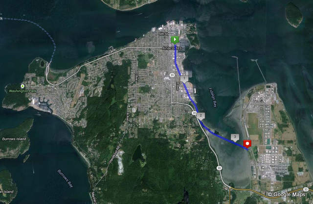
Anacorteans (or whatever those who live in Anacortes are called) are very familiar with the Tommy Thompson Trail, which, according to Anacortes Magazine, “consists of approximately 3.3 miles of paved trail for pedestrians and bicyclists between 11th Street and across the train trestle to March Point,” and, according to Trail Link, “follows an abandoned corridor of the old Burlington Northern Railway and is named for a man who ran a narrow-gauge railway along the Fidalgo Island shore.” Although currently only a few miles long, a Cross Island Connection – Guemes Channel Trail to Tommy Thompson Trail is in the works that will extend it to the Anacortes Ferry.
Officially, the TTT runs from 11th Street at its northernmost to March Point Road at its southwesterly end, but it’s easy enough to continue northward about eight blocks along Q Ave to 3rd Street (the planned route continues north to 8th, one block east to R Ave and then north to 3rd Street before heading west towards the Guemes Channel). Currently, traveling out and back from the start point at 11st Street allows runners, walkers and bikers about a 5-K each way, for a round trip total of a 10-K of paved trail on which to travel.
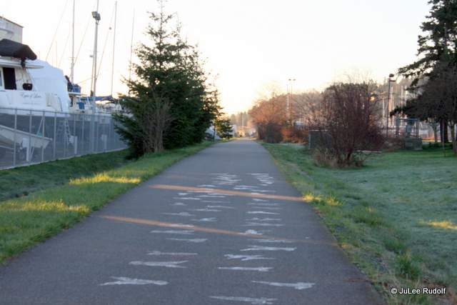
Although I wasn’t even aware of the trail when we first moved to Whidbey Island, during the past few years I’ve run many miles (and walked some too) along it. In addition, as Runner 8 during Ragnar Northwest Passage last summer, I got the chance to run on it at night. I’ve also run on (and beyond) it while participating in the Anacortes Art Dash. Both events take place in July. But I digress as usual. And now back to the trail…
During the past week, I’ve made a few trips to various places along the trail in hopes of seeing some super cool stuff to share with anyone who might need a little push to get out there and spend time on it.
North End
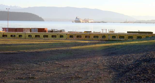
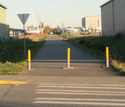
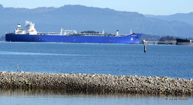
One weekday morning, I stopped by 3rd Street (technically north of the official start of the trail) at about 7:30 am. The first things I noticed, besides the sunshine, were the sights and sounds of shipbuilding taking place along the nearby waterfront.
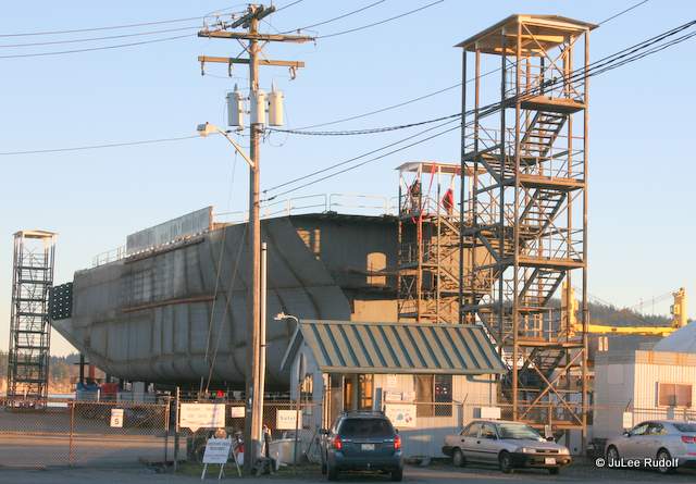
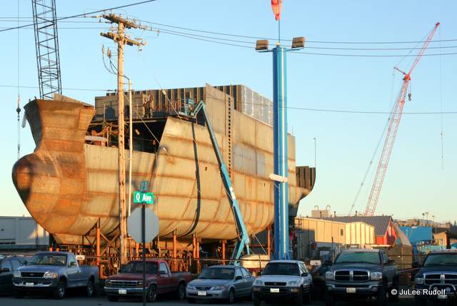
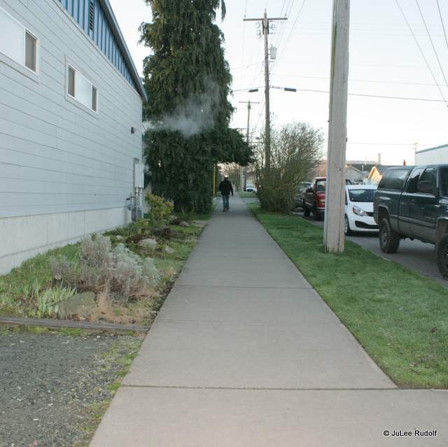
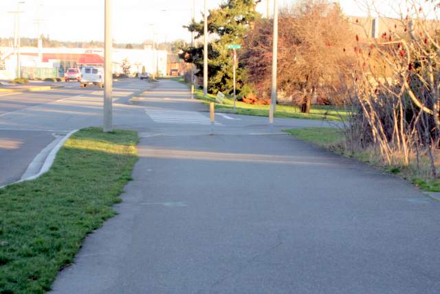
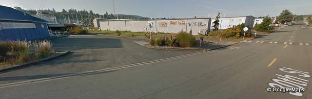
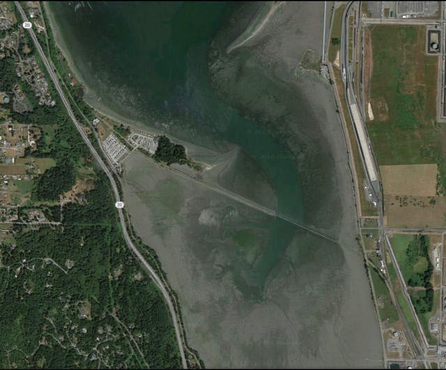
Facing the south from the same spot you can see the sidewalk that extends beyond the north end of the trail. This is just above the little green arrow on the (featured image) Google map.
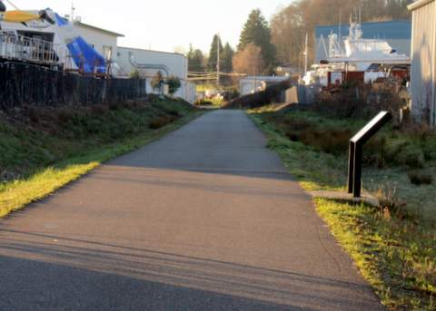
Middle North Section
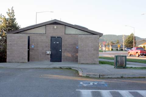
Continuing south for about a mile, you’ll reach a parking lot complete with bathroom facilities at 21st Street.
From here you can access the Anacortes Skatepark, mere feet from the trail.
Middle South Section
Along 30th Street, you’ll find another public restroom at a Yacht Broker building opposite some cool murals. In this image from Google Maps, the murals are on the building in the center which will be to your right as you head south along the trail. The restrooms in the blue building to the left.
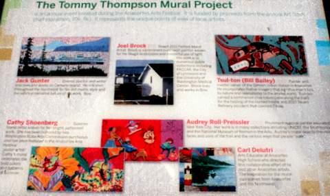
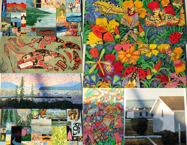
Here are all of the murals in collage format.
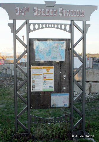
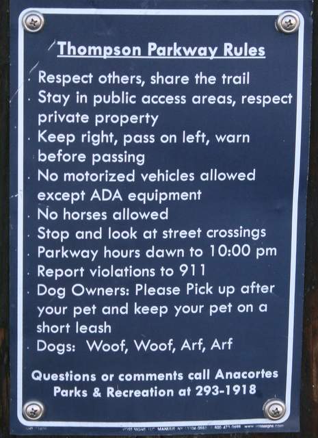
Thirty-fourth Street is just a few blocks south. This is where you’ll notice a lot more information signs, usually in groups of three. As you enter the trail here, you’ll notice the Thompson Parkway Rules. My favorite, “Dogs: Woof, Woof, Arf, Arf.”
South End
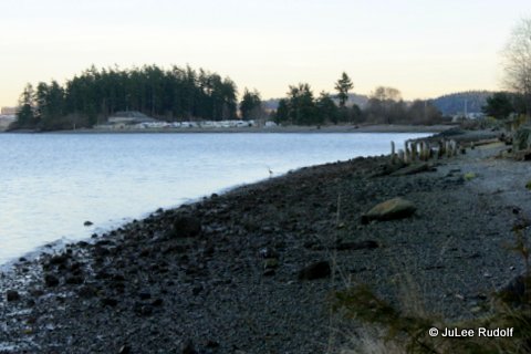
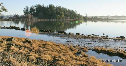
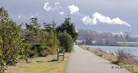
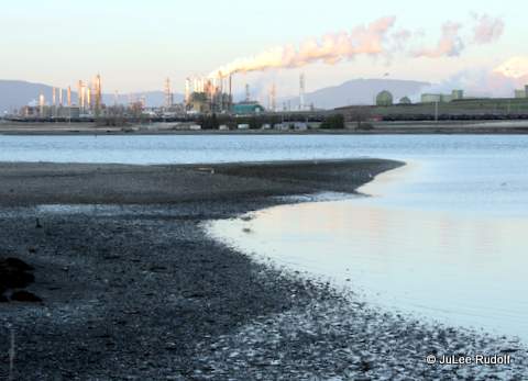
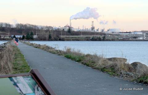
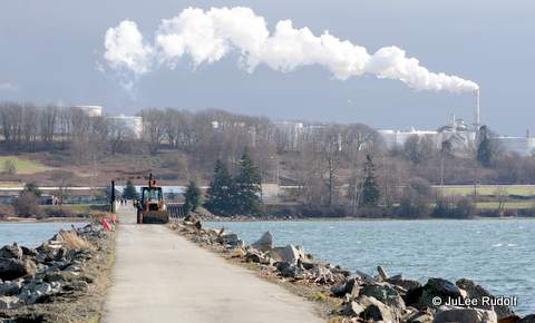
Soon you’ll reach what I think is the prettiest part of the trail, the south end, where it extends across Fidalgo Bay.
The following photos, which are in order from north to south along the trail, were taken at four different times: low tide at sunset, low tide at sunrise, high tide in the morning, and high tide during a very windy afternoon.
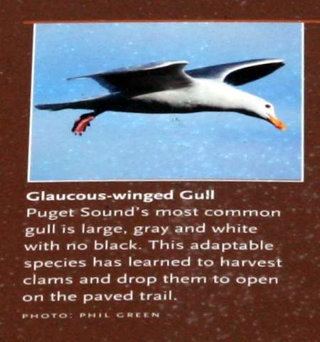
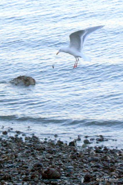
I noticed a Glaucos winged gull (learned the species from an information sign) dropping a mollusk in hopes of breaking open the shell.
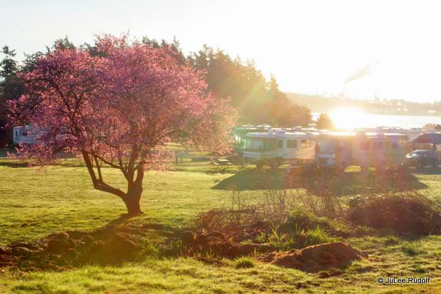
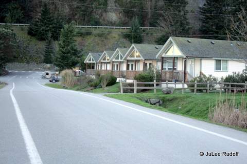
Just a little further south, you pass through the Fidalgo Bay Resort RV Park.
This view is from just north of the entrance to the park along Fidalgo Bay Road.
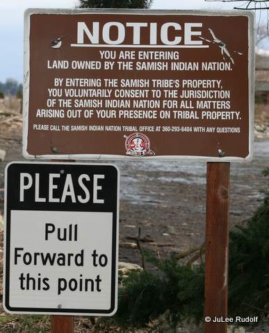
I hadn’t realized until parking along Fidalgo Bay Road and accessing the TTT along Weaverling Road (the entrance to the RV park) that the Samish Indian Nation owned this land. It isn’t a typical place to access the trail because there isn’t much space to park except maybe for a couple of cars along the dirt shoulder beyond the bike lane. Normally, you’d already be on the trail heading south as you passed through this RV park.
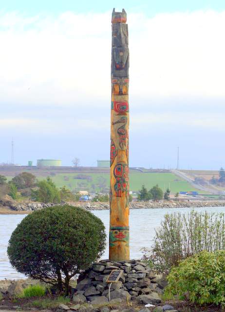
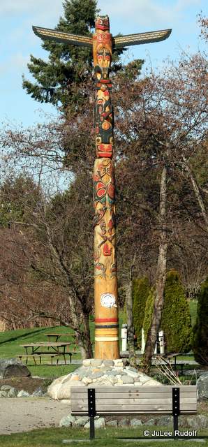
This Samish Indian Nation totem pole greets you as you enter the RV park.
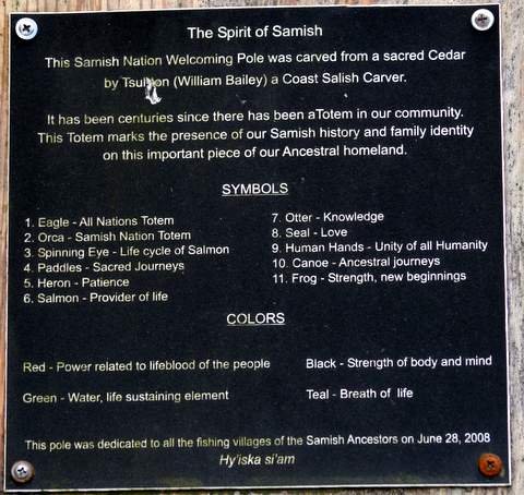
At the base of it is a sign with a key to the Welcoming Pole’s symbols.
As you walk east along Weaverling Road (or south along the trail), you’ll notice this second totem just to the east of the trail north of the RV park.
Looking back (southwest) along Weaverling Road you’d see this view of some cute cabins that are part of the RV park.
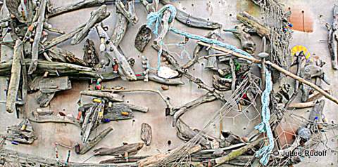
Soon, you’ll reach the trail, where you’ll see the final of three restrooms (a porta potty) next to an artwork display of fishing related items. As I neared the trail, I noticed a Belted kingfisher perched atop a tree at the inlet between Weavering Spit and the trail. Although one of my favorite bird species, I’ve found them to be nearly impossible to photograph because they are super shy and fast flyers. As I lifted my camera, it dashed off, making its call as it did so.
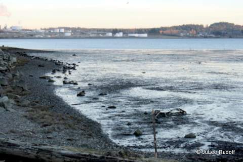
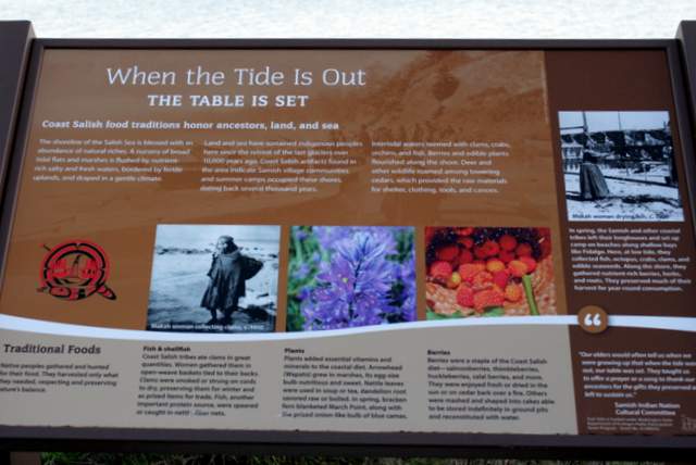
“When the tide is out, the table is set,” applies to herons and gulls as well as to humans.
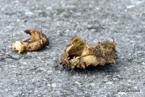
Walking along the part of the trail that crosses Fidalgo Bay, I noticed several crab shells that appeared to have been dropped by birds. These appear to be the remains of a Helmet crab but I also noticed some Dungeness crab shells.
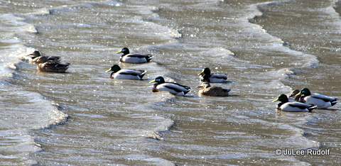
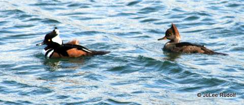
Wind blowing towards the backs of their heads gave these Hooded mergansers a new look.
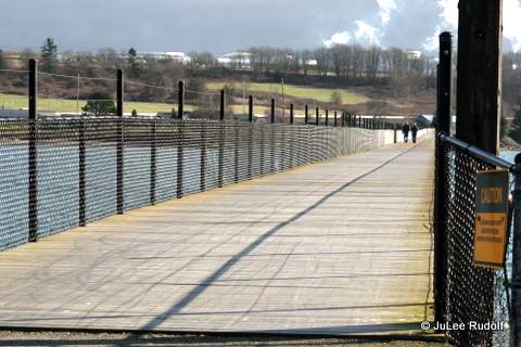
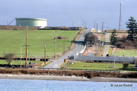
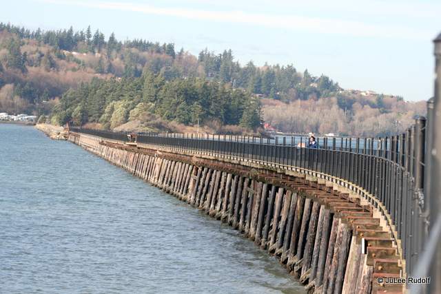
The trestle, about four-tenths of a mile long, marks the southernmost part of the trail.
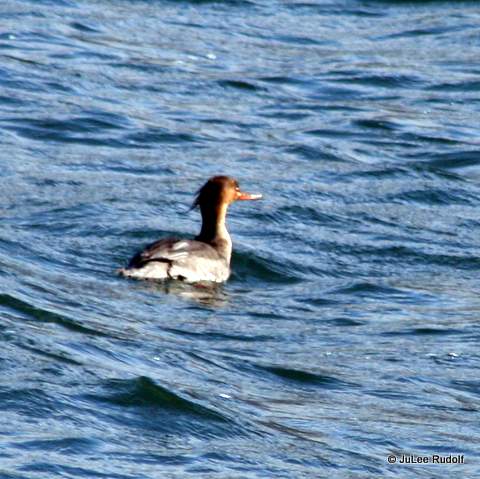
I think this is a Red-breasted merganser.
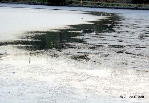
Along the entire section of trail that crosses Fidalgo Bay, you’ll likely notice many shells. This is what is left after birds (I’ve seen gulls and crows do it) drop mollusks (and, it appears, smaller crabs) in order to crack the shells to get to the stuff inside.
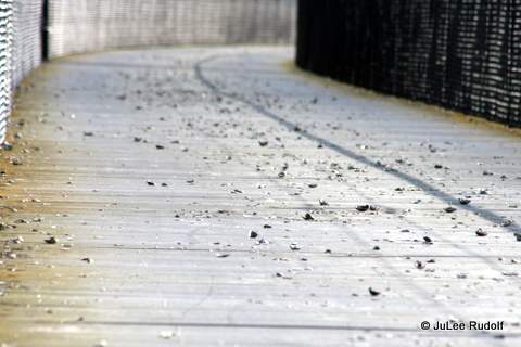
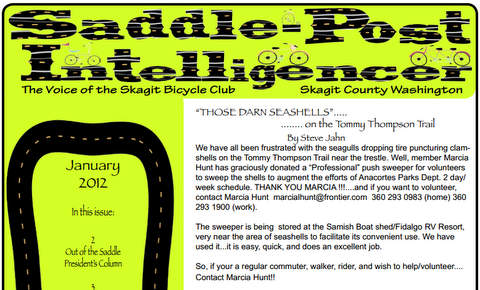
As this 2012 Newsletter story confirms, the Skagit Bicycle Club provides volunteers to clean them off.
As you near March Point Road, look to the left to see “the” (only) hill that you’ll have to climb if you choose to participate in the otherwise super flat, scenic, Anacortes Art Dash Half Marathon. It’s steeper than it looks.
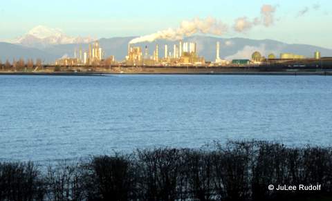
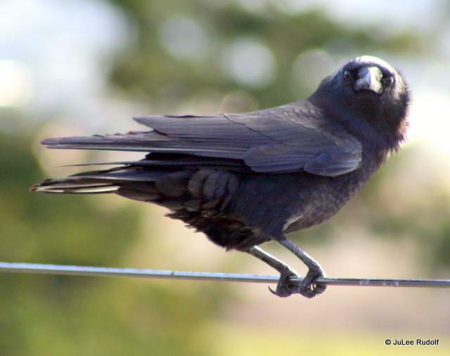
Although the wind was really blowing, several crows were hanging out on the cable that runs along the top of the fence on either side of the trestle part of the trail. This was my favorite shot of the day. As I neared the end, I heard a super loud siren coming from the direction of the Shell Puget Sound Refinery followed by an assurance that the warning sound was only a test.
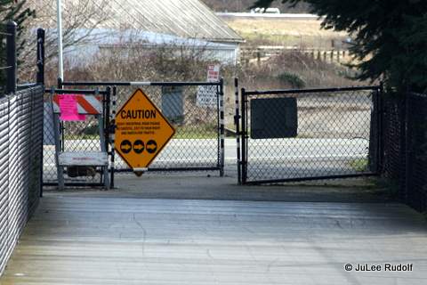
Soon, I’d reached the south end of the trail. Bikers (and runners who want to go far) can access March Point Road just beyond the signs.
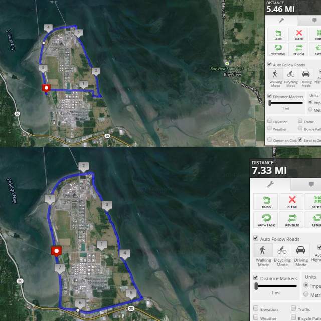
March Point is a great, super scenic place. Completing the smallest loop (following N Texas Road) from the end of the TTT, you could add 5.5 miles to your route. The large loop would add 7.3 miles.
I had no plans to complete any extra miles on this particular day. When I reached the end, I turned around and headed back.
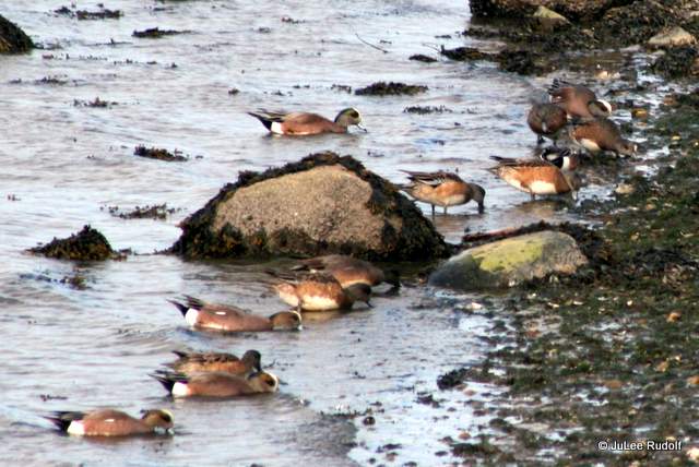
I noticed a bunch of ducks harvesting something (probably mollusks) along the north side of the trail in Fidalgo Bay.
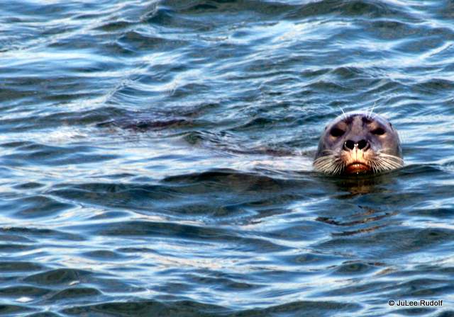
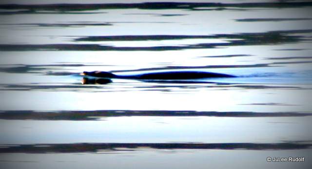
Paying super close attention (since the water was really choppy), I’d been hoping to spy a harbor seal. And did! This one submerged as soon as I stopped and acted interested. When it didn’t surface after a few minutes, I gave up on seeing it again and continued on. I could even see its whiskers.
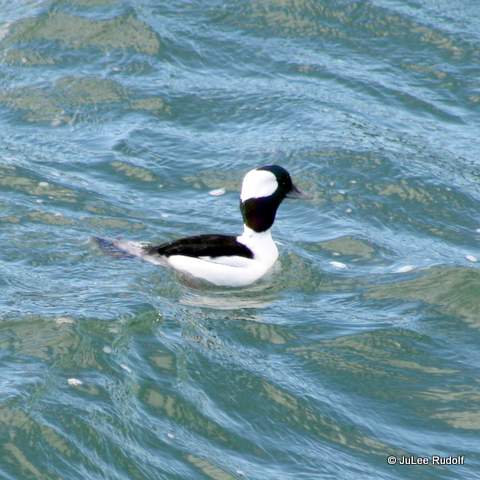
I also noticed a Bufflehead, which are pretty common in the area.
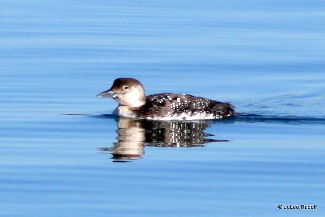
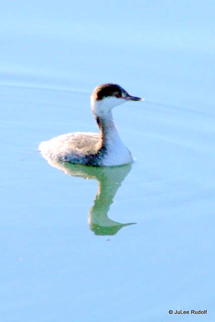
On a separate calm, sunny morning, while walking with my husband, we noticed a loon (shown earlier), several grebes (they seems small compared to most shore birds) and what I’m pretty sure was an otter.
I was super happy to have had some really cool creature-encounters along the Tommy Thompson Trail.


Thanks for the lovely pictures and narrative… I walked along the southern end out across the water on my visit last September!
LikeLike
You are so welcome. I hope you get back out there when you return in March.
LikeLike