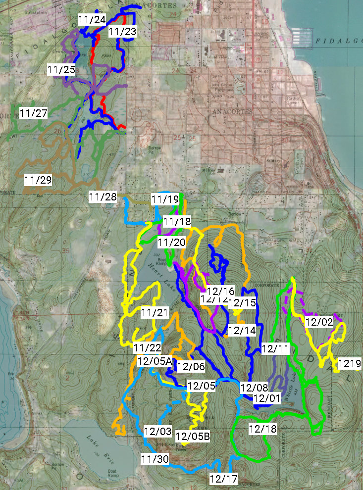
 On my 19,947th day on earth, I learned something that came as a complete surprise: I am not invincible to injury. Racing down Mount Constitution in early October, the medial meniscus at the back of my knee detached from the bone with an unmistakable (but not painful) “pop.” A month later, I broke my arm. With a minimum of six weeks of restriction from sports, it was the right time to attempt a quest I’d been contemplating for several years: hike all 57 miles of trails in the Anacortes Forest Lands (ACFL). Doing so would allow me to stay in some semblance of shape as well as traverse several miles of unexplored trails. I decided to begin at Heart Lake, the area with the flattest, fewest trails (10 miles); move to Little Cranberry (17 miles); and finish up at Whistle, which boasts the steepest, most (30 miles) trails.
Heart Lake (11/18-11/22): Favorite Trails–209, 210, 249

 Ski-hill-like symbols on the back of the ACFL maps, “easiest,” “more difficult,” and “most difficult,” accompanied by a brief description confirm what’s easy for anyone familiar with the area to figure out herself: the highest concentration of physically and technically easy trails of the ACFL’s 2,800 acres are located at Heart Lake, which is where I began my quest. Trail 210, accessible from the main parking lot, loops most of the way around the lake and is one of my favorites for several reasons: (1) it meanders past a number of old growth Douglas Firs south of the lake; in the fall it’s home to one of the most noticeable mushrooms–Fly agaric, easy to identify with its bright red cap and spikey beige spots; (2) near the parking lot and the junction with Trail 224 grow Black Cottonwood trees, which boast beautiful spade-shaped leaves that transform into a gorgeous golden color before joining those of the Bigleaf Maple, Western Redcedar foliage, pine needles and other stuff that creates a colorful carpet on the forest floor every fall. I covered part of this trail on the 20th of November and finished it off the following day.
Little Cranberry Lake (11/23-11/29): Favorite Trails–101, 103, 115

 Sometimes what seems like it’s going to be awful turns out to be awesome, which was true during much of the time I spent near Little Cranberry Lake. On the 25th, minutes after yielding to two horses, I noticed an old, typical-size pile of horse manure littered with tiny protrusions, which turned out to new-to-me, the snowy inkcap. Two days later, I headed south and west towards Trail 137, the only one on which I’d never walked, after nighttime rain that changed to morning drizzle. Pacific tree frogs called intermittently, and as I passed Mitten Pond: the siren call of hoo-ing owls beckoned. Great Horned owls had recently been seen in the area and after listening to Bob Jepperson’s soundtracks, I suspected that species. Time-constrained, I continued towards my original destination, where I arrived in time to see the sun rising between the trees. As I backtracked along Trail 10, I heard an unfamiliar sound, the quietest of quacking in an area littered with deciduous tree leaves wet with the night’s rain–possibly that of a wood frog. From the same spot, I watched a confident Douglas squirrel demonstrate the proper way to deseed a cone from a Douglas Fir tree, its primary diet, and namesake.


Whistle Lake (11/30-12/19): Favorite Trails–201, 204, 218, 239, 247, and the 300s
 The last day in November, I hiked the quarter mile long Ray Ault Trail (214), which scared the heck out of arm-casted me with its steep-ended accesses along Mt Erie Road. It was worth it for the section that passes a craggy rock face, but I wouldn’t do it again without full use of my appendages. Three days later, I proceeded further up the same road and to check out another unfamiliar trail: 239. The map indicates 0.5 miles, but the fun didn’t begin (with a steeper section and a brief glimpse of a retreating barred owl) until after I passed the half-mile mark. And it was another quarter mile to end with a view towards the southwest of Lake Erie. During what was left of the fourteen days I spent here, I continued to encounter one species of birds more than any other: the robin-sized, super shy Varied Thrush with their “blue-gray on the back and rich burnt orange below,” which retreated immediately each time, departing with conspicuously loud wingbeats. In addition to the thrushes and a couple of owls, I encountered at least a dozen species total of woodpeckers, ducks, sparrows, wrens, herons, eagles and an errant Trumpeter swan (in Big Beaver Pond), which was easy. The ACFL is home to as many as 65 bird species. During one the last days with my cast, I bit off more mileage than I could chew before dusk during what turned out to be a nearly three hour venture that ended with me carefully picking my way along the trails in the dark hoping that my phone’s flashlight wouldn’t die before I found my car (it didn’t). When I tallied up the total distance of ACFL trails on which I’d never traveled before, it came to a mere four miles.


 Windy weather threatened to delay the completion of my quest, but with only days to go until the cast would come off, I braved (or foolished) death by windthrow in order to catch ’em all. Trees swayed, branches flailed, and the fronds of sword ferns, probably the most common herbaceous plant in the Forest Lands, waved. In my meanderings, I’d considered these prolific plants to be as unremarkable as they are ubiquitous. Were they trying to tell me something? I found them in one of my favorite books Plants of the Pacific Northwest Coast where I learned, “Sword fern leaves were used by the northwest coast peoples as a protective layer in traditional pit ovens, between food in storage boxes and baskets and on berry-drying racks. The leaves were also used for flooring and bedding. The large rhizomes were dug in the spring and eaten as a starvation food by [several tribes]…” Ancestors of these unassuming plants had saved people’s lives! Maybe they were waving to nudge me towards insight. I spent 27 days covering 80 miles of trail, during which I encountered hundreds of the thousands of species of flora and fauna that live in the ACFL, but the thing that left the biggest mark on me was a common plant. The sword fern reminded me that everyone has an important backstory that can be learned with a little effort.

Thanks to my sister JoDee for suggesting this title.
 Snap! I felt a pop at the back of my knee as I reached mile five along one of the most scenic sections of single track trail I’d ever traversed. Under different circumstances, I would have stopped, but with several miles to go on my Moran Constitutional Relay team’s penultimate leg, there was no time to waste. I jog/hiked the uphill sections, and skip-hobbled the flats and descents for 45 uncomfortable minutes, keeping my knee bent slightly so it wouldn’t hyperextend, which was my knee’s-never-been-hurt fear. Runners who’d backtracked after finishing coaxed me through the last half mile with promises of “You’re almost there.” Three and a half miles after my knee went bad, I stepped off the trail and onto the pavement at the busiest of the race’s six exchanges: Mountain Lake Landing, placed our team’s chip in a slot atop a sign, sloppy Operation Game-like, and passed it on to Tiffany, our team’s last runner.
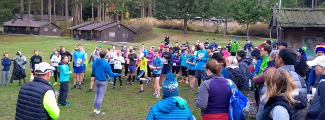

 The race begins on a Saturday morning at 7:30 am. Participants may camp or stay in the cabins that surround the primary congregation place, the Environmental Learning Center (ELC), mere steps from the start and finish each day, or elsewhere on the island. Trails pass towering old growth trees, lakes, streams, and waterfalls. Everything was lush green under clear skies outside the canopy of trees and the most exquisite layer of mist inside much of it. The light rain that fell Sunday took nothing away from the scenery. It was still spectacular. Most got the chance to spend some time entirely alone in the wilderness.
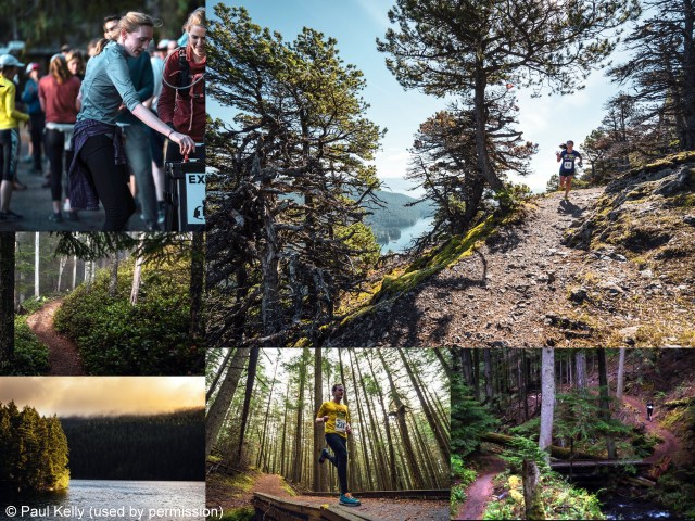
 According to
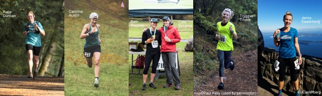
 We paid to eat and sleep at the ELC, so we didn’t see much of the island outside the park except to and from the ferry terminal, which is where I learned a valuable lesson: not only must you obtain a reservation for the ferry trip from Orcas to Anacortes, you must use it wisely. With 90% of the ferry’s 144 vehicle capacity reserved, as few as 14 vehicles are allowed on from the standby line. We arrived at 2:00 pm with a 5:15 pm reservation and were placed in the standby line. Once the 3:15 left, I sent my teammates off as walk-ons and explained to two of the three onsite Washington State Ferries employees that I had a 5:15 reservation and wanted to use it if wasn’t going to make it on as a standby (I was in the outside lane, so it’d have been easy to move me) after showing them where I was in the line. Both assured me that I would, but when “my” ferry left without me, I realized that they were not only lazy, they were wrong. I waited for the 7:30 ferry. Don’t be like me: get a reservation on the 3:15 ferry or later and insist to be placed in the reservation line.
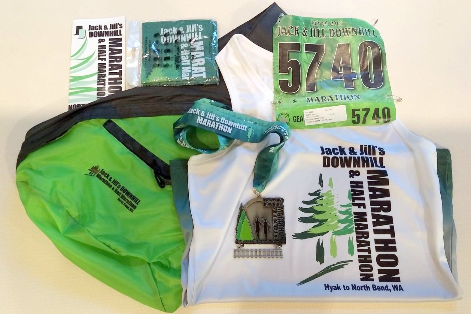
 Two fat flies spin wacky spirals around my head and torso, like tiny sharks circling their prey.
  In May, my 19-year-old son and I complete the
  During race week, organizers assign us to the first shuttle bus to the start–at 4:00 am. Killing time at our hotel the night before, we learn that
  About 6:15, 600 participants drop extra gear, apply temporary Boston Qualifying pace tattoos to forearms, don headlamps, and assemble behind the start line. Pacers in fluorescent yellow hold slim wooden sticks with times atop. My goals are to run 10 minutes/mile or better, not walk, and be mindful. I’ll be listening to songs by artists like Avril Lavigne and Cardi B, my daughter’s playlist and her contribution to the day. Right on time, the race official sends us off in waves along the
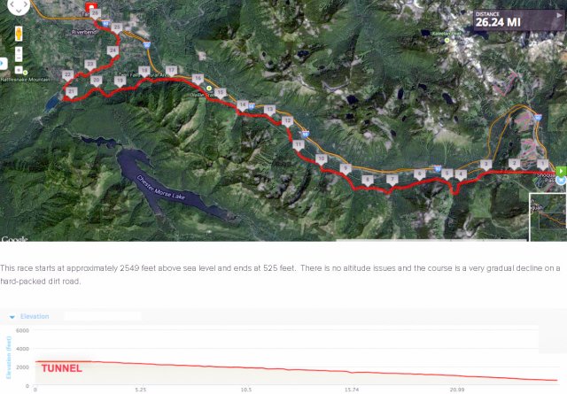
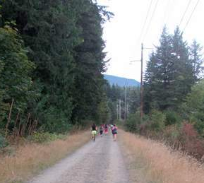 I pay attention to the wildflowers (foxglove in white, lilac, cotton candy pink and every shade in between, yarrow, daisies), mostly evergreen trees, trestles, rock climbers, mountains, streams, and rocky hillsides and try not to let the bikers calling out and ringing warning bells get me down. We share the trail with its dust, rocks, and ruts reluctantly. I stay to the right, debate whether to follow the pack that moves left to gain a bit of shade from the trees or save energy by remaining in the sun a little longer. Organizers boast a downhill course, which is true, but 2,000 feet of descent in 26.2 miles calculates out to a one percent grade, which mostly feels flat. I’m grateful for the few sections of trail entirely shaded and surrounded by trees on what turns out to be the hottest day of the year so far. And I wonder how my son is doing, somewhere behind me.
 Four hours and fifteen minutes and over 40,000 strides later, I cross the finish line, stop my watch, accept my medal, a bottle of water, a cold wet cloth, and hobble to a dusty patch of grass, where I sit and wait, debate whether or not to vomit. Finally, the announcer calls out my son’s name–twice. The only two Garretts in the race, both age 19, finish within a second of one another. Best moment of the day: being present to see my son accomplish this goal. We agree that it will be the last one we’ll run…ever.
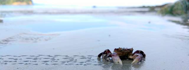


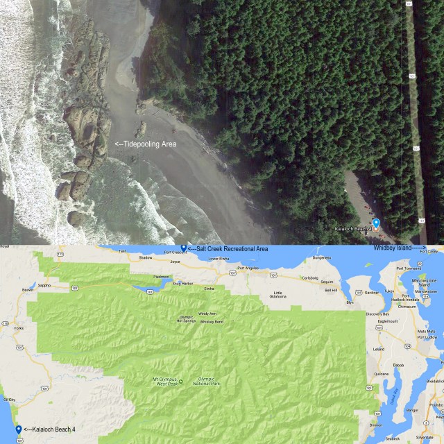
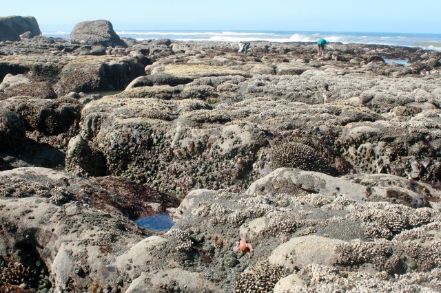
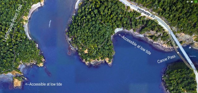
 A year ago, I first learned of a prospective place to view unfamiliar sea life: Salt Creek Recreational Area in Clallam County. Poor planning brought me there at a relatively high tide during a record low tide week, but it was obvious that if the water were to recede a few more feet, I’d be in tidepool paradise. According to the
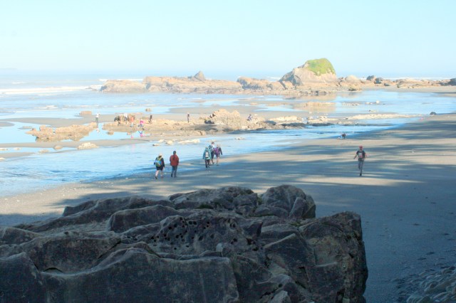
 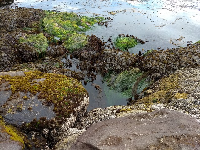 This June, I arrived at Salt Creek half an hour before the lowest daytime tide of the year. Along the northeast side, a young family picked their way over an expanse of slippery, barnacled boulders. The mom exclaimed “starfish,” at regular intervals, which sent the rest of the family scrambling in her direction to view and photograph each one, then return to his or her own search, “
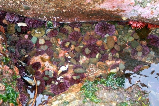
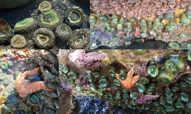
 The primary finds: sea urchins in dark purple (
 Best way to avoid worrying for weeks about how you might perform in a race–sign up last minute, which is one reason I agreed to join the Anacortes All Stars Ski to Sea 2018 team only thirteen days before the race. The other: I’d get to run almost entirely downhill. And since the team captain recruited sponsors, my cost to participate was a mere $6 (that is not a typo). Two days after the race, my quads still scream whenever I step or sit down so I walk like a stiff-legged zombie.
 “First run in 1973, the
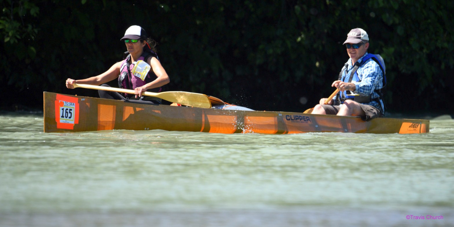
 On the last Sunday in May, eight Anacortians completed the seven-legged race: cross-country ski (Nina), downhill ski (Lisa), running (me), road bike (Mike), canoe (Megan and Eric), cyclocross (Julie) and kayak (Patrick) a grand total of 93.5 miles. We first three arrived at the Mt Baker Ski Area at 6:30 am for a 7:00 pre-race meeting and 7:30 start. Nina, our cross-country skier, kept track of the team’s orange plastic timing chip (attached to a black velcro wrist strap). Teammates pass the chip after placing it near a red and white bulls-eye sensor that registers the time at the limits of each leg.
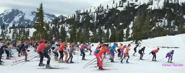
 Cross Country Ski: What to do when you’re competing against Olympic gold medalist
  Run: I made my way across the snow to meet Lisa, collected the timing chip, ran past the bullseye and down the Mt Baker Highway. While waiting, I’d wondered how best to carry the chip, how fast to go, and what would happen once I reached the last half mile when the course becomes flat after a steady 6% downhill grade for the first 7.5 miles. Our team’s fastest female runner (Megan) had quizzed me about my prospective pace. She insisted I could do better (and I did). Part of my plan was to lean in, literally.
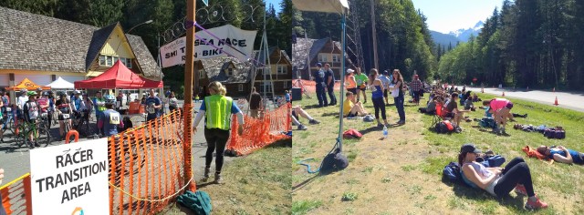
 Bike: At the pre-run meeting, a race official informed us–the Good Samaritan Law is in effect: if someone needs help, we should stop and offer aid. I’m glad that I didn’t have to step over a fallen, bloodied runner. Nina said same. Mike, our cyclist, however, followed rule, stopped to make sure a cyclist with a flat had the equipment he needed before continuing. The bike leg covers the longest distance 41 miles, over 40% of the total. Even with the good Samaritan delay, Mike finished within a few minutes of his 2017 time.
 Cyclocross: Julie (a leader of the
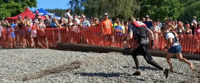

 Great effort on every leg shaved about 27 minutes off the team’s 2017 time, good enough for 156th place of 353 finishing teams. And everyone had fun, so we met our goals. With the 2018 Sea to Ski relay in the books, I’ve learned to Lean In, that it’s the journey, not the destination, and that camaraderie is the best part of racing…especially once you’ve reached the half-century mark.
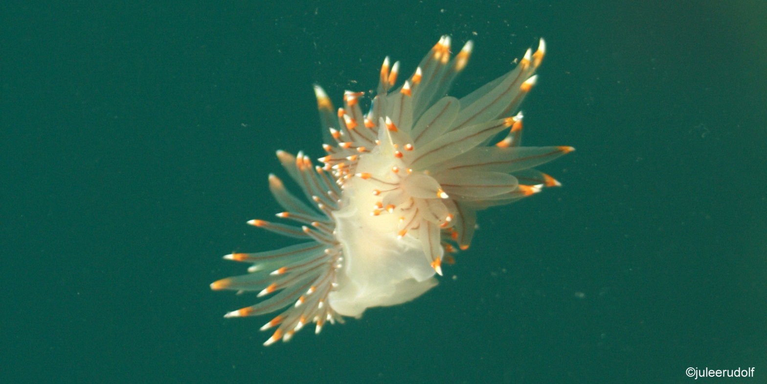
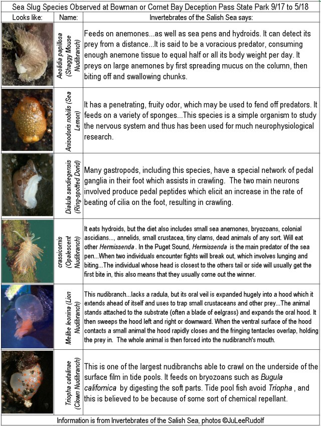
 Sea slugs cast a spell on me…and it all began with fake news. Well, semi-fake. Okay, it was actually two photographs, and the one that cast the spell wasn’t exactly fake, but it wasn’t of “the” sea slug. It was a vibrantly-colored red-tipped, black and white version of the same sea slug species taken underwater in all its flowing cerata glory. The actual sea slug, fully exposed to the air because it hadn’t paid attention to the tides, was smallish, blobbish, and its orange-tipped cerata were all clumped together like a minuscule bowl of purple sauce spaghetti with shredded cheddar cheese on top.
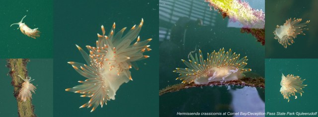

 According to
 For a few weeks after I saw my first sea slug, it seemed as if they simply appeared whenever I showed up. One might argue that they were there all the time and I had simply started paying proper attention, but I like to think that they heard me coming and crawled quickly in my direction, because of which, I christen myself the Nudibranch Whisperer of Deception Pass. Although I am prepared to defend my title, the next time you go beachcombing or tidepooling at Deception Pass State Park or elsewhere, I hope you will give nudibranch whispering a try.
 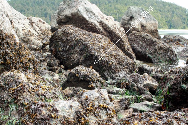 Check out
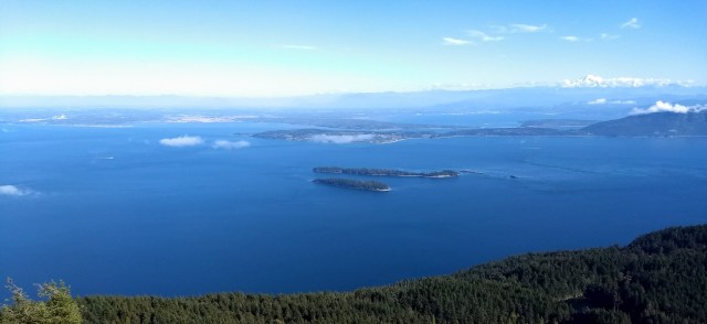
 Mount Constitution, which tops out at 2,400 feet, is the highest point in the San Juan Islands. It’s located on Orcas, the largest of
  On a clear day, from a rock face along the eastern edge of Mt Constitution’s summit, you can see for miles. Mt Baker, St Helens, Rainier, the Olympics and the Canadian Rockies are a few of the more familiar sights. The quickest way to the top is by car.
 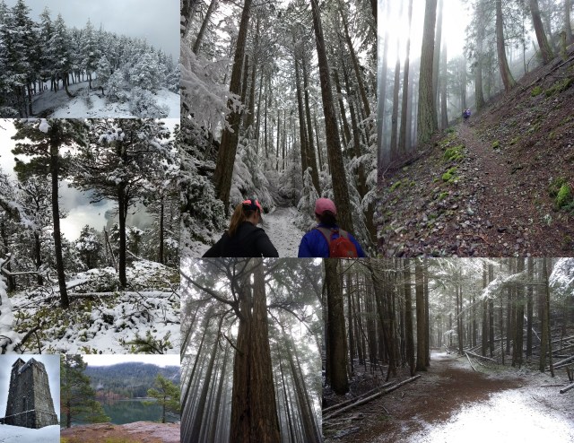 Seven weeks prior, on a cold morning in early spring, half of our group previewed the course. We arrived at a nearly empty parking lot at 8:00 am and spent the next four hours running, hiking, reading maps and trail signs and taking photographs as we made our way along the route during which we made but one navigational error that added a mere half mile to the actual route. With temperatures in the upper 30s, we weren’t surprised to encounter snow. The three of us completed the course together, mindful of the peace and quiet we experienced because of the cold cloudy weather that meant we would miss out on the view at the top, but not see a single soul getting there. When experienced at a leisurely pace, the hills didn’t scare us. We looked forward to returning in the future with our friends, hopefully, with better weather.
 We decided to run separately, so we knew that someone would be the first of the group over the finish line. Several of us suspected it would be my sister, who at 55 is not only the oldest, but also the one with the fewest years of running experience. JoDee spends most of her trail running time at elevations similar to that of Mt Constitution, which provides the benefit of
 The race day weather forecast called for sunny skies with high temperatures in the 60s. At 5:00 am, as 55 participants in the 50-mile distance took off towards the trails, our group of six was asleep in our bunks in a rustic cabin dubbed Swan. Three hours later, we debated what to wear and carry as 100 marathon distance runners crossed the start line. At 9:00 am, race director
 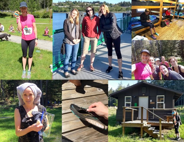 Afterward, we encountered and congratulated the overall winner of the half marathon, 47-year-old
 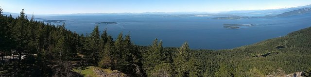 The fun we had adventuring together confirmed another thing that we already knew: completing a challenge is always better with camaraderie. We Pacific Northwesterners are blessed to live in a beautiful place filled with jaw-dropping scenery, miles of trails, acres of trees, the Salish Sea, and adventurers willing to take on challenges like the
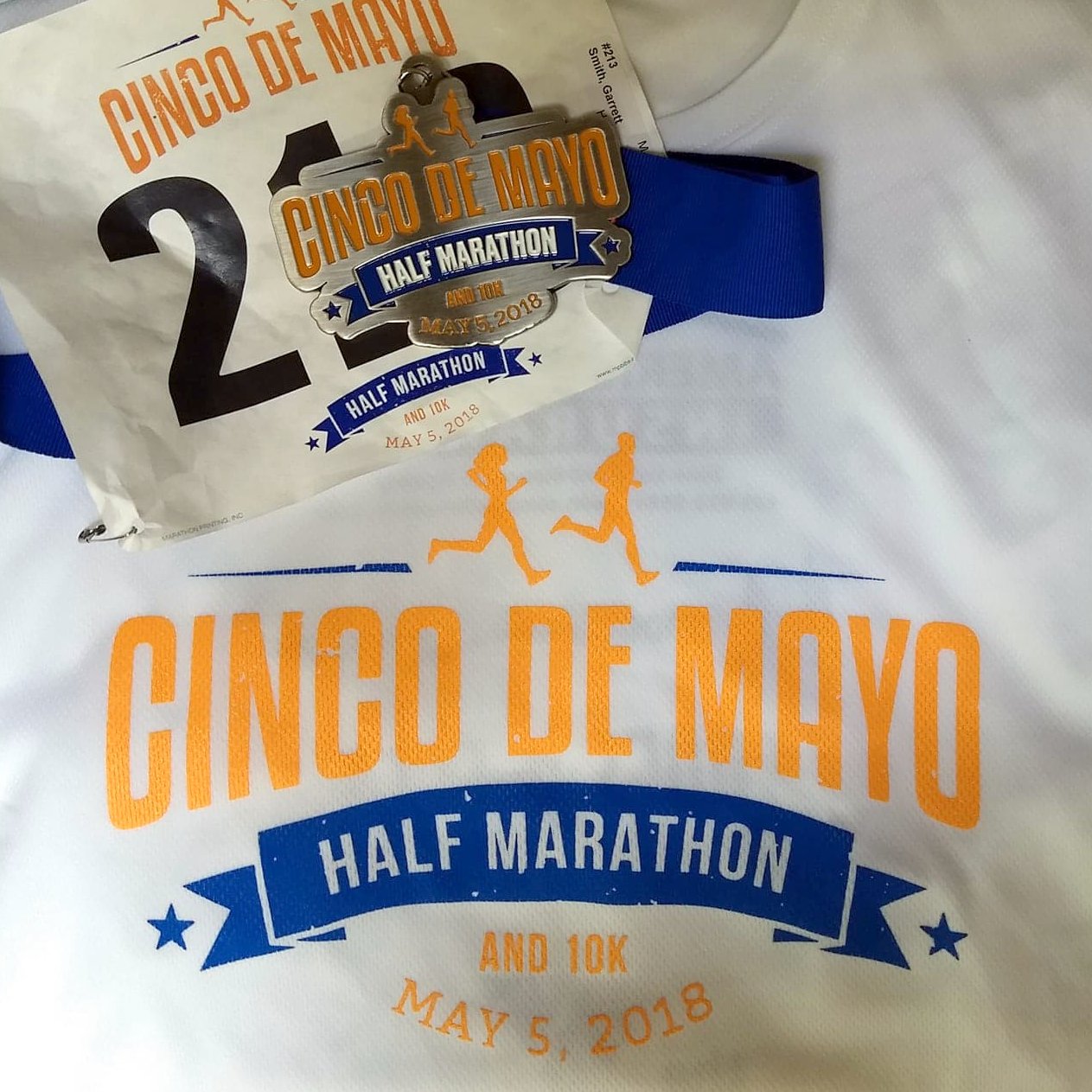

 Three miles from the finish line of the
  I’d learned that I’d be running my first road half marathon in eight years one month before the race, when my son, attending college 3,000 miles away, mentioned (1) that he was following a
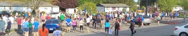
 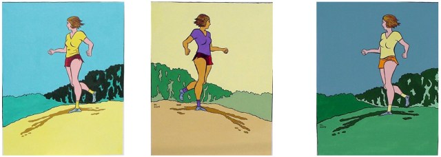 Day of race weather was 60-something and sunny without even a hint of a breeze. The nearly flat route boasts beautiful views of the Snoqualmie River (including two crossings of the historic, single-lane
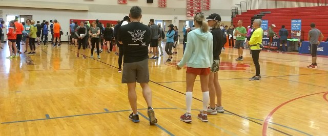
 Fortunately, the dreaded out-and-backs turned out to be blessings in disguise, as they allowed me to gauge my first-timer’s progress, at two miles, he was a quarter mile ahead of me, at eight, nearly a mile.
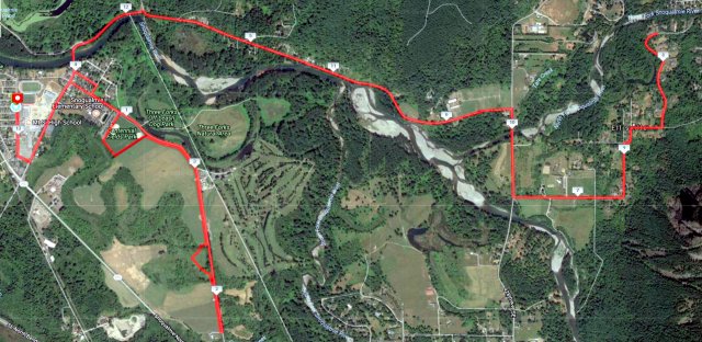

 With the guy-in-gray walking at the 10-mile mark scare a thing of the past, my thoughts returned to my two-hour completion goal. I hadn’t looked at my watch since mile two, and I didn’t plan to start. I hadn’t noticed anyone who looked my age in front of me, and wondered whether I might place in my age division if I held my spot, a perk of participating in a small race like this one (with only 243 participants). I’d be annoyed if I lost out on doing so by a minute or two, my total stopped-to-take-photos time, and I was too tired to gain on anyone. Just beyond the final aid station staffed by friendly, energetic teenagers holding paper cups while calling out “Gatorade” on the left and “water” on the right and assuring us that we were “almost there,” I noticed the fluorescent pink mile 11 marker. I’d had enough of running this pace, which seemed fast but I suspected wasn’t because I’d mostly given up running on roads in favor of trails, which we run more slowly because of the hills, roots, and rocks.
 Two miles later, I turned right off Meadowbrook Way into the Mount Si High School parking lot following an older-than-me man clad in a sweat-stained red shirt and green-edged black shorts. He looked like he was barely moving. Which meant the same for me. A running club member called out encouragement to a young woman I’d been near for the last five miles. Both wore the same black tank with a winged T emblem. Garrett was headed our way, having crossed the finish line minutes prior. He smiled. I felt like I was flying, but the clock told a different story. I met my goal of finishing in under two hours…by 63 seconds. At the
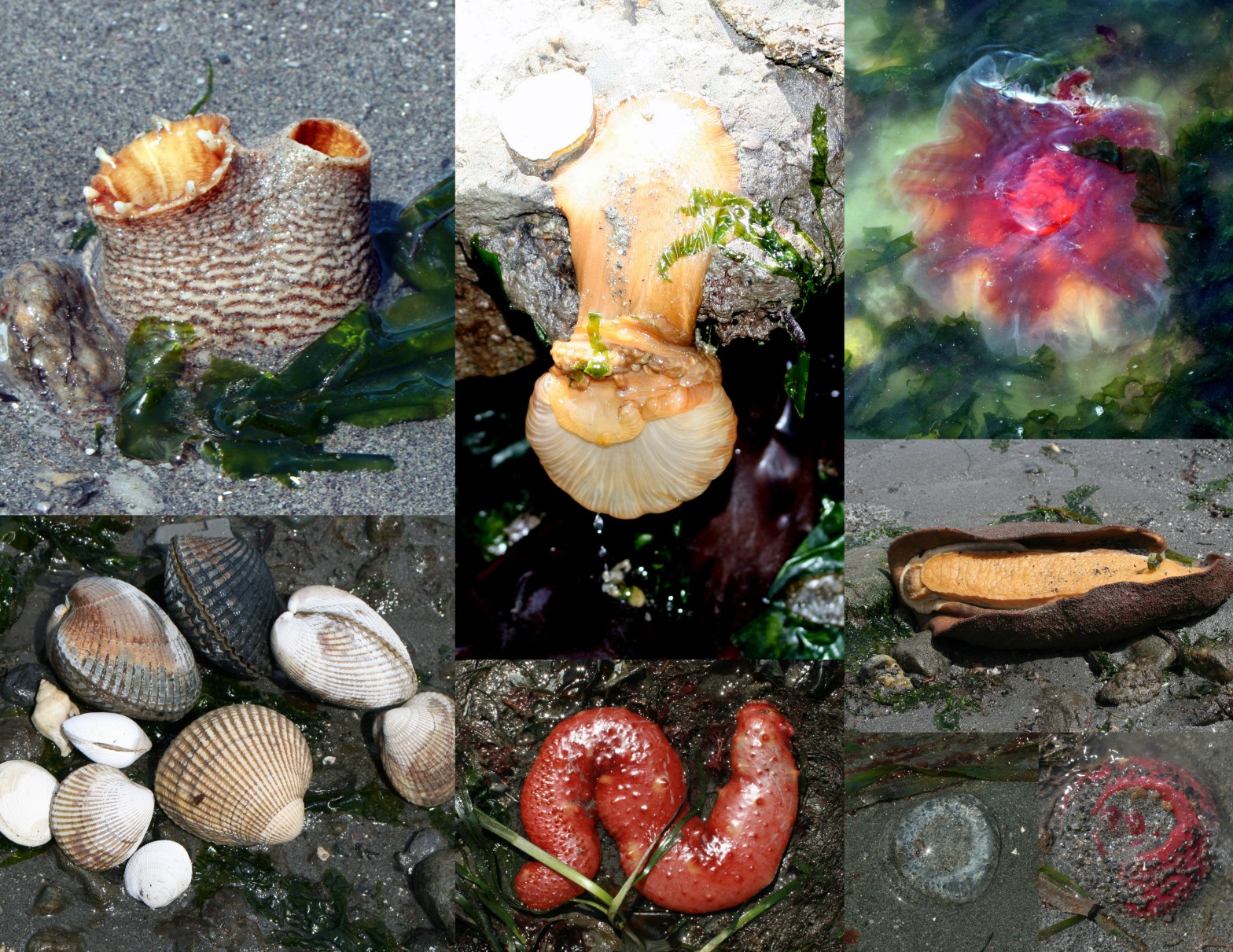


 Pre-bird through e-Bird:
 (6) Tour it by sea:
 Arrive with ten bucks cash or an Annual Discover Pass:
 It isn’t the only (trail) show in town:
 Three years ago, the first year 11th grade students in Washington were scheduled to take Smarter Balanced Assessments, “
 Because
 The
The  Students in the Class of 2019 are the first required to pass two SBA exams: the ELA and Math, the state’s most rigorous math assessment yet. Now OSPI is asking these same students to squander several class periods’ worth of instruction in order to prepare for and take the WCAS, even though they’ve not been taught the material on the test and have already taken (and likely passed) a high school science assessment last spring. That’s why I’ve decided to opt my 11th grader out of taking it. I hope that you will too.