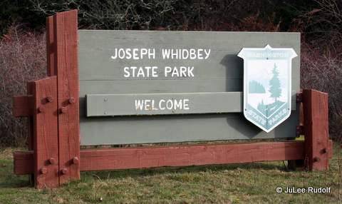
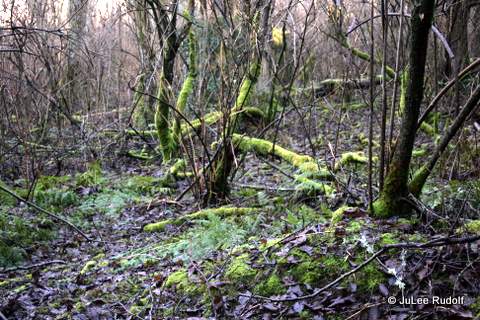
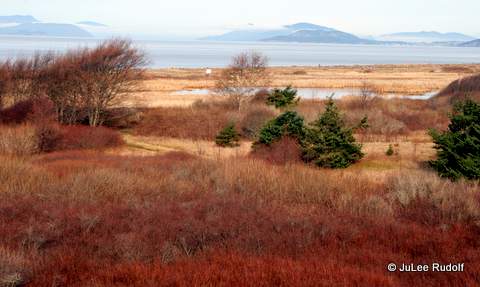
Recently, I took two trips in as many days to Joseph Whidbey State Park, which, although not far from where I live, I hadn’t spent much time in the past. My husband warned: it’s wet. That turned out to be the understatement of the year.
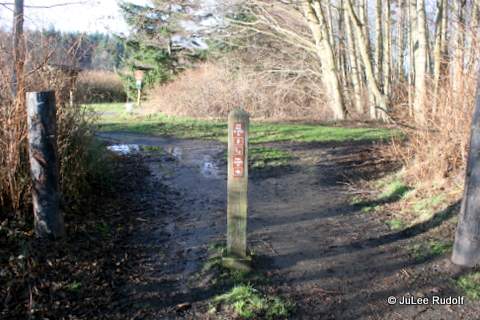
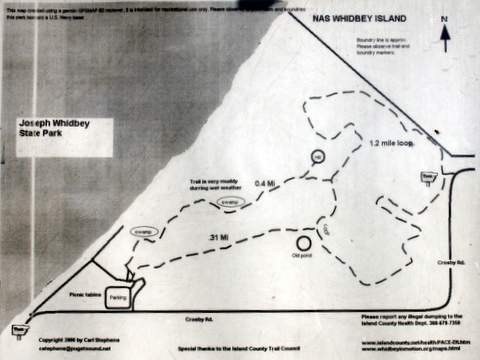
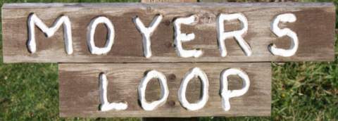
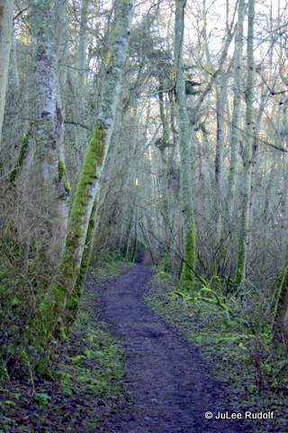
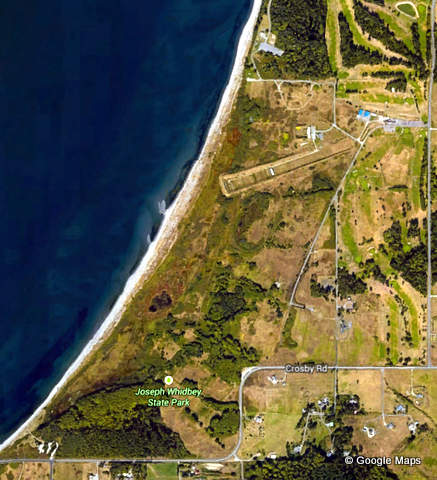
The first time, I parked in a large gravel parking lot on the east side of the park along Crosby Road, which provides access to Moyers Loop, shown on the map as 1.2 miles long. The Official Park Map is less detailed.
Entrance to Moyers Loop at JWSPEntrance to Moyers Loop at JWSPJWSP Map
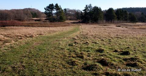
I wondered whether the trails at Joseph Whidbey were long enough and passable enough for trail running. After reviewing the map, I headed to the left, planning to complete a clockwise loop. I noticed that initially, the trail was wet, grassy and flat. Things looked good for future trail running.
Moyers Loop at JWSP
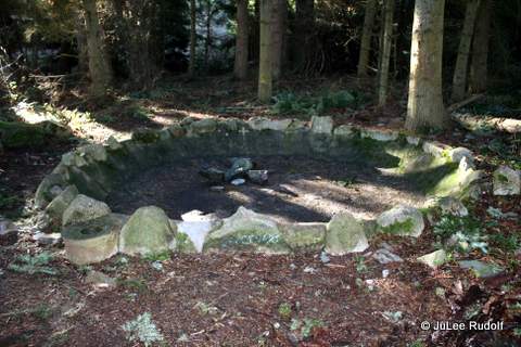
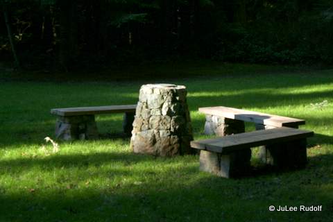
Soon, I entered an event wetter section that branched off of Moyers Loop (shown as 0.31 miles on the map) that was surrounded by trees. I heard two eagles calling to one another, then came upon this fire pit with a cluster of several large feathers hanging from a nearby branch.
Fire pit along Moyers Loop at JWSP
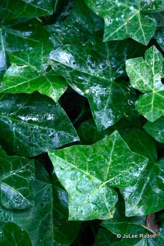
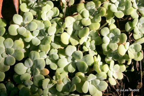
Ivy covered the ground just past the pit.
Ivy at JWSP
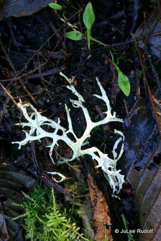
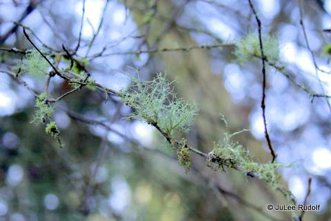
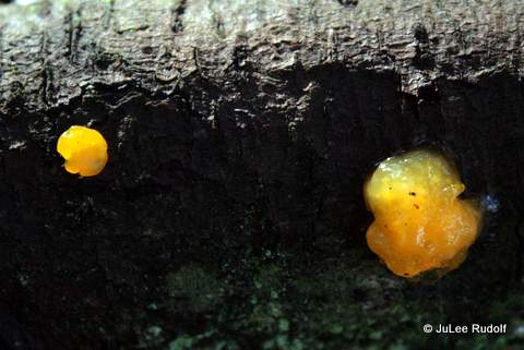
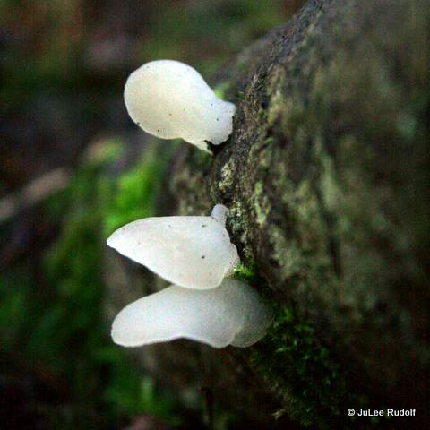
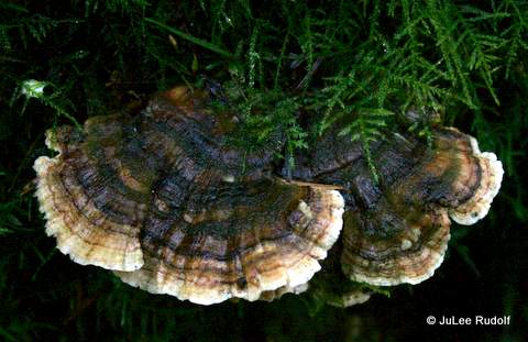
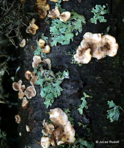
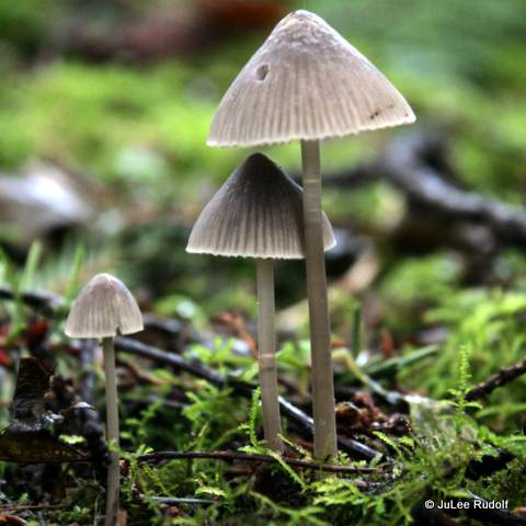
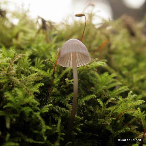
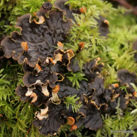
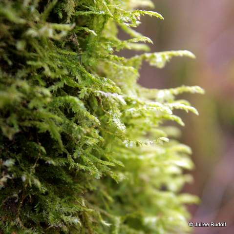
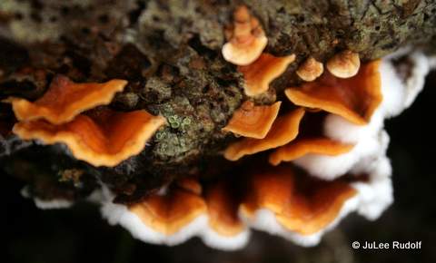
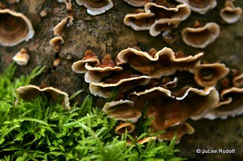
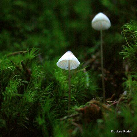
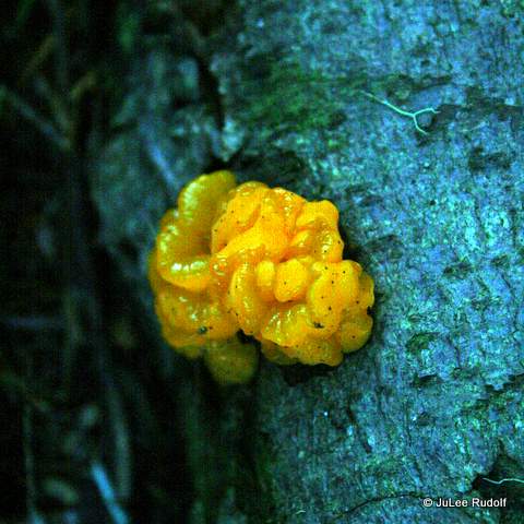
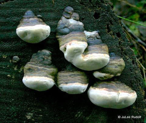
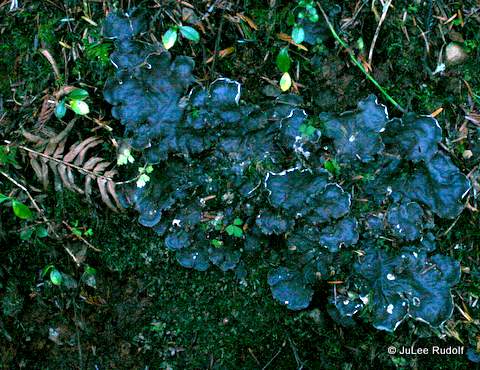
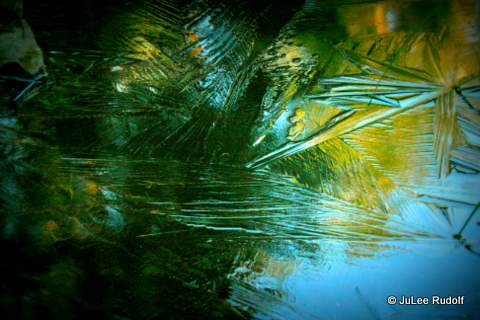
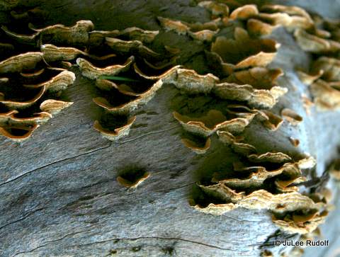
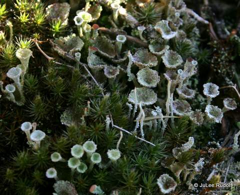
Moss, lichen and fungi and decaying logs, branches and plants covered nearly every surface of the ground and much of the lower parts of the trees.
Path to the west from Moyers Loop at JWSPLichen at JWSPLichen at JWSPJelly-like fungus at JWSP
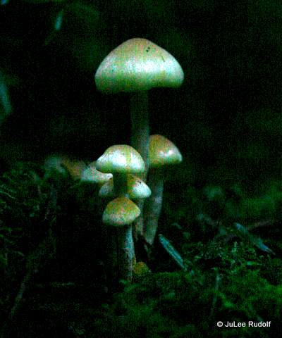
I’d never seen this species of white fungus? before.
Jelly-like? fungus at JWSPMushroom at JWSP
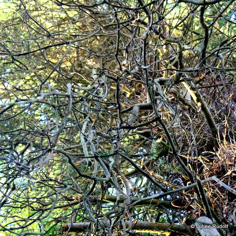
There were several different types of trees, including this covered in tangled branches.
Before long I’d reached the parking lot at the main entrance to the park with signage about the hours (8:00 am to dusk), requirement of the Discover Pass and restroom.
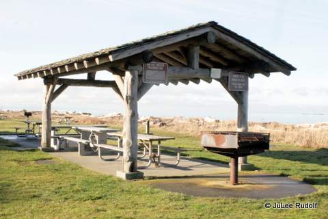
From there, I headed towards the beach, where there is a covered picnic area.
Covered picnic area at JWSPView towards the SW at JWSP
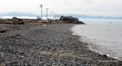
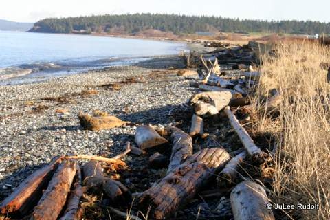
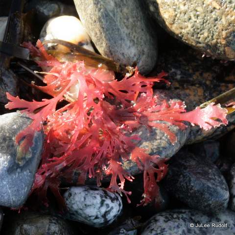
As is the case during much of the winter, the tide was pretty high. The beach was covered in glacial till, driftwood and seaweed.
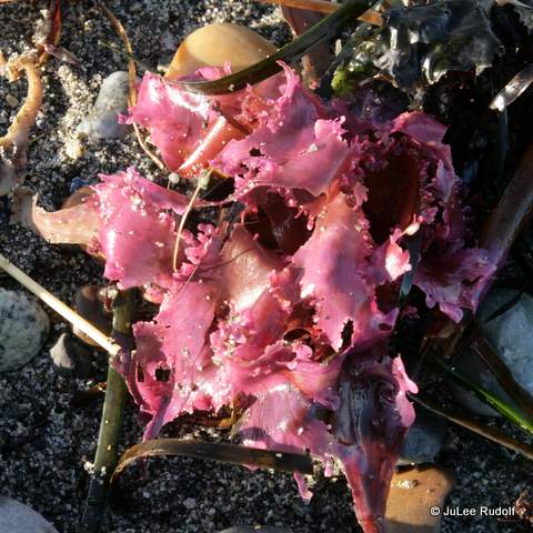
View towards the north at JWSPSeaweed at JWSPSeaweed at JWSP
A friendly guy walking his dog answered my question about a trail just above the beach. He said that it ran about a mile or so, eventually leading on to NAS Whidbey, where walkers were allowed unless orange markers had been placed to indicate that the munitions range was in use.
NAS Whidbey shooting range (top right at angle)
I returned along the same way I came, took a few photos, and planned to try the beach walk another day.
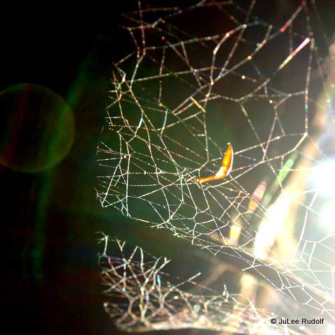
Spider web at JWSPLichen at JWSPLichen and fungi on a log at JWSPMoss-covered trees at JWSP
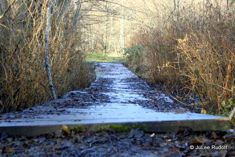
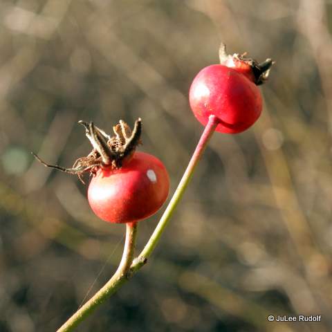
Board walk along the Moyers Loop at JWSPRose hips? at JWSP
I’d never seen this type of lichen? before.
I
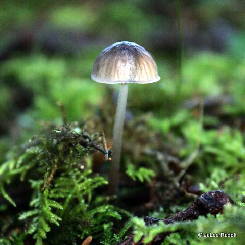
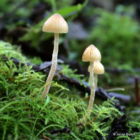
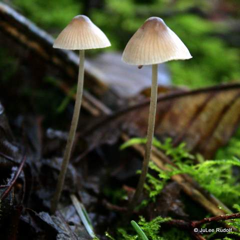
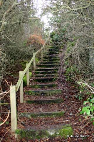
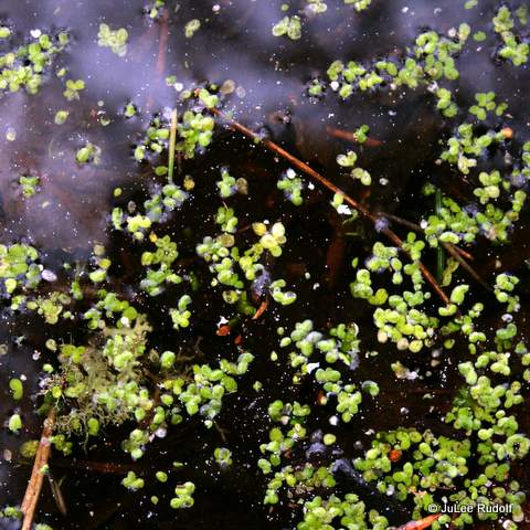
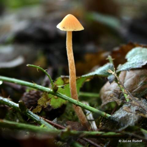
The next day, I returned, parked near the main entrance and followed the path marked 0.31 miles on the map towards Moyers Loop. I completed much of the loop, slogging through water and mud, then headed down to the area very appropriately marked “swamp” 0.4 miles, where I found deeper water, sloppier mud, small ponds and exactly the types of vegetation I expected.
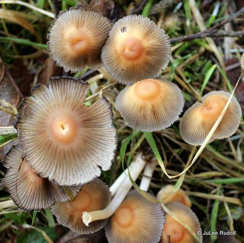
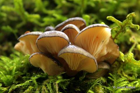
Stairs leading from main parking lot to swamp at JWSPMushroom at JWSP swamp areaMushrooms at JWSP swamp areaMushroom at JWSP swamp areaDog lichen at JWSP swamp area
Moss at JWSP swamp areaMushrooms at JWSP swamp areaLichen at JSWP swamp areaLichen and moss at JSWP swamp areaMushroom at JWSP swamp area
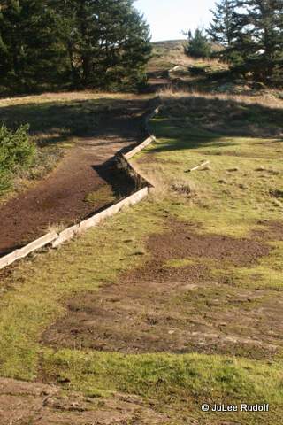
Persons had even made an effort to build a bridge of sorts. At other locations along this and the Moyers Loop, someone had placed branches and flat boards amidst the muck to make for easier passage.
Bridge along JWSP swamp area trail
Past the swamp area, I noticed a path that led up a hill, so I followed it, later noticed it marked firm-grasp-of-the-obvious as “Hill,” which provided a nice view towards the northwest, then ended.
Returning to the loop trail, I traipsed around to the sound of weapon fire from the NAS Whidbey gun range and then continued back to the beach hoping to give the beach trail a try. With my trail shoes already sopping wet, I was willing to cross a little water. The further I walked, the deeper it got, so when I reached the other end of the first in what appeared to be a series of short narrow trail ponds, I gave up, walked towards the shore, and headed back to my vehicle. Using MapMyRun, I found the distance from its start, near the covered picnic area, to Rocky Point Road, beyond which you can’t go far, to be just over a mile one way. I concluded that during dryer conditions, Moyers Loop would be a good place for a beginner trail runner to try, but will have to wait for better weather to learn more about the beach trail.
While at the park, I spoke to a several dog walkers, all of whom sung the park’s praises in spite of all the water and mud. I plan to return some time this spring.
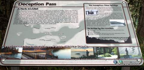
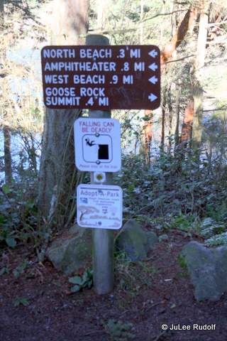
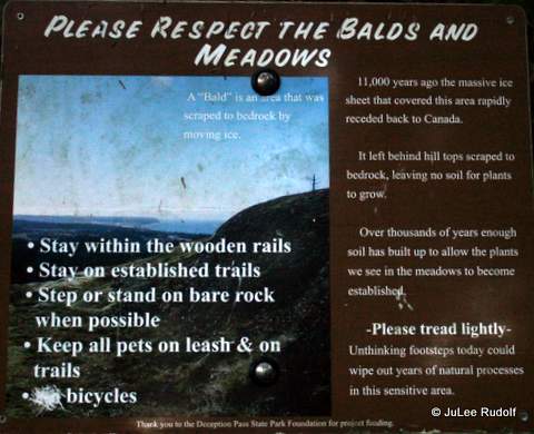
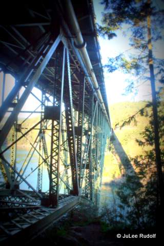
Now that I’ve finally figured out the trail system around Goose Rock, I have decided that these are the two most ideal hikes in terms of time, effort and scenery that begin from the parking lot north of Deception Pass Bridge. Either way, you’ll need to park, display your Discover Pass, and head towards the stairs to the left of the bridge.
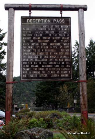
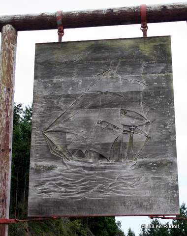
On your way, take a look at this conspicuous sign.
Sign south of Deception Pass Bridge
As you pass by, take a look at the back, which shows a ship that for some reason, I had not noticed during the many times I’d driven by it before.
Reverse side
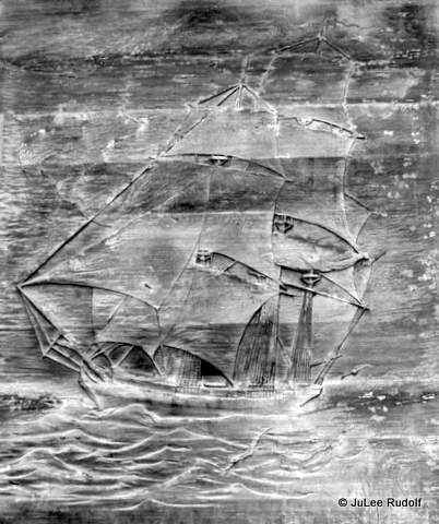
Here is a cropped and edited version. Hmm…Sign Unseen (more appropriately, Unnoticed…until now)
Visitor Info south of Deception Pass BridgeDeception Pass sign south of the bridge
Eventually, you’ll want to head down the stairs.
Sign at base of stairs south of Deception Pass Bridge
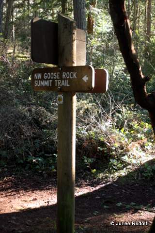
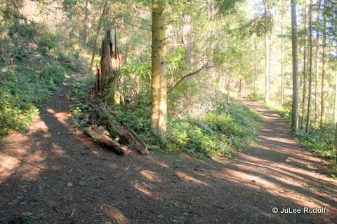
If the sky is clear, I recommend that you go right and proceed towards the summit of Goose Rock. This morning I hiked from the base of the stairs to the top, with no dawdling, in about ten minutes. If it’s your first time, you’ll want to pay attention to the signs. At first, the path is obvious. Turn right here to head towards the summit.
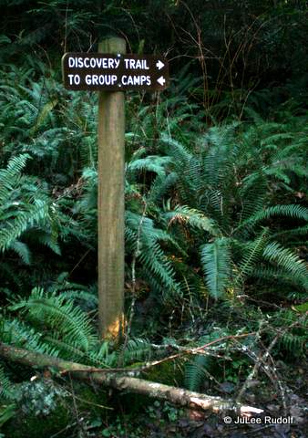
The only place you might make a mistake would probably be by missing this sign. Follow the direction arrow towards the left, because if you don’t, and instead head down and towards the right, you’ll end up on a much longer hike along the Discovery Trail.
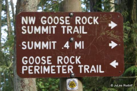
Goose Rock Summit Trail sign
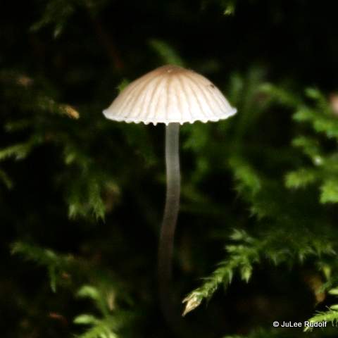
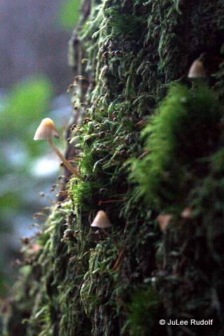
There are many types of mushrooms, plants and birds to see along the way.
Jelly like fungus along the Summit TrailInformational sign along the Summit TrailMycena along the Summit Trail
About ten to fifteen minutes after you start, you’ll have likely reached the top. You can head towards the left, shown in the following photo, which, if you continue along it, will take you down the south side of Goose Rock towards the Quarry Pond campground. At the top, there are a few open areas large enough to fit a picnic blanket and, in fact, the day I took the following photo, a family was picnicking nearby.
Path at Goose Rock Summit
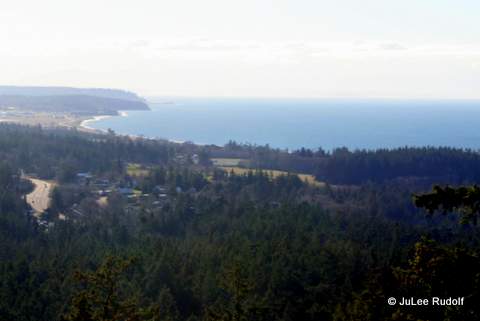
For a view of the coastline, head instead towards the right, knowing that whatever you do, you’ll have to come back to the same spot and back track to return to the parking lot (the trail at the top does not loop).
View from Goose Rock Summit towards the SW
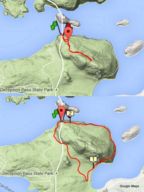
Round trip, the 0.9 mile hike takes about 20 minutes, plus time to stop at the top. My GPS watch shows the route like this.
Goose Rock hikes: Summit Trail (top) and Discovery+Perimeter Trails (bottom)
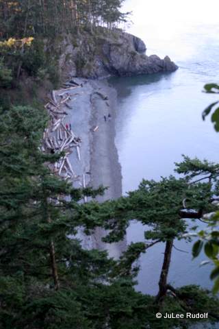
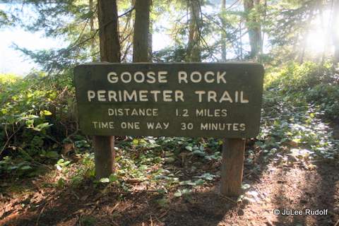
If you arrive on a cloudy day, or you have more time, one of my favorite all-time hikes from the parking lot south of Deception Pass Bridge, which is also makes for a nice but super short trail run, is the Discovery Trail plus Perimeter Trail, which I like to complete in the counterclockwise direction just because. This is a little trickier. At the base of the stairs, head left towards North Beach. There are some nice views of Lighthouse Point, Lottie Point and soon, North Beach.
Lighthouse Point (to the very left)North Beach
Within about five minutes, you’ll reach the completely unmarked start of the Discovery Trail. If you are paying attention, it seems obvious, but if you miss it, you’ll end up at West Beach.
Heading from the parking lot towards North BeachDiscovery Trail (off to the left)Mushrooms along the Discovery Trail
Within a few minutes, you’ll know that you are on the correct path as you will pass a sign before hiking under Highway 20.
Passing under Highway 20 along the Discovery TrailSign along Discovery TrailRed Belt Conk along the Discovery Trail
Soon you’ll reach the southernmost part of the trail with this conspicuous sign. If you head towards the right of the sign, you’ll reach the Quarry Pond campground. To continue the hike, take a sharp left (the trail that is nearly parallel to the sign and to the left will lead you close to the water and you’ll have to turn around).
Sign at south end of Discovery Trail
You’ll pass a couple of signs to the right. Remain on the main trail.
Eventually, you’ll reach a Y. Signs (and logic) indicate that to stay on the Perimeter Trail, continue to the right.
Summit Trail / Perimeter Trail Junction S of Goose Rock
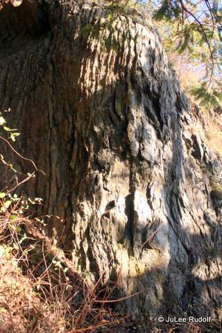
Cornet Bay will be visible on the right. As you head up, you’ll notice it getting rockier.
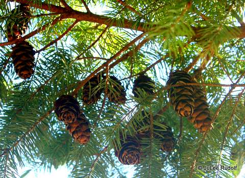
Perimeter Trail at Goose RockDouglas Fir cones along the Perimeter TrailDog-lichen along the Perimeter TrailMycena along the Perimeter TrailDeception Pass Bridge from Goose Rock Trail
Soon, you’ll be back at the bridge. The approximately 2.2 mile hike takes about 45-50 minutes, closer to an hour if you stop often, which I hope you choose to do.
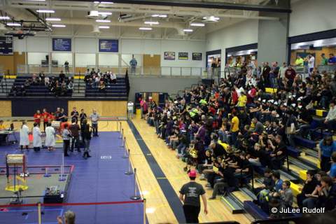
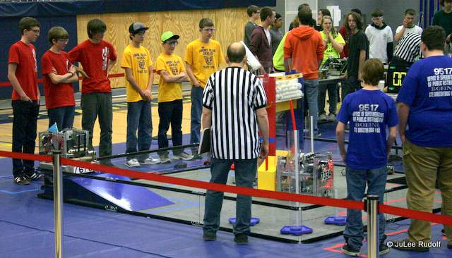
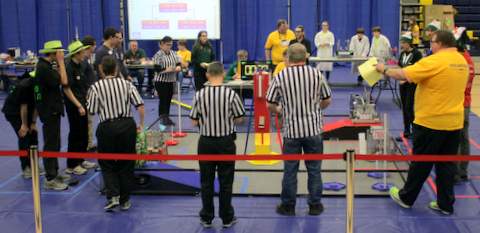
Last Sunday, January 11, the First Tech Challenge Pasteur Interleague Championship was held at Everett High School. Twenty-nine of the thirty-two teams between Bellevue and British Columbia that qualified to participate showed up for a battle of the robots. As it was my first time attending a robotics competition, I had a lot to learn, including the fact that teams consist not only of the drivers and coaches we saw that day, but also of fabricators and programmers. Many others provide support including teachers, mentors, parents and other volunteers. The Anacortes High School Cyborg Ferrets teams #7198 and #8934, who both competed, consist of about a dozen 9th through 12th grade students. Oak Harbor High School’s team, Whidbey Island Wildcat Robotics, team #7676 also competed in hopes of earning a slot in the State Championship. All teams spent many hours fabricating their robots, which must, when all parts are retracted, fit within an 18 inch cube, programming, testing and tweaking their designs to prepare for the challenge.
Organizers gave a brief presentation before the matches began explaining information about the organization and the competition.
FTC Pasteur Interleague Championship
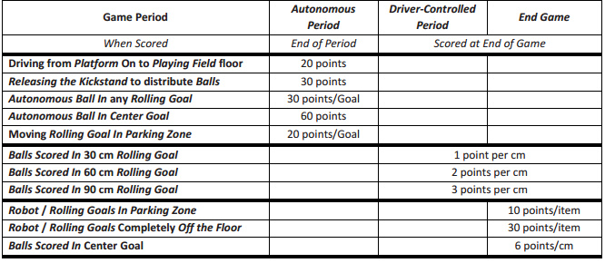
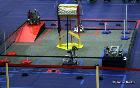
This year’s Challenge Game, called Cascade Effect, requires teams of two robots each to perform specific tasks in order to score points against their opponents.
Cascade Effect Point Scoring SystemRobots are placed in specific locations within the 12′ x12′ field to start the match.OHHS Wildcats watch the referees place the center goal in position
After teams place their robots in position, judges place the center structure, filled with 40 large and 160 small white plastic balls (half each side), minus one small and one large ball allowed per team, in one of three positions. During the initial 30 second time period, robots act in autonomous mode with pre-programmed movements. Robots score points by exiting platforms, releasing kickstands, placing balls in goals and moving rolling goals to specific locations.
The fun really begins as the timer is reset to two minutes in preparation for the Driver-Controlled Period, during which the teams’ drivers attempt to earn points by placing balls in rolling goals by controlling the robots remotely.
Robots attempt to place balls in rolling goals
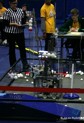
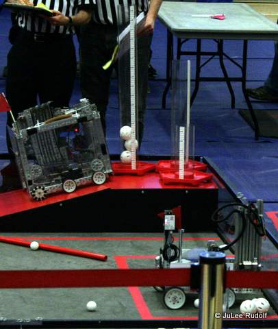
During the End Game, the final thirty seconds of the match, teams earn points not only by placing balls in rolling goals, but also by moving rolling goals to the Parking Zone or completely off the floor onto the ramp, placing balls in the center goal and by moving their robots to the Parking Zone or ramp.
Fix-It places balls in the Center Goal during the End GameRobots move rolling goals and themselves to ramps and the Parking Zone
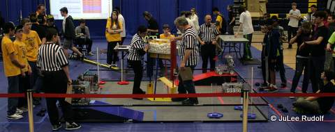
For this event, every team partnered with a different team each time, playing six matches total, one of which paired the OHHS Wildcats with the AHS Cyborg Ferrets A.
Anacortes High School Cyborg Ferrets #7198 (in red) team up with Oak Harbor High School Wildcats #7676 (in yellow)
Anacortes High School’s novice FTC team, Cyborg Ferrets B, is shown here.
AHS’s Cyborg Ferrets B #8934 (in red)
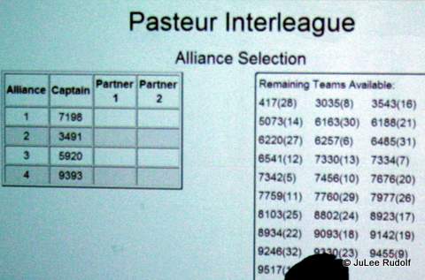
After all initial matches had been completed, teams were ranked based on their past and present league play. Anacortes Cyborg Ferrets A #7198 was ranked first, followed by Victoria B.C.’s Fix-It #3491 in second, Mount Vernon High School #5920 in third and Arlington High School #9393 in fourth.
Pasteur Interleague rankings
Teams were then tasked with choosing two alliance partners whose strengths balanced their own weaknesses.
The top four ranked teams choose their allies
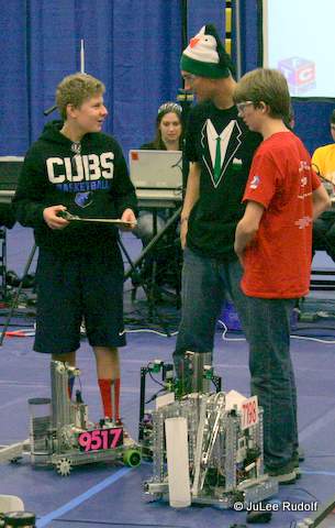
According to their scout for the day, the Cyborg Ferrets chose #9517 Sedro Woolley High School and #6541 International School (Bellevue, in the Penguin hats) Titan Robotics because, of all available teams, they had the potential to score the most points for tasks that the Cyborg Ferrets tended not to perform, namely: moving rolling goals and robots. Although the OHHS Wildcats were not chosen as an alliance partner, their mottoes said it all, “We are one team, we have one mission. Our goal is to complete that mission as one,” and “We don’t lose, we learn.”
Teams 7198, 95147 and 6541 talk strategy
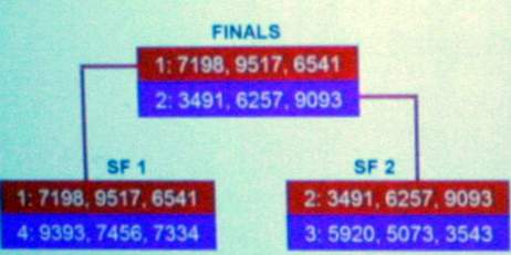
With twelve teams remaining, the alliance of the first and fourth and second and third ranked teams played three matches each. The winner of each then competed first place.
In the final match-up, the Red Alliance won the first match and tied the second, meaning that the last match of the day would decide it all.
The Cyborg Ferrets battle Fix-It in the championship-determining match
During the 30 second autonomous period, Red Alliance team #6541, scored multiple times when they exited the ramp, placed their two balls in a rolling goal, then moved the goal to the Parking Zone. During the 2:00 minute period, the Red Alliance team members made contact on their side of the center goal, releasing the kickstand and the balls. The battle between Blue and Red Alliance continued down to the wire. Team #6541 placed a rolling goal on the ramp and then remained off the field. Just before the buzzer, Red Alliance team #7198 placed several balls in the center goal, leading them, #7198 Anacortes High School, Sedro Woolley High School and #6541 International School (Bellevue) to victory and earning all three a spot, along with five other teams, in the FTC State Championship to be held later this month, on January 31, at the Showare Center in Kent. FTC volunteers treated the audience to an impromptu performance of the Chicken Dance while the award recipients were being finalized.
Even before our trip, my sister JoDee, who participated in horse 4-H in high school and best remembers the year that our parents gave her a saddle for Christmas in order for her to ride the horses that the people across the street owned–she’d sit on the fence that surrounded them and wish she could be riding, mentioned that they had horseback riding nearby. I hoped she was wrong…
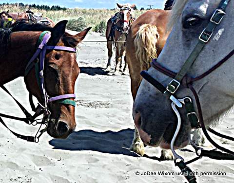
When we arrived at Pacific Beach, which is a really nice, flat, super beach that lies quite south along the Washington coast and extends for miles where we stayed at Pacific Beach Resort & Conference Center, JoDee went straight over to the pamphlet rack and grabbed the yellow one marked Horseback Riding. After learning from the front desk that the place wasn’t far by car, that the staff had never tried it, and returning to our cottage, she called the place. By then, I was a little concerned, but we were far from committing. She was bummed to learn that August was the busiest time of year and that instead of her ideal scenario (riding along quietly together with a guide, enjoying the serenity of the sand and the quiet clomp of the horses’ hooves), it’d be like – 20 horses trotting along with a bunch of folks of differing abilities, squished together, maybe like sardines. Unfortunately, this did not faze her.
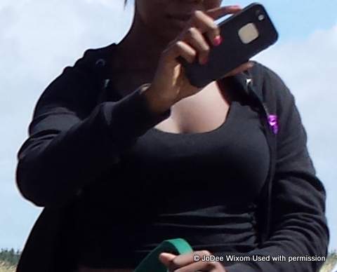
We set out for the 20 minute drive to Ocean Shores. I started meditating… We showed up and walked up to this super fat, slobbish guy in an orange, over-sized t-shirt, who chewed, spat, invaded our personal space and told us how this was just his summer job, in the winter he was a professional crab fisherman. Seriously, he looked like a serial killer–if serial killers were fat, which they don’t tend to be. We stepped back a couple of feet and asked more questions about the horse’s welfare, like how often they “work” and how far away they were boarded. His answers didn’t impress us but we were there and decided to go through with it. My sister paid the 40 bucks (20 per person for an hour ride), we signed the waivers and walked off to kill half an hour on the beach. It was a gorgeous day (rare, as you know) and a little breezy and JoDee sweated the number of other persons who were, like us, loitering near the horse place.
We watched a big group (about 20 folks) on horses heading towards us with the fog following. It looked safe enough so I tried not to sweat it.
We also noticed some unusual sea creatures on a large piece of driftwood that we later learned were goose barnacles.
Finally, we headed back when we saw a different group of about the same number of riders headed towards the place where the boss stood. Four girls in their late teens were calling the shots (imagine overly-long story by fat guy in orange t-shirt about the rules concerning workers under the age of 16, blah, blah, blah, they can’t even be on the premises, can’t work very long hours, etc., etc). They helped the current riders dismount while I stood there and started to stress out while JoDee worried that she’d get a too-docile horse.
They lined us up in front of the horses that were tied to horizontal wooden bars, and then went smallest to largest (horses matching humans) without asking who was experienced and who wasn’t, even though we’d had to indicate so on the form (my friend says it was probably because of risk management). The boss gave everyone one last chance at the dorky bicycle helmets, which only the two youngest kids wore. I would have taken one except that he’d told me earlier, “Nobody uses them.” Once they finished with the kids, they placed a couple of teenagers, then a super pretty gal who spent (I kid you not) the entire ride taking selfies.
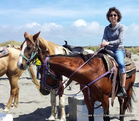
Then they called JoDee up and told her that her chosen horse “was for kids,” to which she (experienced horseback rider) replied, “Maybe you should give this horse to my sister. She’s a beginner.” Thus, I ended up riding Tator, a small dark brown horse with a black mane and tail. JoDee ended up on a bigger, light colored horse that was supposedly also for kids. Fortunately, beforehand I’d asked my sister to ignore me, enjoy her ride and not worry about what I was doing, which was pretty much freaking out the entire time. Her horse walked really fast and she was super confident, so she was up with the leader girl named McKenzie at the front, oblivious to the antics of all the naughty, supposedly “for kids” horses. Since Tator was slow, he’d get behind, then suddenly start trotting to catch up with the other horses. Except for trying to avoid Socks (which was hard as he seemed to have it in for Tator), I spent the whole time waiting for my horse to get behind, start trotting, at which point I’d try to post so that my butt might survive, then feeling relief when he finally caught up and returned to walking. Eventually, we reached the turnaround and for some reason many of the horses alternately stopped to pee. The way back was much like the way out except that I felt a little bit calmer. Except for one point when McKenzie’s horse did this wild thing with his head near Tator and I thought I was going to get bucked off, it was pretty uneventful, with most of the “kid” horses doing the walk-slowly-then-suddenly-start-trotting thing.
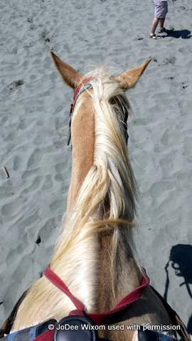
Tator (with purple harness) at Ocean Shores
When we got back to the start, the guides told us to halt the horses and wait for them to help us dismount, but Tator wouldn’t have it. He wanted me off asap, so instead of standing still, he continued towards the rail as I thought how wrong it would be to survived all that only to get bucked off at the end. Thankfully, I was got off before he did anything dangerous. The fact that I petted his neck several times on the way back and said, “Good Tator, Good Boy,” had no effect on his bad behavior. When JoDee and I met up afterwards, she gushed at how fun it was. Her only disappointment was at not getting the chance to canter off into the sunset with her fast-walking horse. OMG I was just happy to have survived.
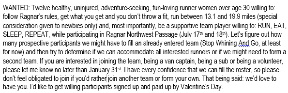
Four Septembers ago, just after I started trail running weekly with a group of gals, I asked if any of them might be interested in running Ragnar Northwest Passage, a nearly two-hundred mile relay race that begins in Blaine, Washington, near the Canadian border and ends in Langley on the south end of Whidbey Island.
It didn’t take long to find twelve women willing to run thirteen to twenty or so miles each, after which I registered the team, collected money from participants and started wondering how we, an all-novice team, might pull it off.
Surprisingly, not a single participant dropped out and the race went off without a hitch. Everyone was glad to have run the race and we had few mishaps save for Runner 11 completing the last mile of injured Runner 7’s third leg. Afterwards, in my first post ever, I blogged about what I’d learned, Ten Things I Wish I’d Known about Ragnar before Captaining an All-Rookie Team.
The following year I agonized over the dilemma of who to ask back. I wanted to invite some novices who I thought would enjoy the challenge, but I knew that a number of the past year’s participants wanted to run it again. Fortunately, things worked out. The second year’s team, Intrepid Bipeds (another learning experience, trying to choose a name that everyone can live with) consisted of six gals from the 2013 team and six new gals, which was perfect. A former van mate “offered” to “take Van 1,” that is, be the Van 1 Captain, which wasn’t exactly doing me, Van 2 Captain, any favors. As you can see from the chart I created after last year’s race that compared Van 1 versus Van 2 distance and climb.
As the captain, I knew I needed to act like it and agreed to captain Van 2 for a second year, which was even more fun the second time around. Although Van 2 covers a little more distance, a lot more climb, runs more legs in the dark has a shorter sleep break at an inopportune time, Van 1 runners must be up at the crack of dawn on race day to get to the start and, if the team sets that rule, must kill several hours after finishing their legs in order to meet their teammates at the finish. Unfortunately, we’d forgotten to get window paint, so we had to make due with the only window markers we could find at a local drug store.
I’d labeled the lids of the water bottles so that we could keep track of them. This turned out to be entertaining. At the end, we were left only with the frowny-face. Nobody wanted anyone to get stuck with it, so we just switched out the lids.
At Exchange 6, we collected our race numbers, tattoos, window stickers, race mag, and flags, attended the required safety meeting, bought some gear, applied our tattoos and decals and hung out with the Van 1 gals while we waited for Runner 6 to arrive.
The first legs are pretty easy, even if hard, because everyone is excited to get started. The weather is usually great in July, as was the case in 2014. After completing our first legs, we went to Anacortes to Eat.Sleep. at the house of one of our van mates, and, after checking on Van 1’s progress, drove to La Conner High School.
Running at night, before you’ve done it, sounds scary, but it turns out that almost everyone who does so ends up liking that leg the most. Once Runners 7 through 12 had completed their legs and we’d handed off the wrist slap band to Van 1 at Oak Harbor High School, we headed to my place for another round of Eat.Sleep. It’s hard to sleep when you know you’ll be running again in only a few hours. In 2013, this bothered me (and I slept only about half an hour). In 2014, I didn’t even try, just rested for awhile before eating breakfast, checking on the Van 1 Runners’ progress, packing up the van and heading to Coupeville.
At this point, Van 1 was done, but we’d agreed that they would meet us at the finish line in Langley so that we could all cross it together as a team. Thirty and a half hours after Runner 1 crossed the start, we all joined Runner 12 as she crossed the finish line. Each finisher receives a medal and each van receives a free pizza, which teammates take to a table in the beer garden for some post-race refreshment and rehashing of the race.
Another year, another successful session of Run.Eat.Sleep.Repeat. Because two of my long time runner friends from out of town joined us, one from San Diego and one from Bellevue, I had more fun the second year.
After the second year, I posted this on my Facebook page:
Once again, I hope to have half veterans and half first-timers on the team. To make things fair, we’ll pick two groups of six gals and then draw straws to determine which group ends up in each van.
Although I’ve run races of all sub-ultra distances on the roads (5k, 10K, 15k, half marathon and marathon), and a few trail races, Ragnar is one of my favorite all-time events. It’s challenging enough that some gals think they might not be able to make it, but they always do, which is really rewarding for everyone. In my opinion, a person who is physically prepared to complete a half marathon can handle Ragnar. And for the hardcore, there’s the Ultra division, consisting of a team of six, meaning each person must run about thirty miles.
If you’ve never run Ragnar, I hope you’ll give it a try. You’ll be glad you did.
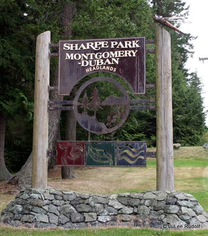
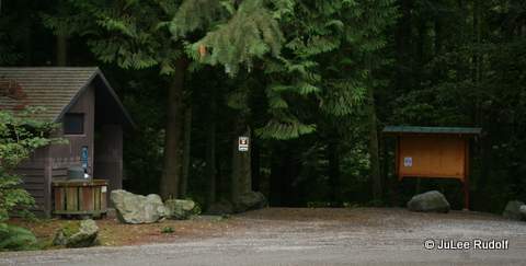
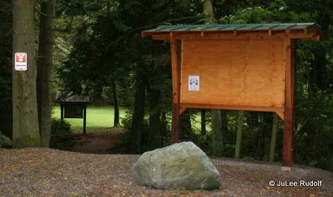
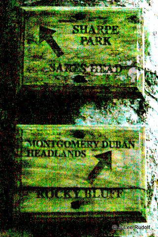
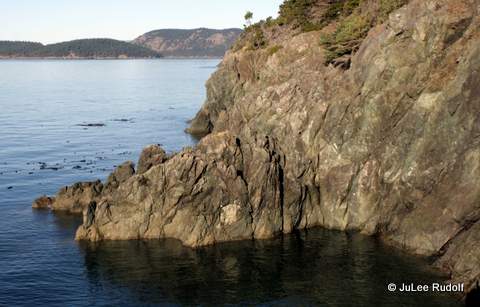
Always on the lookout for a new place to trail run, I headed out to Sharpe Park, “Together, Montgomery-Duban Headlands Park and Sharpe Park comprise a forest of over 110 acres and almost a mile of natural area shoreline,” to hike on a recent sunny afternoon, thinking that it would be a great opportunity to check out the view.
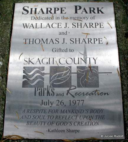
Sign at entrance to Sharpe Park / Montgomery Duban HeadandsParking area at Sharpe Park / Montgomery Duban HeadlandsSharpe Park / Montgomery Duban HeadlandsDedication plaque at Sharpe Park
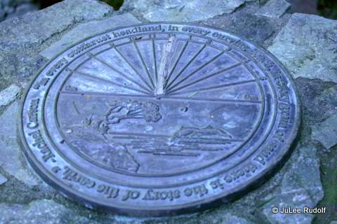
Map in hand, I took a look at a sundial surrounded by benches near the trail head.
Benches surrounding sun dial at Sharpe Park
The quote along the perimeter is Rachel Carson’s, “In every outthrust headland, in every curving beach, in every grain of sand there is the story of the earth.”
Sun dial at Sharpe Park
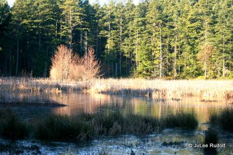
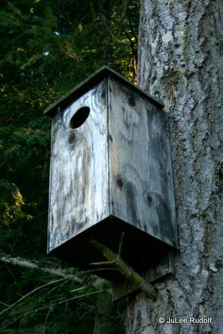
Then I made my way to the Wetland Pond.
View of Wetland Pond at Sharpe ParkBird house near Wetland Pond at Sharpe ParkIce at edge of Wetland Pond at Sharpe Park
I followed the well-marked way along the perimeter trails: Sharpe Park and Upper Loop, realizing pretty quickly that it was a little too technical, narrow and steep in places to make for good (safe) trail running.
Trail marker at Sharpe ParkTrail marker at Sharpe Park / Montgomery Duban Headlands
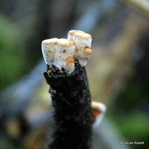
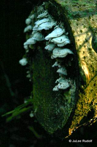
Along the Upper Loop trail, I noticed some fungus on downed trees that I had not seen before.
Fungus at Sharpe ParkFungus at Sharpe Park
Camera icons on the map show locations of great views.
View from Bluff Trail at Sharpe Park
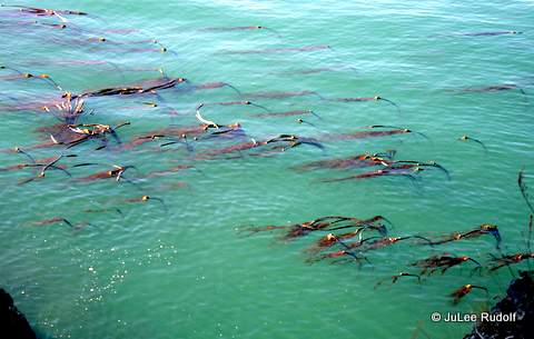
Near the face of the bluff, the water was filled with Bull kelp.
Bull kelp viewed from Bluff Trail at Sharpe Park
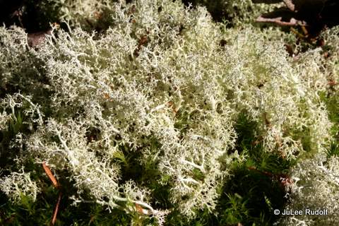
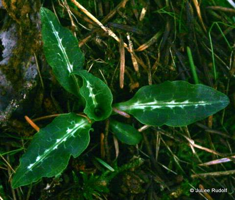
Near the junction of the Bluff Trail with Starbucks Connector, I encountered a woman, who I thought was taking a break, but was, in fact, looking at “the composition.” She was knowledgeable about local plant species, so I asked her the names of a couple of plants, which she provided (both scientific and common names): a type of Reindeer lichen and sedem. She offered to show me an orchid no longer in bloom, called the Downy rattlesnake orchid, which I then noticed along parts of the Starbucks Connector trail after I thanked her and continued on my way.
Reindeer lichen at Sharpe ParkSedem at Sharpe ParkDowny rattlesnake orchid leaves at Sharpe Park
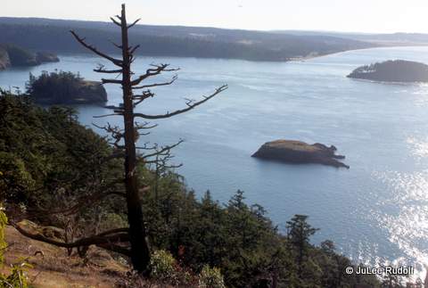
I continued to Sares Head Viewpoint, which has some stunning views that I won’t ruin for you by providing more than one image, looking south towards Deception Pass State Park.
View of Deception Island (right), Rosario Head (left) and Northwest Island (center) from Sares Head Viewpoint at Sharpe Park
Near the bench at the top, I noticed a type of lichen that I’d not seen before.
Lichen at Sares Head Viewpoint, Sharpe Park
It took me nearly an hour to get to this point, having traveled about 1-3/4 miles to the uppermost part of the Sares Head. Unfortunately, I made a small but significant mistake as I followed a trail that continued towards the northwest (private land) instead of retracing my steps. I returned to the park to share the view at Sares Head with my husband and our tries-to-drag-you Cairn terrier, Scamper, the next day, following the Lower trail on the way over and the Upper trail on the way back. It took only about 20 minutes to reach the view point which is about three-fourths of a mile one way.
After two hikes in as many days, I concluded that this isn’t a great place for trail running but it is for hiking. I plan to spend more time at Sharpe Park in the future.
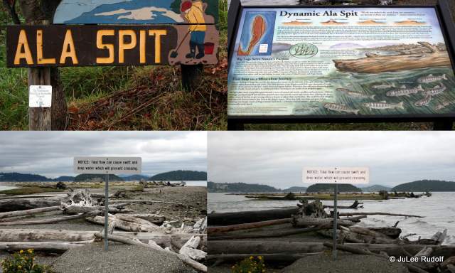
Only days remain in the winter crabbing season, so I decided to take my crabbing net along on a dog-walk with my family at Ala Spit. In the past couple of years, restoration work has been done at the spit. The first thing we noticed was was a wide log-less sandy section at the entrance to the spit, which is in contrast to the past. I took the two bottom photos in this collage on the same day in late September.
Ala Spit
Now, the same area is almost bare of logs.
Entrance to Ala Spit (December 2014)Entrance to Ala Spit (December 2014)
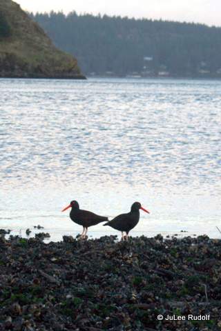
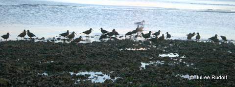
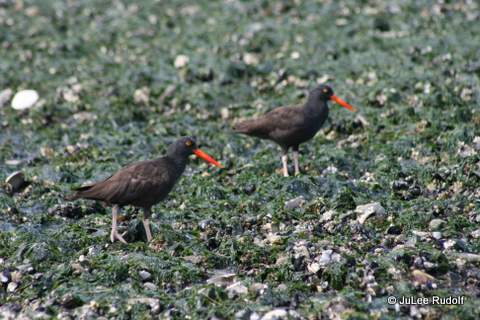
It was nearly dusk and we didn’t see a single crab (nor did the one other person out there crabbing at the same time), but there were some birds, like the Black oystercatcher.
Black oystercatcher at Ala SpitBlack oystercatcher at Ala SpitBlack oystercatcher at Ala Spit
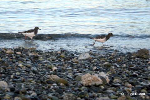
We also noticed the Black turnstone, a bird that looks really neat when flying (they seem to dart and turn as a unit).
Black turnstone at Ala Spit
Most of the time (though not on this day), you’ll also notice cormorants skimming along the water (or flying really high) nearby.
Cormorants above Ala Spit
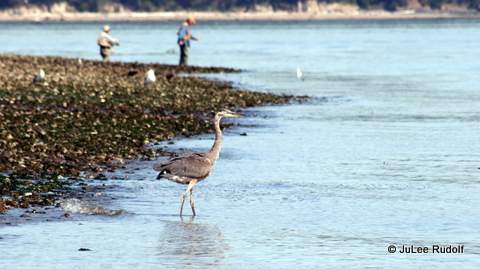
Besides the super common seagulls, you also typically see heron, like this one.
Heron at Ala Spit (August 2013)
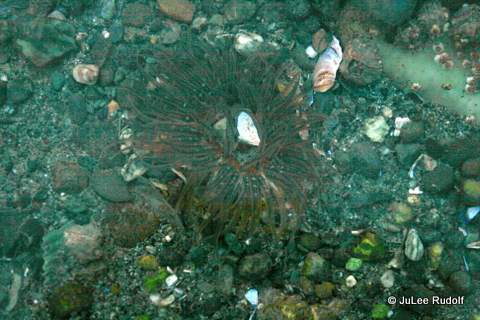
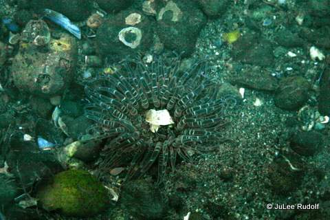
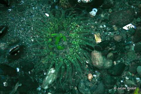
The coolest thing, however, that I noticed on this day (December 27) was something I’d never seen there before: anemones! They were living right at my feet along the northeast corner of the spit. Since it was getting dark, I didn’t have much time to explore, but in the 20 minutes or so that I did, I saw four. When I (just now), tried to figure out the name (searching “green anemone”), I quickly found the answer:
Buried green anemone at Ala Spit (December 2014)Buried green anemone at Ala Spit (December 2014)Buried green anemone at Ala Spit (December 2014)Buried green anemone at Ala Spit (December 2014)
This time of year, with low tides typically occurring at night, it isn’t easy to beach comb, but I was able to see these during about a +3.9 foot tide. I hope to get the chance to see them again soon.
I love to read. And I l choose specific books for various reasons, the most common being: heard about it on NPR, saw it at Amazon.com, a friend highly recommended it, chosen as a book club pick, or previewing it for my teenage son or daughter. In case you are interested, this is what I’ve been reading recently.
1. The Girl on the Train by Paula Hawkins (liked it)
I’ve seen this book everywhere and finally decided to read it. A girl on the train and a couple of others as readers learn the series of events leading to a woman’s disappearance. It reminded me a lot of Gillian Flynn’s Gone Girl.
2. Story Hour by Thrity Umrigar (liked it)
A small group of friends and acquaintances have formed a new book club. This title was our first pick as a foursome and is the story of a friendship between a therapist and one of her patients.
3. The Last Starfighter by Alan Dean Foster (liked it)
This summer, I picked up several books for my former bookworm, now reluctant reader teenage son, including Armada by Ernest Cline, who wrote Ready, Player One (a book we both enjoyed). Reviews on that book mention this one, at least I thought so until I ordered the book and realized it was actually based on the movie…groan. My son wasn’t interested in this, but I read it because I hate to waste things and I’d already paid for the book since our local library didn’t have it. At least it’s better than the super archaic seeming movie.
4. Man in the Woods by Scott Spencer (it was okay)
When our book club was still forming, we chose a few titles, including this one. I’m not a big murder mystery reader, so it was a nice change and I loved some of the writing (especially the similes) though I wasn’t a big fan of the plotting.
5. Bad Feminist (Essays) by Roxane Gay (loved it)
This was one of my two book kit picks when we first started talking about forming a new book club. Of all the books I’ve read this year, it was one of the top five that really made me think about things in a different way, especially about race in America especially the portrayal of African Americans in certain books and in movies that Ms. Gay discusses in detail.
6. Re Jane by Patricia Park (liked it)
My former high school classmate turned writing chair at a university recommended this, so how could I resist? My only regret was not re-reading Jane Eyre first, since I couldn’t really make a proper connection between the two connected books.
7. The Martian by Andy Weir (liked it)
This was another of the several books I chose for my son, hoping he’d return to reading. He did love it (I liked it) and even passed it on to a similarly science-minded friend. It’s super face paced and interesting, but I was over the main character’s obnoxiously witty banter-y narration early on in the story. I do look forward to seeing the movie.
8. Retaliation by Yasmin Shiraz (liked it)
Apparently, when you share an email address on your profile page at Amazon.com, persons will ask you to review books and other items for them. This was the first (and only so far) book I reviewed at the request of the author, though, in fairness, I actually chose to buy it rather than receiving it for free. The level of violence surprised me in a story about high school kids who live in an inner city area. I admire the author for her efforts to raise awareness about teen violence and suicide.
9. Welcome to Utopia by Karen Valby (it was okay)
Ingratiate yourself into a tiny community, find its flaws, and then share them with the world (losing the townsperson’s respect in the process). Such was the case in the creation of this book, which began as an article. The title was one of two first picks for our newly forming book club.
10. Up Ghost River by Edmund Matatawabin (loved it)
Because we live so far north, I sometimes listen to CBC (Canadian Broadcast Company) radio, which occasionally discusses subjects such as this dark part of Canada’s education past. It’s a disturbing story, but one worth reading.
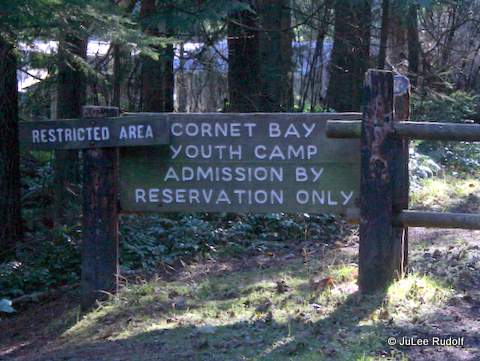
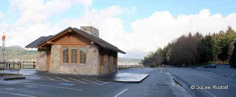
Cornet Bay dock in winterCornet Bay dock in summerCornet Bay parking lot in winter
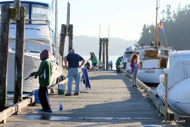
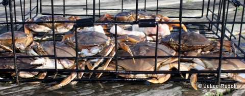
If you want to be guaranteed to harvest legal-sized Dungeness or Red Rock crab around Whidbey Island: buy a boat. If that’s not an option, you should try crabbing from the dock at Cornet Bay. With boaters, fishermen and crabbers all sharing the same dock space, it can get a little crowded in the summer; however, in the winter, you may find yourself alone save for others’ crab pots (center photo is winter, bottom is summer). The summer crabbing season runs from the 4th of July through Labor Day weekend in September, while the winter season runs from October through December. Crabbing is typically allowed from Thursdays through Mondays, that is, no crabbing on Tuesdays or Wednesdays.
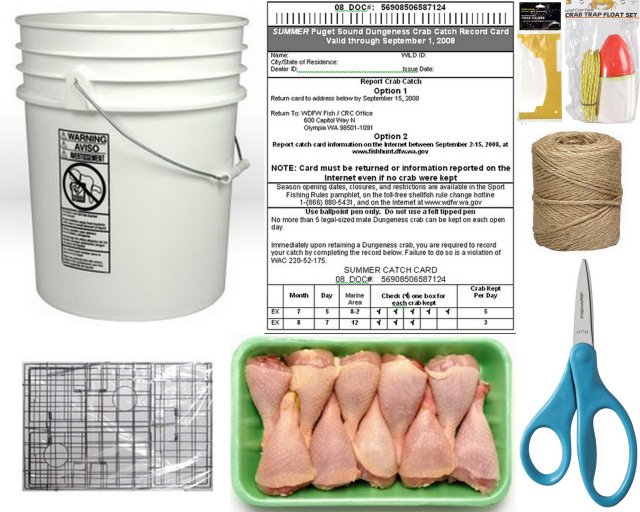
Before you go, be sure to buy a shellfish harvesting license, a Discover Pass and review Recreational Crab Fishing rules at the Washington Department of Fishing and Wildlife site. You will also need: a crab trap, lead line (the water is shallow at Cornet Bay so you don’t need more than 30 feet), a red and white buoy (if you plan to leave the pot unattended), bait and either a bait holder or something to attach the bait to the pot, a crab measurer, hatchet (for killing what you catch) and a bucket or cooler in which to place your crab.
Locally, you can get all you need to go crabbing in Oak Harbor at Ace Hardware or WalMart and in Anacortes at Sebo’s Hardware or Ace Hardware. Before you go, you’ll want to assemble your trap, attach the bait to the pot (either using string or placing it in the bait holder and attaching that to the pot), label the buoy (which you have to have if you plan to leave the pot unattended) and attach it to the line that you’ll connect to the center top of the pot. The Washington Department of Fishing and Wildlife provides an excellent pamphlet that explains everything.
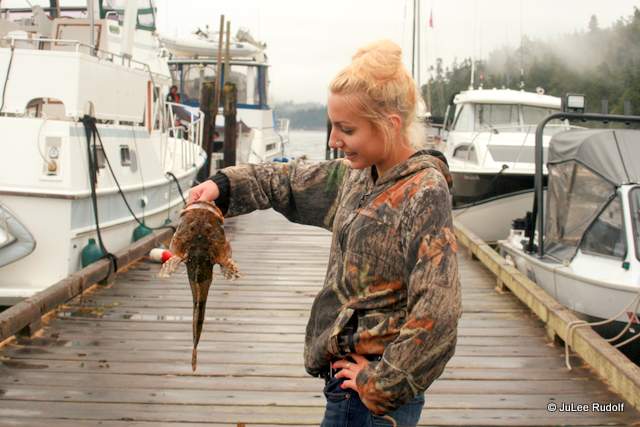
When you arrive at the dock, pay attention to the location of other crabbers’ pots. There’s no real rule, but if you place your pot directly next to another person’s, they’ll probably glare at you. Some folks prefer to place their pots in specific spots, but I don’t think it matters that much. Walking along the stationary dock leading to the floating one that you crab from you won’t likely notice the sign high up that says, “FISHERMEN MUST YIELD TO BOATERS.” That includes crabbers, so I like to place my pot somewhere that is unlikely to be blocked by an incoming boater who plans to moor their vessel. I took this photo this summer of a gal who found a Cabezon in her crab pot. To the left of the fish you can see a large boat that obviously arrived after a crabber dropped his or her pot and so will require the crabber to maneuver his or her way around to check it.
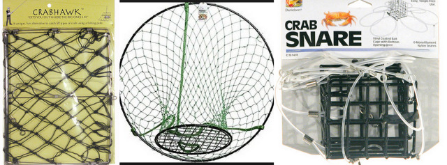
Once you’ve dropped your pot (throw it out away from the dock) and left a little bit of extra line to accommodate the tide, tie the line to the low wooden rail. I always leave my pot for one hour to several and return later to check on it. I’ve never heard of a crab pot being stolen from Cornet Bay dock and can’t imagine it happening, especially during the day. If you have little kids along who you want to experience the fun of pulling the pot up often, there are alternate pot types including the crab jaw, the crab snag and the crab ring (the open kind). These types of crab traps must be babysat. All three types can be thrown further from the dock than the heavier, bulkier “box” type trap.
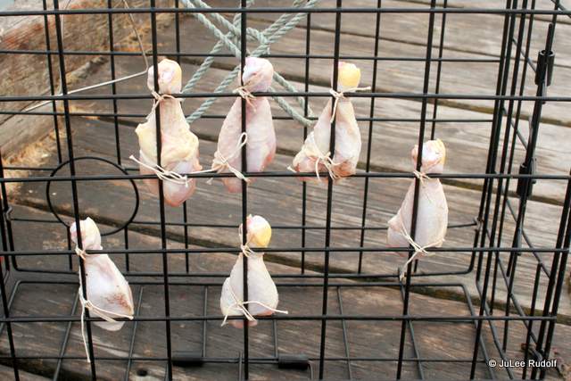
I like to use chicken drumsticks for bait because they are easy to tie with cotton twine (starting with the small end) to the pot. People tend to use bait holders (which the crab can’t access, so the bait lasts) but I don’t mind the extra effort of tying it to the trap so that the crab can snack while they wait to be kept or released. Note: crab prefer their bait fresh.
Although on this particular day (Christmas Eve), I didn’t catch any keepers, I was excited to have trapped this female Dungeness crab with eggs. I always try to return the less-than-legal sized crab pretty far from my or others’ pots (because they tend to come right back). And I do so carefully so that I don’t damage the crab’s shell as it hits the water.
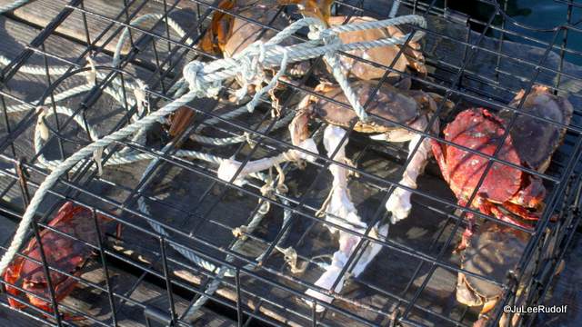
Two days later I returned and dropped my pots before heading out with friends for a long trail run at Hoypus Point, accessible only a short distance from the dock. My friend Nina’s family greeted when we returned and her kids agreed to help pull up the crab pots. Best of the event: hearing the cheers as I announced, twice, “It’s a keeper,” and, of course, the kids’ participation. After marking my crab catch card, I brought the two legal-sized crab home to kill (I’d forgotten my hatchet), clean and cook.
Dungeness crab from Cornet Bay
Summer crabbing is a different story because you are competing with half a dozen to dozens of other crabbers for the same (I swear there are only about ten keepable crab on a typical day) few big-enough-to-keep crab. During the 2015 summer season, I decided to crab when the season started, at 6:00 am on Opening Day. Of course, about twenty other persons had the same idea. Within an hour, I caught four legal sized Dungeness and one Red Rock crab, which is a Cornet Bay dock crabbing record for me. This summer, I’ve had one other “good” day at the dock, during which I caught four keepers. Typically, I harvest an average of one legal-sized crab if I leave the pot out for three to six hours. This week I crabbed three days and caught two Red Rock crab, which must be five inches across the back. Males and females may be kept. In a typical summer season, I harvest a total of about two dozen crab.
This summer (2016), I arrived late on opening day, several hours after the season had started. In about six hours time, I caught one Dungeness and one Red Rock crab…sigh; but during that time, I met two tween girls who spent the entire day (from the 7:00 am start until late afternoon) with their family, methodically checking their family’s 8 pots (two per person) who had nearly all caught their limit of both crab species!
I asked a Park Ranger about the rule requiring crabbers to “retain the shell from the field,” and learned that technically, crabbers must retain the crab shell until they arrive home with their crab. In practice, at least this enforcement officer said that crabbers must retain crabs’ shells until they leave the dock. You may then clean your crab near the shore and leave the shell in the water. Seagulls will be happy to take care of the guts for you.
You must release soft-shelled crab. The WDFW, which explains how to determine whether or not you’ve trapped a soft-shelled crab, explains the reasoning behind the requirement, “A soft-shell crab will yield less than 20% of it’s weight in meat while a prime hard-shell crab will yield 25% of its weight in meat. Harvesting crab when they are hard-shell maximizes the yield for a given number of crab. More significant, however, is that the meat from a soft-shell crab is of very low quality compared to meat from a harder cousin. People have described this meat as watery, mushy, lacking in texture, or even “jelly-like” and as a result it is often thrown away. Carefully releasing these soft-shell crab eliminates this wastage and allows the crab to be harvested later, when meat quality and quantity is greatest.” During one of the last days of the winter 2015 crabbing season, I had the chance to ask an enforcement officer from the Washington Department of Fish and Wildlife how he handles crabbers who break shellfish harvesting rules. He said that the most common infractions he tickets for are folks who harvest undersized crab and those who exceed the allowed limit of crab. The most common thing I notice with fellow harvesters, especially inexperienced ones, is persons who harvest soft-shelled crab, so I asked him about this. He said that those who take crab that are molting are only hurting themselves and that he tends to give them warnings instead of tickets and educate them on the law prohibiting harvesting of soft-shelled crab. Molting crab are absolutely obvious. If the crab’s body or upper sections of its legs show any give when you try to squeeze it, it’s molting. And if you can crack the crab with your hands after cooking it to remove the meat without needing a metal tool to do so, it’s molting.
This photo from the Washington Department of Fisheries shows the proper way to measure crab, which is at the narrowest part of the crab shell near (but not including) the spines.
“Fall is typically the best time to crab. Beginning in September, crabs tend to be more “filled out”, meaning there is a higher percentage of meat. This is determined by the condition of the shell. Hard-shelled crabs contain 20 to 30 percent meat by weight, compared to soft-shelled crabs, which can be as low as 12 percent.”
“Slack water (the time around high or low tide) are the best times to crab. During slack water, crabs are generally walking around and foraging since they are not getting pushed around by tidal exchange.”
“Many different types of bait are used for crabbing: turkey, chicken, mink, fish carcass, shad, herring, clams, etc. Fresh bait is best.”
“Allow between one to two hours before retrieving your gear if you are crabbing with crab pots and 15 to 30 minutes if you are crabbing with rings.”
“An experienced crab handler will sort crabs by keeping them at ease. They want to get out, but they don’t want to be forcefully grabbed. A quick shake of the pot is often more effective than reaching directly for them.”
“Be sure to carefully and quickly release crab, do not throw them from heights as this will often crack their carapace and kill them. It is illegal to retain only the claws on all species.”
I learned something very important in 2017 from Don Velasquez, WDFW Fish and Wildlife biologist–most crabbers’ intuition, to store and transport crab in seawater, actually kills them! Instead, set crab in a bucket or cooler. Soak towels or burlap sacks in water and place them over the crab. Keep the container cool and the crab can survive for days this way.
I prefer to first kill the crab (which I do by hitting them about mid-abdomen with a hatchet) before cooking, rinse them with a hose, then remove the shell, lungs and whatever guts remain. After cooking (in boiling salted water) and draining, the shells turn bright orange. These two crab contained about 2 cups of crab meat.
Although crabbing at Cornet Bay can be frustrating (more often than not, I come home empty handed), it’s always fun. Even if you don’t catch any keepers, you’ll likely trap at lot of crab. And dock crabbers tend to be really friendly, so if you have any questions, just ask another crabber.
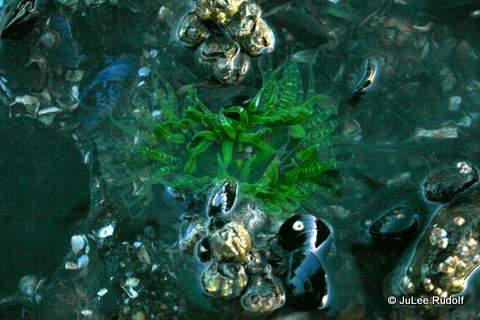
Lastly, there’s lots to do at Cornet Bay and other places within Deception Pass State Park while you wait for crab to enter your trap. Just look in the water to see eel grass (which is where crab tend to hang out), sometimes with stuff on it (like these brooding anemones), bull kelp and, sometimes, crab.
On any given day (at specific times, which I’ve yet to figure out), you’ll find “the regulars” fishing for herring and smelt along the right-hand-side of the dock at the bottom of the ramp. You can do this too. Check out the Washington Department of Fish and Wildlife pamphlet for more information.
Along the perimeter of the dock (you’ll have to kneel down and look over the edge), you can find tube worms and anemones (plumrose I think) and low tide exposes creatures on the pilings like anemones and barnacles. This past week when the presence of more than normal jellyfish were being found in the Puget Sound was in the news, I saw Fried egg jellyfish (Phacellophora camtschatica) several times in the water near the dock.
As you exit the dock, walk to the left to access miles of peaceful trails. At low tide, comb the one mile stretch of beach (bring shoes that you don’t mind getting muddy) that parallels Cornet Bay Road towards Hoypus Point.
Take a boat ride around Cornet Bay, through Deception Pass and over to the Rosario and Bowman Bay areas by way of Deception Pass Tours (note: the boat has priority at this location on the dock so don’t place your crab pot there during tour hours). The boat tour begins at the Cornet Bay dock (but you have to buy the tickets elsewhere). Access Goose Rock trails from the Quarry Pond campground (only 2 miles away along Cornet Bay Road) or the parking lot south of Deception Pass Bridge. And bring your binoculars to watch gulls, eagles, herons that fly by or walk towards the right when you leave the dock and watch for birds (swallows that live in the little bird houses on an adjacent dock).
A few of years ago, I took a writing class through a local community college’s extension program. A woman named Ruth Wilkins (who has since passed away) taught it. She was knowledgeable, supportive and kind. One assignment was to compose a poem on any subject. I got to work and produced this one, which she (as was common) did not criticize in any way. I then emailed it to a friend I call Mrs. Language Person. She only had issue with one of my favorite parts of the poem, so I refused to change it. Unsatisfied, I sent it to my former high school classmate, a writing chair at a four year university. She was also kind to me and it, but I was still not happy. Finally, I entered it into a local writing contest. After I saw the winners announced, I contacted the organizers, who sent me the judges’ comments, which I tried to incorporate. Then unincorporated. Then reincorporated less extensively (adding the first stanza). Eventually, I realized that it was far from perfect, but that wasn’t the point. I wrote it for me and I like it…pretty much.
Urchin
Senseless
unaware
as the sea assaults the shore
Aristotle’s lantern
shines no more
Is this a test?
Your final place of rest?
Incorrigible children scatter
scour the driftwood-strewn,
cement gray coast
for corpses
egg shell skeletonned,
space ship shaped,
palm-sized
forms
spines shorn
shades of green
like artichoke leaves
the lichen
that grows on local trees
Once a formidable foe
bristlyspiny from head to toe
long since left defenseless
You await
your fate
fodder for the land
as the beach’s sand
where you lie
while the urchin
cries,
“I found one!”
You contemplate
your fate
dust covered, fading
on a mud brown
windowsill
Maybe shared (carefully?)
for show and tell.
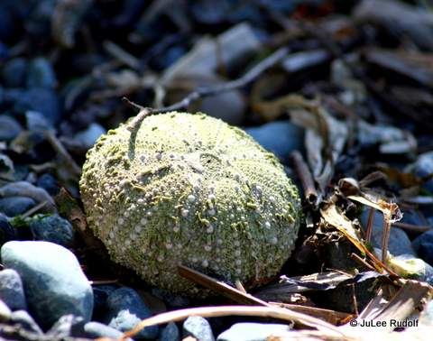
This is the back story. One day my children and I were out at Crescent Harbor, a Whidbey Island beach, collecting sea urchins, which, on that particular day, were everywhere. It made me think of the word “urchin” and its multiple meanings. With the judges’ comments, I felt compelled to learn more about urchins, especially about their senses, which I did. Those who know a bit about them will hopefully understand some of the text that I added at the beginning (the entire first stanza) as a result of the judges’ comments.
Here are the judges’ comments:
General Comments: this poem creates a nice doubleness for the urchin image: it is both the searching child, and the found artifact. The poet makes good use of seashore imagery in describing the shells. There are some rhymed lines, but this is not overdone.
One suggestion I have: because the poem shifts abruptly into second person (“You”) at the third stanza, and repeats that in the fourth, perhaps the poem should begin with an address to the urchin, rather than beginning with the incorrigible children.
Content/message: Your use of urchin to describe both children and sea urchins is fun, and writing from both perspectives is an interesting idea.
Form: It is difficult for editors to read poems with center margins. Consider using left hand margins only.
Use of Language: Random use of rhyme – leaves/trees, foe/toe, await/fate and land/sand leads the reader to expect its repetition at regular intervals, but we don’t find that here. It leaves her feeling like she got lost within the poem.
General Comments: We tend to favor visual description over other senses, but this would be a perfect poem to incorporate the smells and sounds of the beach as well.


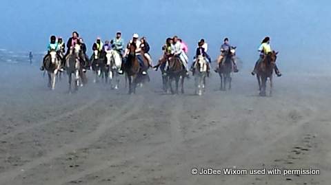 We watched a big group (about 20 folks) on horses heading towards us with the fog following. It looked safe enough so I tried not to sweat it.
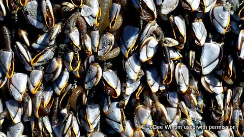

 When we got back to the start, the guides told us to halt the horses and wait for them to help us dismount, but Tator wouldn’t have it. He wanted me off asap, so instead of standing still, he continued towards the rail as I thought how wrong it would be to survived all that only to get bucked off at the end. Thankfully, I was got off before he did anything dangerous. The fact that I petted his neck several times on the way back and said, “Good Tator, Good Boy,” had no effect on his bad behavior. When JoDee and I met up afterwards, she gushed at how fun it was. Her only disappointment was at not getting the chance to canter off into the sunset with her fast-walking horse. OMG I was just happy to have survived.
 Four Septembers ago, just after I started trail running weekly with a group of gals, I asked if any of them might be interested in running
  The following year I agonized over the dilemma of who to ask back. I wanted to invite some novices who I thought would enjoy the challenge, but I knew that a number of the past year’s participants wanted to run it again. Fortunately, things worked out. The second year’s team, Intrepid Bipeds (another learning experience, trying to choose a name that everyone can live with) consisted of six gals from the 2013 team and six new gals, which was perfect. A former van mate “offered” to “take Van 1,” that is, be the Van 1 Captain, which wasn’t exactly doing me, Van 2 Captain, any favors. As you can see from the chart I created after last year’s race that compared Van 1 versus Van 2 distance and climb.
 As the captain, I knew I needed to act like it and agreed to captain Van 2 for a second year, which was even more fun the second time around. Although Van 2 covers a little more distance, a lot more climb, runs more legs in the dark has a shorter sleep break at an inopportune time, Van 1 runners must be up at the crack of dawn on race day to get to the start and, if the team sets that rule, must kill several hours after finishing their legs in order to meet their teammates at the finish. Unfortunately, we’d forgotten to get window paint, so we had to make due with the only window markers we could find at a local drug store.
 I’d labeled the lids of the water bottles so that we could keep track of them. This turned out to be entertaining. At the end, we were left only with the frowny-face. Nobody wanted anyone to get stuck with it, so we just switched out the lids.


 Running at night, before you’ve done it, sounds scary, but it turns out that almost everyone who does so ends up liking that leg the most. Once Runners 7 through 12 had completed their legs and we’d handed off the wrist slap band to Van 1 at Oak Harbor High School, we headed to my place for another round of Eat.Sleep. It’s hard to sleep when you know you’ll be running again in only a few hours. In 2013, this bothered me (and I slept only about half an hour). In 2014, I didn’t even try, just rested for awhile before eating breakfast, checking on the Van 1 Runners’ progress, packing up the van and heading to Coupeville.
 At this point, Van 1 was done, but we’d agreed that they would meet us at the finish line in Langley so that we could all cross it together as a team. Thirty and a half hours after Runner 1 crossed the start, we all joined Runner 12 as she crossed the finish line. Each finisher receives a medal and each van receives a free pizza, which teammates take to a table in the beer garden for some post-race refreshment and rehashing of the race.


 Although on this particular day (Christmas Eve), I didn’t catch any keepers, I was excited to have trapped this female Dungeness crab with eggs. I always try to return the less-than-legal sized crab pretty far from my or others’ pots (because they tend to come right back). And I do so carefully so that I don’t damage the crab’s shell as it hits the water.
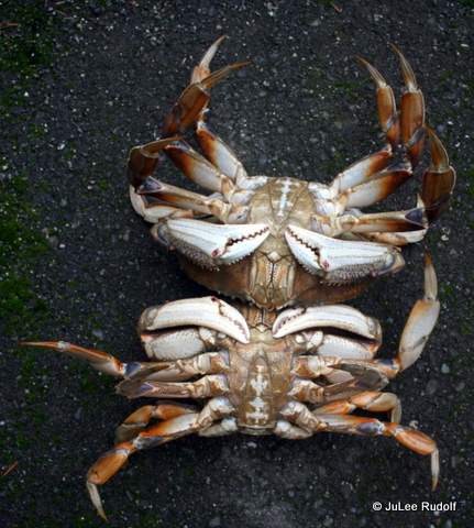

 I asked a Park Ranger about the rule requiring crabbers to “retain the shell from the field,” and learned that technically, crabbers must retain the crab shell until they arrive home with their crab. In practice, at least this enforcement officer said that crabbers must retain crabs’ shells until they leave the dock. You may then clean your crab near the shore and leave the shell in the water. Seagulls will be happy to take care of the guts for you.
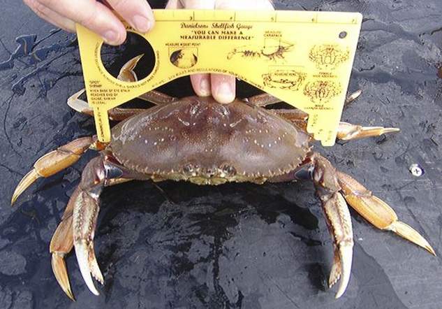

 Although crabbing at Cornet Bay can be frustrating (more often than not, I come home empty handed), it’s always fun. Even if you don’t catch any keepers, you’ll likely trap at lot of crab. And dock crabbers tend to be really friendly, so if you have any questions, just ask another crabber.


 Lastly, there’s lots to do at Cornet Bay and other places within Deception Pass State Park while you wait for crab to enter your trap. Just look in the water to see eel grass (which is where crab tend to hang out), sometimes with stuff on it (like these brooding anemones), bull kelp and, sometimes, crab.

 On any given day (at specific times, which I’ve yet to figure out), you’ll find “the regulars” fishing for herring and smelt along the right-hand-side of the dock at the bottom of the ramp. You can do this too. Check out the
 Along the perimeter of the dock (you’ll have to kneel down and look over the edge), you can find tube worms and anemones (plumrose I think) and low tide exposes creatures on the pilings like anemones and barnacles. This past week when the presence of more than normal jellyfish were being found in the Puget Sound was in the news, I saw Fried egg jellyfish (Phacellophora camtschatica) several times in the water near the dock.
 Take a boat ride around Cornet Bay, through Deception Pass and over to the Rosario and Bowman Bay areas by way of