Spend the Day at Bowman Bay

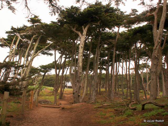
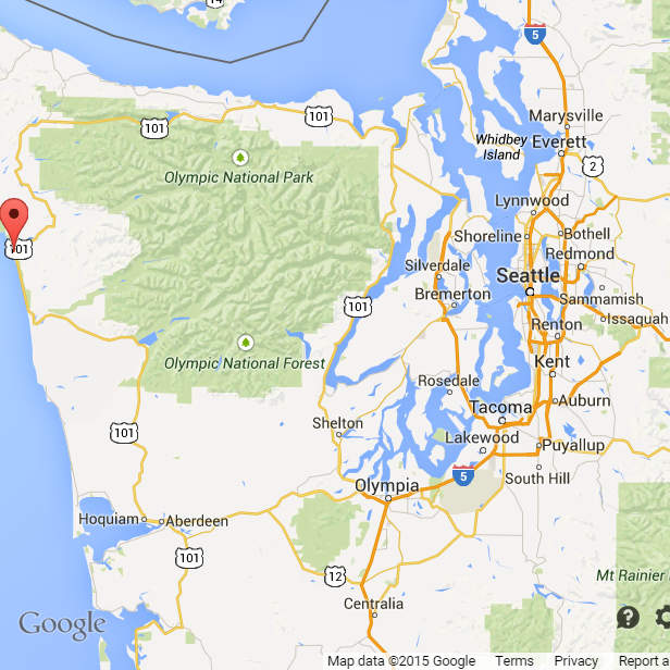
Bowman Bay is one of several great locations within Deception Pass State Park where a person, couple, family or group could easily spend an entire day. Others include Cornet Bay, West Beach, North Beach and Pass Lake. BowmanBay

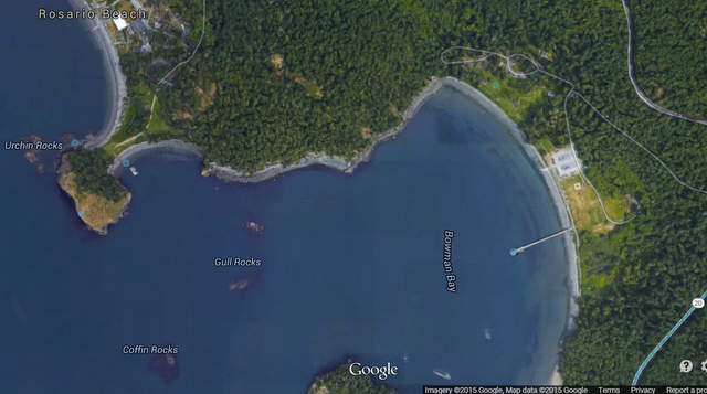
According to the Deception Pass Park Foundation site, “Before receiving its modern name, Bowman Bay was known as “Reservation Bay” due to the period in which it was a military reservation. In the early 1900s, Bowman Bay was one of several modern-day park areas set aside for military use. The area was eventually renamed in honor of Amos Bowman, who was one of the first white settlers on Fidalgo Island. Nearby Anacortes is an amalgamation of “Anna Curtis,” Bowman’s wife. At the turn of the century, Bowman had a wooden dock built at the bay in hopes that it would become a major port, but Bowman’s dream was never realized.”

IMG_9496-002
Deception Island from the Bowman Bay shoreline

Chrome Legacy Window 512015 50822 PMtrail route bowman

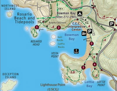
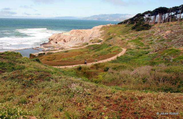
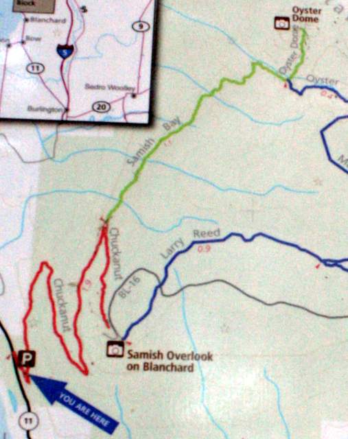
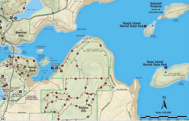
Bowman Bay is centrally located between several super scenic hiking trails indicated by the dashed dark green lines on this excerpt from the Official Park Map, including Lottie Point LoopLighthouse Point, and Bowman Bay/Rosario Beach.


IMG_9649-002

IMG_0484-001

IMG_9315-001
“Gull Rocks” within Bowman Bay

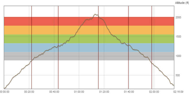
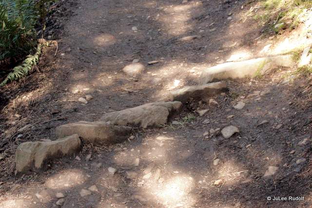
More serious hikers and trail runners can complete all three, plus the hike towards Pass Lake, which contains an additional trail, for a grand total distance of five miles. My trail running friends and I typically run along the Bowman Bay/Rosario Beach Trail to and around Rosario Head, then back through the Bowman Bay parking lot, complete Lottie Point Loop (the most difficult because of the climb) followed by Lighthouse Point Loop, head up towards Pass Lake, then back down and return to Bowman Bay parking lot. There are two races that allow you a chance to check out the trails: Deception Pass Marathon (and Half) in April and Deception Pass 25K and 50K in December (lottery held in June).

IMG_9660-001The dock at Cornet Bay is a more popular place from which persons go crabbing and fishing because crabbers and fishermen and women are much more likely to catch something, but the one at Bowman Bay makes for a nice, safe walk with handrails along the entire length of the main dock (a smaller dock near the end rises and falls with the tide as does the main dock at Cornet Bay). It’s more of a challenge to catch crab in Bowman Bay than Cornet Bay and the crab you do catch will likely be Red Rock than Dungeness. If you’re daring (and can stand the cold) during low tides, take a good-quality long-handled fishing net with the smallest holes you can find and walk along the shore line. If you’re lucky, you’ll see Red Rock crab that you can scoop up. Even if you don’t collect any keepers, you’ll have fun.

IMG_6437-001
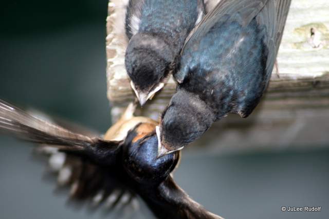
Birds like to hang out there too, like this family of barn swallows. When you notice barn swallows flying around near the dock, take a look underneath as you’re likely to see nests hiding juveniles.

IMG_5402-001
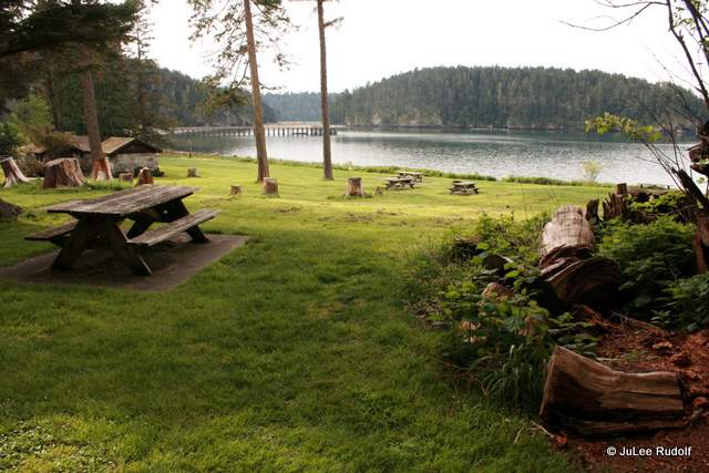
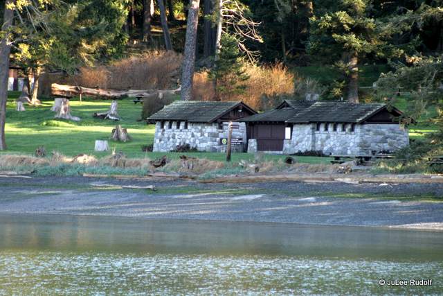
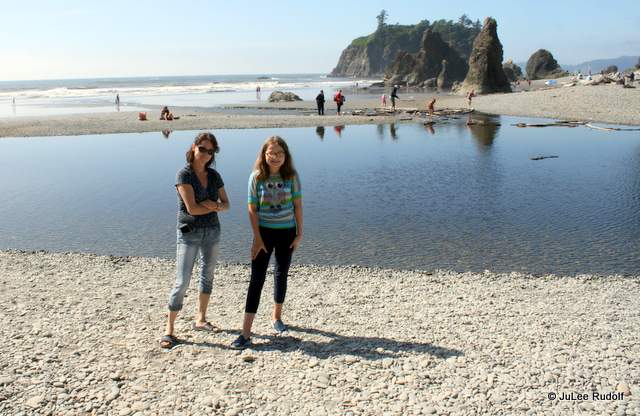
Bowman boasts the usual picnic tables, barbecue grills, restroom and a playground, the only one in the park…such as it is, as well as a gigantic field perfect for playing soccer, frisbee, turning cartwheels or whatever. During weekdays off-season, you can have this place nearly to yourself but on weekend summer days, the place is packed which isn’t nearly as much fun.

Deception Pass Dash 2014 at Bowman Bay
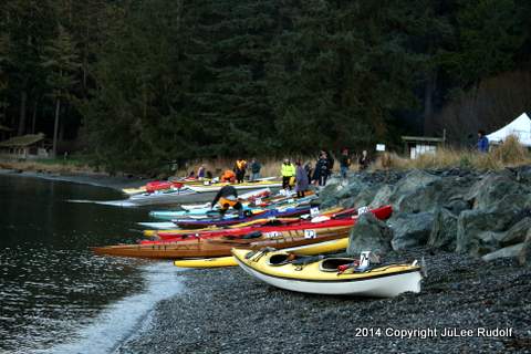
Bowman Bay is a great place from which to canoe, kayak and stand up paddleboard. In fact, it is the start and finish point for the annual Deception Pass Dash, according to their site, “An exciting 6-mile paddle through the swirling current of Deception Pass near Oak Harbor, Washington for human-powered vessels; kayaks, canoes and SUPs.” During the summer, you can rent both kayaks and SUPs, available near the parking lot, or book a SUPS or kayak tour.

IMG_2246-001

IMG_5383-001There is a second lot within the Bowman Bay open only during camping season which provides closer access to the Bowman Bay/Rosario Beach trailhead and the Civilian Conservation Corps Interpretive Center as well as additional grassy areas, picnic tables, barbecue grills and a statue of a CCCIC worker. According to the Washington State Parks website, “The Civilian Conservation Corps Interpretive Center is located in the Bowman Bay area of the park. The center was originally a bathhouse built by the Civilian Conservation Corps (CCC) in the 1930s. In 1987, the building was renovated into a museum by CCC alumni and Washington State Parks staff. The center’s exhibits tell the incredible story of the CCC’s work across the State of Washington during the Great Depression. The center is free-of-charge and is open from 10 am-6 pm mid-May through Labor Day. Group tours and off-season visits can be arranged by calling 360-675-3767.”

IMG_2059-002
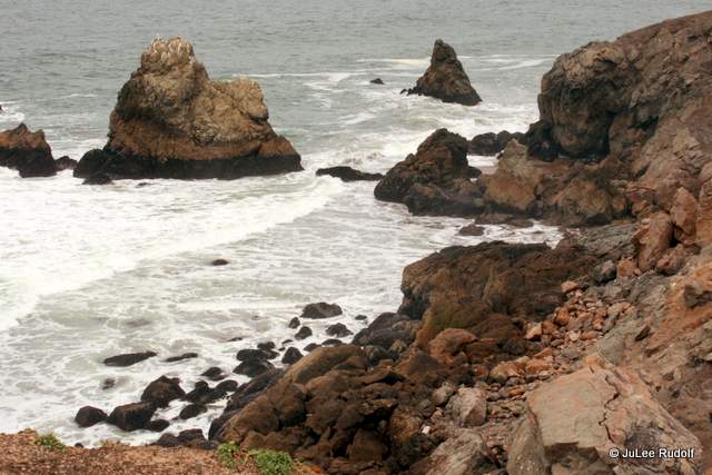
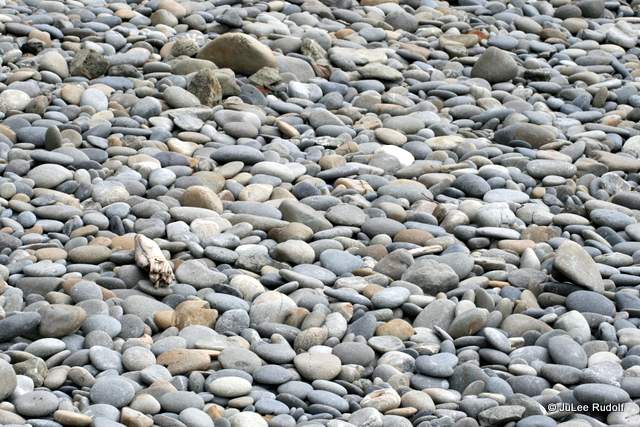
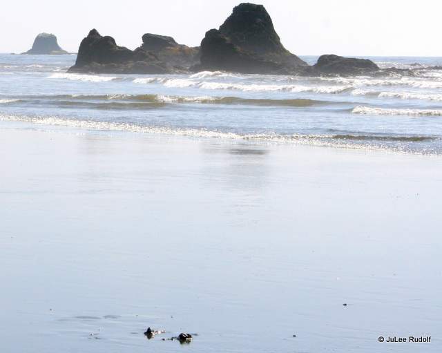
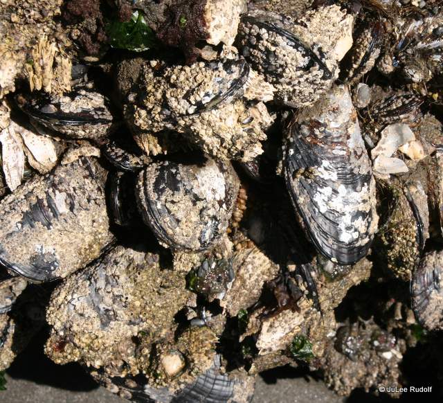
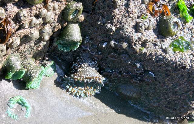
This summer (of 2017) I learned yet one more super fun thing that you can do at Bowman Bay: beachcomb. I already knew you could carefully flip over rocks to see shore crabs beneath (and then, please, please carefully flip them back to their original position) but during about a dozen super low tide days, you can walk along the shore between Bowman and Rosario to see other crab species, sea squirts and dozens of other sea creatures.

IMG_2190-002IMG_2514-001

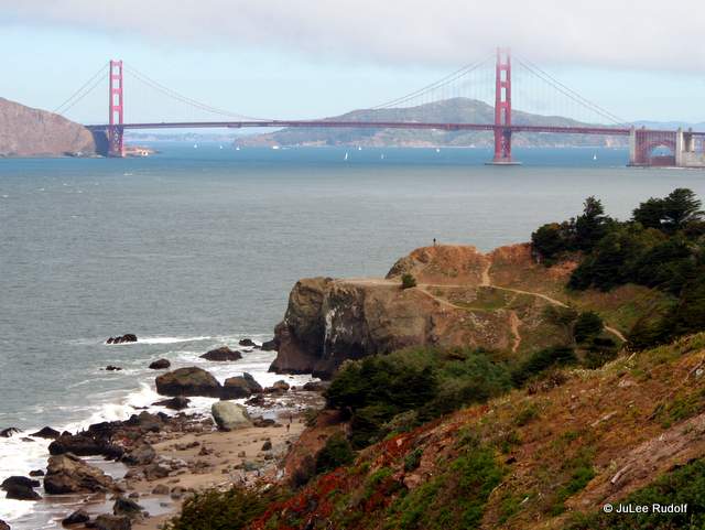
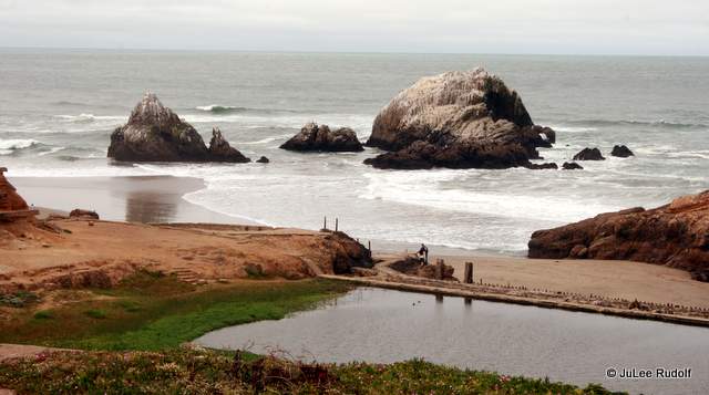
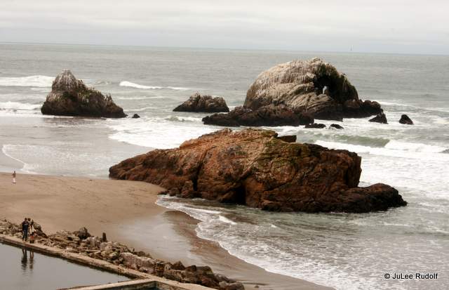
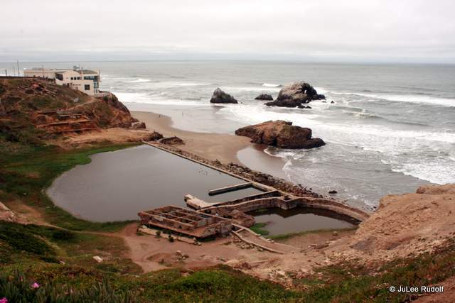
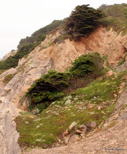
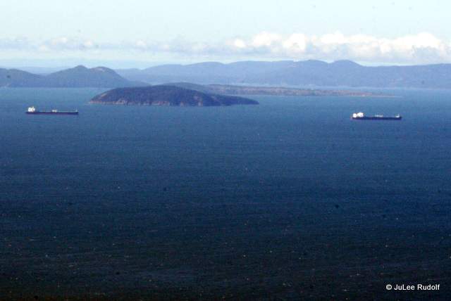
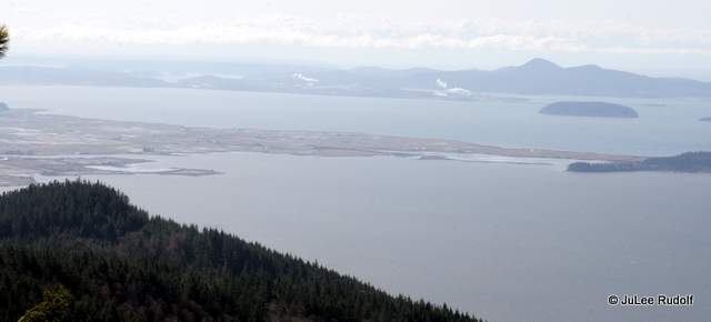
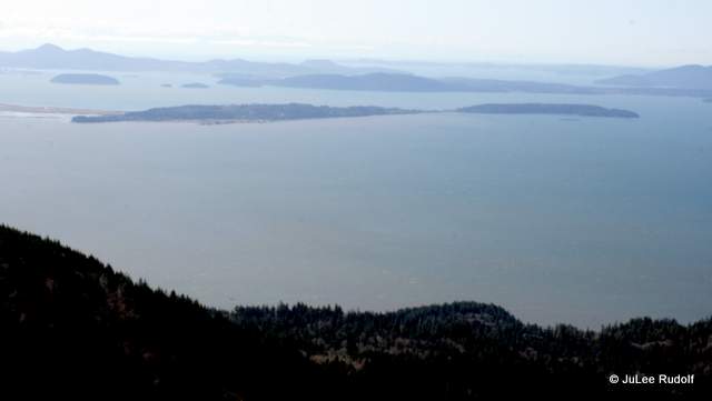
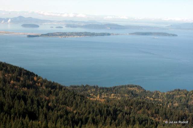
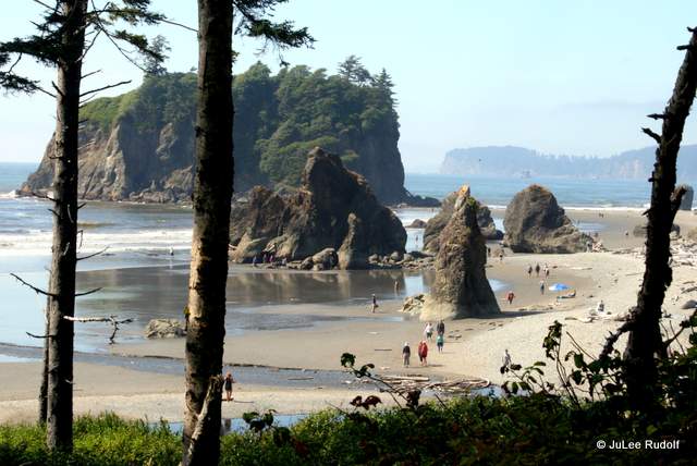
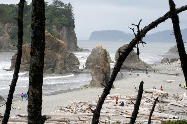
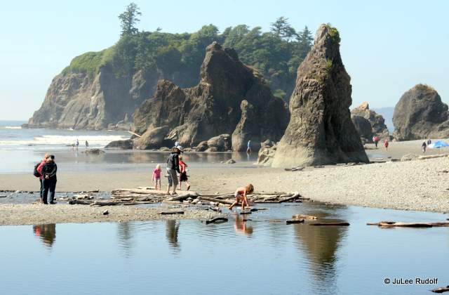
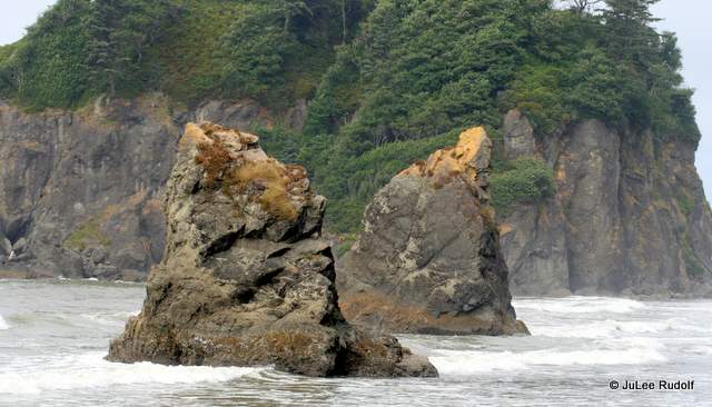
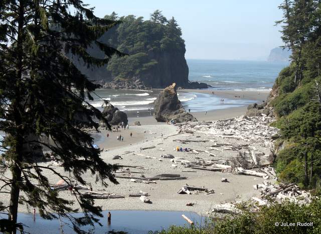
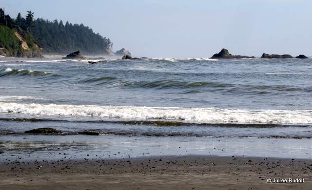
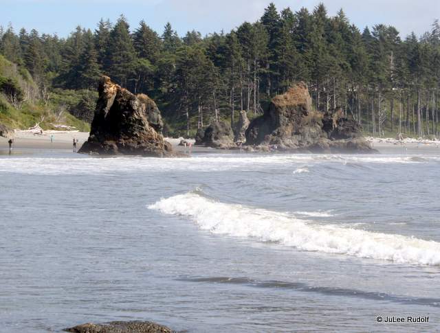
It’s also the place from which to get the best view of the bay.

Remember to arrive early (especially during holidays and weekends), prepay for your Discover Pass to avoid the hassle and plan to have a blast.

Lands End Lookout

Earlier this year, the Anacortes Cyborg Ferrets FTC Robotics Team #7198 competed at the Pasteur Interleague Championships where they earned a berth at the State by becoming the Winning Alliance Captain, then did same to advance to the FTC West Super Regional Competition in Oakland. Seventy-two teams from 13 western states competed in hopes of a chance go to Worlds. Although the Cyborg Ferrets failed to advance, they learned valuable lessons that they plan to incorporate during next year’s FTC season. Namely, there’s more than one way to skin a cat (no offense to felines).

While judges checked robots for size, weight and component compliance requirements, our family made our way to a beautiful area of San Francisco, Lands End Lookout,

IMG_9799

part of the US National Park Service. Their site provides a perfect description,

Chrome Legacy Window 4222015 43042 PM

“At the northwestern corner of San Francisco, there is a series of stunning views at every turn in this wild and windy trail. Hillsides of cypress and wildflowers, views of shipwrecks and access to the ruins of Sutro baths, a San Francisco specials memory.”

We parked along Point Lobos Ave and ate lunch at Louis’ Restaurant. The food was fine. The view was spectacular (note to diners: arrive early to avoid long lines and offer to wait for a spot along the north side of the place). Afterwards, we wandered around the building towards the water where we could access the walking paths

IMG_9752

and what remains of the Sutro Baths .

IMG_9755-001

The sea stacks alone were worth the walk.

IMG_9756-001

IMG_9758

The best view of the former Sutro was further along the path, looking back towards the Cliff House restaurant.

IMG_9767-001

We continued along the rocky shoreline,

IMG_9764

past some small areas of vegetation,

IMG_9765

and up the hill towards the cypress trees.

IMG_9768

I was excited to see some of the same wildflowers we get to enjoy at Deception Pass State Park, like these.

IMG_9781
America maritima (Thrift)

Others, I had not seen before where we live.

IMG_9784

IMG_9792
Campanula scouleri (Scouler’s Harebell)

Soon, we came upon an awesome sight: the Golden Gate Bridge.

IMG_9782

Great views continued (below morning low clouds) as we neared it.

IMG_9786

There were many others visiting that day, but the grounds were so extensive, it didn’t seem crowded.

IMG_9794

The main path gave hikers, walkers and runners plenty to do, but you could also find an occasional offshoot, like this one. This dog impressed me by thinking big.

IMG_9791

As we returned to the start, we passed fields of familiar flowers in full bloom that we won’t see here for a month or two.

IMG_9800-001

My only regret was too little time for photography.

Afterwards, we drove to the Golden Gate Bridge, crossed it from south to north and stopped at Vista Point to admire the bay and the bridge.

When the situation presented itself, I found it impossible to resist snapping a shot of two modestly dressed women (bottom left of frame) interacting as a young woman used a selfie-stick, a device I’d never seen before. We noticed them several more times in use by tourists in San Francisco, especially along Lombard Street.

IMG_9811

IMG_9805

While Vista Point allowed a beautiful, nearly longitudinal perspective of the bridge, Lands End Lookout is my new favorite place from which to view it.

Beyond the Oyster Dome

Oyster Dome, a rock outcropping in Whatcom County, is an excellent place from which to view the San Juan Islands as well as an area of geological interest. Fortunately, for those like me who don’t like crowds, getting there and back requires a 6 mile hike, about 2,000 feet of climb and 2 hours 20 minutes to 3 hours of time. Chrome Legacy Window 4142015 10740 PM

As my yoga class let out on a Monday morning in March, we talked local scenic hikes: outside the windows of the studio there was not a cloud in the sky. One gal gushed about Oyster Dome. She said that it was a difficult hike “about four miles” long and that the trail head was “along Chuckanut Drive,” “not far from Fort Larrabee State Park,” and “at a placed with parallel parking along the roadway.” I set out unprepared.

After successfully navigating my way along Highway 20 to Farm to Market Road, through Edison and finally, Chuckanut Drive, along which I spent 45 frustrating moments lost, I finally found the trail head, within sight distance of Mile Marker 10. The parallel parking spaces were full, so I continued south a short distance, parked and made my way to the trail. I set my GPS watch to start as I headed uphill, hoping I could complete the distance and get back in time to pick up my kids from school three hours later. Almost immediately, I passed a Pacific Northwest Trail marker.

IMG_8972

Likely because of logistics, the informational kiosk was located at a distance from the trail head. I took at quick look at the map.

IMG_8973

Minutes later, I encountered two women returning from the top who informed me that “the bench” was located about a mile up (one-third of the way) and that they typically complete the “6.5 mile” hike in about 2 hours and 20 minutes. If all went well, I knew I would finish within the allotted time.

Besides the quiet, one of the best things about the trail was the view of the trees. IMG_8976

I was (and still am) in my fungi photographing kick, so stopped to get a shot of this growing on the end of a log.

IMG_8977

When I reached the bench, I stopped to admire the view, looked at my watch, and realized I’d only completed one measly mile.

IMG_8981

Trying to be selective about my stops, I photographed this lichen, a small waterfall, and the standard signage. IMG_8980 IMG_8997 IMG_8994

The terrain varied from smooth, to rocky, to rooty and everything in between. IMG_9002

I noticed some polyphore fungi.

IMG_9009 IMG_9006

The first third had been pretty steep. The middle was a little flatter. IMG_9010

A plot of time versus altitude shows the climb: just over 2,000 feet! Chrome Legacy Window 4132015 111821 AM

These red belt conk were near the top.

IMG_9016

Several small streams, including this one, cross the trail. IMG_9019

One particular boulder was absolutely massive.

IMG_9020

As I’d been warned, the upper section, just before a T that you must take to the left to reach Oyster Dome was a bit steep and technical. After walking within the limits of the trees (unable to see the water for the most part) for about 75 minutes, I reached an enormous boulder that I knew had to be Oyster Dome. The view was awesome.

IMG_9026
View to the SW from Oyster Dome
IMG_9022
View to the W from Oyster Dome

I wish I’d had this map to help me figured out which of the many islands was which. Chrome Legacy Window 4142015 12215 PM

I noticed this growth on a tree as I ascended. I knew when I saw it on the descent that I must not be lost. IMG_9033

I also saw this sign that states, “[illegible] STRIATIONS ATOP THIS PARTICULAR MATRIX OF CHUCKANUT SANDSTONE WERE MADE BY REGOLITH SLOWLY RUMBLING ALONG ABOUT 18,000 YEARS AGO UNDER THE PRESSURE OF GLACIER ONE MILE HIGH. ICE EXTENDS WESTWARD OVER VANCOUVER ISLAND AND WORLDWIDE FREEZING LOWERED THE SEA LEVEL ONE HUNDRED METERS.” Cool, huh?

IMG_0652

On the way down, I took a bit more time to take some photographs of things like these mycena mushrooms, trees along the trail, foliose lichen and a waterbar made of rock. IMG_9038 IMG_9049 IMG_9054 IMG_9058

Speed-hiking nearly the entire time, with photo breaks few and far between, I completed the trip in 2:16. A friend offered to join me the next time I went, and did, about a month later. By this time (April 9th), some flowers were in bloom.

IMG_0580
Mimulus guttatus (Yellow Monkey Flower)
IMG_0589
Montia parviflora (Small-leaved Montia)

Things seemed about the same, though I was armed with more experience, water, time and company. Here is the view from the bench.

IMG_0594

I’m not sure I’d ever seen such a large troop of Coprinellus micaceus before. IMG_0597

Further up, I noticed this yellow species of violet.

IMG_0605
Viola sempervirens (Trailing Yellow Violet)

The biggest surprise of the day was many encounters with a flower I remember from my childhood that I hadn’t seen in years: the trillium! It was so dark for the most part, that this (sadly) was the best image I captured of one. I learned from my field guide (Plants of the Pacific Northwest Coast), that (p 102), “Each seed has a little oil-rich appendage that is attractive to ants. The ants lug the seeds back to their nests, where they eat the appendages or feed them to the larvae and then discard the seeds on their rubbish piles…Ants disperse up to 30% of the spring-flowering, herbaceous species in the deciduous forests of eastern North America.”

IMG_0618
Trillium ovatum (Western Trillium)

My non-photography friend Erin patiently waited for me to take photos. This is a typical rocky spot near the top.

IMG_0615

The view was just as awesome the second time around. In fact, maybe even better with the subtle morning sunlight. This time, I was sure we were in the right place. There wasn’t much to see Beyond the Oyster Dome except more trees.

IMG_0632

During the descent, we noticed some slippery spots with well compacted clayey soils. This muddy section above meanders down to similar, flatter trail below.

IMG_0655

We noticed just one Pacific Bleeding Heart plant during the entire trek.

IMG_0664
Dicentra formosa (Pacific Bleeding Heart)

The second round trip took nearly three hours, probably because we set a more leisurely pace, made more stops, and…neglected to notice the sign that would lead us down. Instead, we walked about ten minutes towards Lily Lake. After scratching our heads at several unfamiliar landmarks, we realized our error and turned back. We’ll visit Lily Lake another day.

Two trips to Oyster Dome lead me to provide the following advice to fellow hikers: eat your Wheaties, have a map of the San Juan Islands, and arrive early. Although it was a Monday, we encountered only two persons coming down as we went up, but about 25 persons ascending as we descended.

Chrome Legacy Window 4132015 112036 AM

The Boys in the Boat Author Drops Anchor on Whidbey Island

Triskaidekaphobics might expect that this 13th year of the Sno-Isle Library-sponsored Whidbey Reads might bring bad luck for readers. They’d be wrong. Past titles have included historical fiction (West of Here, Little Century); science fiction (Bellewether); non-fiction (Crow Planet, Undaunted Courage, my favorite of the half dozen I’ve read) and fiction (most of the rest). Checking out their statistics at Amazon.com, the average rating (from one to five stars, five being “loved it”) is 4.2 stars, pretty iimpressive.

Screen Captures12

Not only do persons who fear the number 13 have nothing to fear, they (and the rest of us) are in luck.

This year’s Whidbey Reads selection, published on June 4, 2013, currently ranked third (that is not a typo) on the New York Times bestseller list in the Combined Print & E-Book Nonfiction category,
with an average Amazon.com rating of 5 (out of 5) stars,
one of my favorite all-time reads is
(something avid Whidbey readers already know)…
The Boys in the Boat by Daniel James Brown.

Chrome Legacy Window 4102015 104451 AM.bmp

When I first heard about it in the summer of 2013, the book sounded so great (and the wait for a library copy so long), that bought the book, raced through it, posted a review and began foisting it on my bookworm friends.

Earlier this year, when I noticed signs announcing the title of a book I loved so much as this year’s selection, I was surprised that Whidbey Reads had snagged such a popular, high profile story..

Securing an author to spend a day on Whidbey in order to discuss something they’ve written, both on the south end of the island at South Whidbey High School, a venue that can accommodate 300-400 persons; and the north at Best West Harbor Plaza, which holds about 200, isn’t easy. In fact, it requires the alignment of a significant number of stars.

I checked in with Kathy Bullene, Assistant Managing Librarian of the Oak Harbor Library and Whidbey Reads coordinator to find out how it came about. She said that they’ve been working on the project “for over a year” and shared (via email), “Early in 2014, while we were in the midst of Whidbey Reads 2014 (Little Century by Anna Keesey) I finally checked out the audio version of “The Boys in the Boat.” I had resisted the book because I don’t know anything about the sport of crew, don’t have any particular ties to the University of Washington, and generally don’t read books about sports. It completely enthralled me. Brown immediately drew me into the story and the characters, particularly Joe Rantz and his struggles. By the time I was listening to the story of the Olympic races I was on the edge of my seat, even though I knew the results of the competition. I started talking about the book to other Sno-Isle staff members, customers, and my family. Other Whidbey Reads committee members had read the book and agreed that it would make a great Whidbey Reads title, so we contacted Mr. Brown’s agent and started negotiating to bring him to Whidbey Island in the spring of 2015.”

As for the funding, she said, “Thanks to our timing (earlier than had been typical) and the support of the Whidbey Island Friends of the Library groups and the Sno-Isle Foundation we are able to bring Mr. Brown to the Island. We also received financial support from both Walmart and Island Thrift.  It’s really been a team effort between Sno-Isle staff, community members and organizations that support culture in the community.” A news release states, “Whidbey Reads is a collaborative effort of Sno-Isle Libraries, Whidbey Island Friends of the Library groups and volunteers from each community. Other partners include Skagit Valley College, Best Western Harbor Plaza, Wind & Tide Books, Island Thrift and Moonraker Books. Funding is provided by the Sno-Isle Libraries Foundation.”

Her final words about The Boys in the Boat, “The book continues to amaze me. It’s been out for over two years and it still flies off the shelf. Customers and staff recommend it to each other and family and friends.  It’s about so much more than the sport of crew—teamwork, perseverance, life in Washington during the Depression, and placing team success over individual goals.”

I can’t agree with her more. The Boys in the Boat is an excellent book (one that I include on my Listmania List entitled An eclectic selection of five-star finds). Learn all about it at author Daniel James Brown’s Official Author Website.

There is no time like the present to participate in Whidbey Reads. I hope that you’ll join me (and hopefully enough persons to pack the place) next week during one of the author’s two discussions on Whidbey Island.

Chrome Legacy Window 4102015 10019 PM

Tiptoe Through the Tulips

Every year, not far from here, farmers plant, tend and harvest hundreds of thousands of iris, daffodil and tulip bulbs.

Chrome Legacy Window 422015 101528 AM

All the information a person needs can be found at the Tulip Festival site, including a map of the various fields indicating where the flowers can be found.

Chrome Legacy Window 422015 110826 AM

Having read Michael Pollan’s The Botany of Desire (which covers four crops, including the tulip), Chrome Legacy Window 422015 103658 AM

and watched the PBS program based on the book, I’ve become more interested in this particular plant. In an NPR interview, Pollan talks about the tulip, “GWEN IFILL: Well, also, in talking about… You talk about the apple, but then you talk about the tulip, which is this icy, perfect, beautiful flower but yet drove people to madness in Holland. MICHAEL POLLAN: Yeah, the story of the tulip is kind of amazing. I mean, this was the, tulip mania you’re referring to in Holland, and it was a… Which people are always comparing to the Internet mania, and there are a lot of interesting parallels. Although I’m more sympathetic to the Dutch than I am to the NASDAQ traders, because at least, you know, there was something beautiful here, something new, something… Something, not just a piece of paper. And they were… It was a new flower and they went absolutely mad for it. And its beauty was like we had never seen anything like it before, and…,” On a Tuesday afternoon (not the best time for photographing flowers), my mother-in-law, daughter and I took exit 226 from Highway 20 and followed the conspicuous “Tulip Route” signs. We eventually reached a gravel parking lot adjacent RoozenGaarde, RoseGarden in Dutch, walked along a spectacularly colorful flower-lined path,

IMG_9955 IMG_9964

paid five bucks each admission, and entered the grounds. On the way, I accidentally took a shot that provides a perfect example of poor photo planning. The admission price sign lies smack dab in the center between the plants and the persons!

IMG_9951-001

The weather was sunny but breezy, and we walked past a huge variety of tulips in bloom and headed straight for the fields.

IMG_9969

Signs indicated that to protect the plants, persons were not allowed to enter the fields (so we had to forgo tip toeing). A few oblivious (or defiant) folks did so anyway, but bystanders had hundreds of feet of perfect places to get great shots of tulips. In fact, it was overwhelming. I’d never seen so many flowers in bloom. IMG_9961 IMG_9970 IMG_9998 IMG_9980 IMG_9973 IMG_0003 IMG_9996  IMG_9988

According to the RoozenGaarde pamphlet, the garden is planted with over a quarter of a million bulbs and over 150 flower varieties. It also claims, “The Roozen family business of growing Tulips, Daffodils, and Irises is the largest in the world, covering Skagit Valley with more than 1000 acres of field blooms and 15 acres of greenhouses.” Like the other visitors, we wandered around the edges of the field, avoiding occasional puddles (while toddlers waded right in). Finally, we left the fields and made our way through the garden area near the entrance, which contained a much greater variety. Some, like these, looked like peonies.

IMG_0013

Small signs indicated the name of each variety. Inside a tent, patrons purchased tulips to take home. We could have spent hours there photographing flowers, but the windy weather felt kind of cold. The petals were pretty, but we paid attention to the insides too.

Tulips

After about half an hour, we left, observing flower fields as we made our way back to Highway 20. The official Bloom Map was accurate. The irises and some of the daffodils were done, while the tulips were in perfect bloom.

Chrome Legacy Window 422015 111233 AM

After nearly a week of longing for another look (especially at the various varieties), I returned at 9:30 on a Monday morning, when the sun provides a gentle that is perfect for taking photos. The parking lot was quickly filling, so I grabbed the ticket I’d just bought at a RoozenGaarde field at which I’d stopped along the way,

IMG_0249

walked to the booth, waited in line for a few minutes, handed my ticket to the cashier (the five bucks gains you entry to any open parking lot that RG owns) and entered tulip lover’s heaven.

This time, I skipped the fields (having just spent a few minutes at one a couple of miles away) and spent the entire time admiring flowers in the well-planned tulip-filled (with a few daffodils) flower beds along with about a zillion other persons doing same. This time, I paid better attention to the names,

IMG_0262

and enjoyed the flower plot overviews where families and friends wandered along taking photos of the flowers and themselves.

IMG_0322-001

IMG_0287

IMG_0311

IMG_0342

Again, I couldn’t get past the peony look-alikes,

IMG_0277IMG_0279

or pretty much anything else.

IMG_0273

IMG_0315

IMG_0258

Before I left, I remembered the white-edged purple tulips I’d seen last time, tracked them down and took a couple of photos before departing the gardens…reluctantly. In the future, I plan to visit every year, probably multiple times.

IMG_0345

Although the site indicates that the festival runs the entire month of April, those who wait until the end may miss out on the best blooms. My advice: go soon and arrive at 9:00 am when the gates open to get the best photo-friendly sunlight and beat the 10 o’clock rush.

Ruby Beach – A Hidden Gem

A few summers ago, my family visited Ruby Beach, in the Kalaloch area of the Olympic National Park, located about sixty miles north of our final destination, Pacific Beach.

Ruby Beach
Ruby Beach

At the time, it felt like a concession; I’d hoped to continue south to my then favorite: Cannon Beach (shown here),

IMG_4603

which would have required an additional three hours of driving one way.

We followed Highway 101 south, exited onto Ruby Beach Road, followed it about two-tenths of a mile, parked, then walked down a fern-lined path to the beach. I captured the following two screen shots from Google Maps. The first shows the start of the trail, the second, an overview of the beach.

Chrome Legacy Window 3252015 124619 PM

Chrome Legacy Window 3252015 124747 PM

It was one of the most beautiful beaches I’d ever seen. I’m a sucker for sea stacks, which is the name for the large rock outcroppings shown here.

IMG_8685

Once we reached the beach, which has an extremely flat slope and extends for miles, we understood the existence of the Tsunami Hazard Zone sign at the intersection of Highway 101 and Ruby Beach Road.

Chrome Legacy Window 3252015 125830 PM

Although there were quite a few visitors, it didn’t feel crowded because there was so much to do. There were plenty of driftwood logs to walk on, the Cedar Creek to cross (some kids swam in it),

IMG_4459

the right kind of sand for building castles, waves to watch and sea stacks to observe or climb.

IMG_8700-001

Unfortunately, the tide was too high to access the largest one, shown here in the background.

IMG_8697-002

Seeing my photos once we returned home, I realized I’d only taken a dozen or so shots. But it didn’t matter. I was hooked. I looked forward to a return trip, which we made last August. The weather was, again, great.

IMG_4456-001

The view was excellent from pretty much everywhere.

IMG_4455

We checked out Cedar Creek en route to the tallest sea stack.

IMG_4458

It was a better place for rock skipping than beach combing, as shown by these round flat rocks, the result of glacial action.

IMG_8699-001

We checked out these shorter sea stacks, which lie to the south.

IMG_4464-001

IMG_4470

Even the view from the largest sea stack facing towards the trail access to the beach was nice.

IMG_4473-001

We didn’t notice tide pools, but found these mussels near the tall sea stack.

IMG_4474

In the same area, we observed Giant Green Anemones (though these were only about two inches in height). A chiton is well-camouflaged to the right of the anemones.

IMG_4476

We hung around for about an hour at my new favorite beach before continuing on our way. I hope to return again and again. I’m not sure that my photos did this beach justice, but these two, taken by John Fowler, do.

Chrome Legacy Window 3252015 12815 PM

Chrome Legacy Window 3252015 12832 PM.bmp

Visiting Kukutali Preserve

I’ve studied the Deception Pass State Park map many times in order to prepare for trail runs and hikes, envying Kukutali Preserve (Kiket Island) visitors because indicated below the name is this disappointing phrase, “access by reservation only.”

Chrome Legacy Window 3192015 113734 AM.bmp

Fortunately, as of last spring, the note no longer applies. According to information available at the Kukutali Preserve link on the Swinomish Indian Tribal Community site,

“Kukutali Preserve is the first Tribal State Park in the history of the United States to be co-owned and jointly managed by a federally recognized Indian tribe and a state government…The preserve encompasses 83 acres spanning 3 islands with over two miles of natural shoreline, and is adjacent to 38 acres of Tribally owned tidelands.

On June 16, 2014, Kukutali Preserve was officially opened to the public…it symbolizes a coming of full circle for the Swinomish people, who now have access to traditional lands and tidelands and can, once again, guide the stewardship and protection of Kukutali for future generations.

Our Kukutali Preserve logo is a representation of a cattail mat creaser. Creasers were small hand tools with a triangular relief notch on the bottom. The creaser was used in conjunction with a triangular cross-section rod to create a scoring across many cattail leaves to aid in sewing them together as a mat…

Historic use of the area by the Tribe included shellfish gathering and beach seining for salmon. The traditional name of the area, Kukutali, means “place of the cattail mat”, referring to the temporary shelters of cattail mats erected at the summer clam digging and beach seining sites.”

Last month, on a sunny Saturday morning, I found and printed directions to the preserve as well as the trail map. (Find more important information at the Visiting Kukutali link, including, “People hiking only. No dogs, bikes, or horses.”)

Chrome Legacy Window 3192015 115844 AM

Finding Snee Oosh Road was not difficult, but I must have blinked as I neared the parking lot entrance because I drove right by and had to back track. My biggest fear, beyond accidentally treading on territory that was not allowed, was that it would be packed with persons like me competing for peace and quiet. I arrived, at about 8:00 am, and realized I needn’t have worried. I was the only one there! The parking lot contained about eight parking places, an ADA-compliant porta potty and an information kiosk.

IMG_8714

IMG_8721IMG_8737IMG_8728
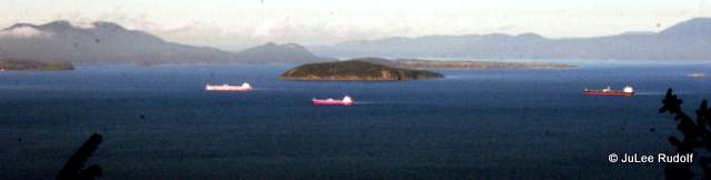
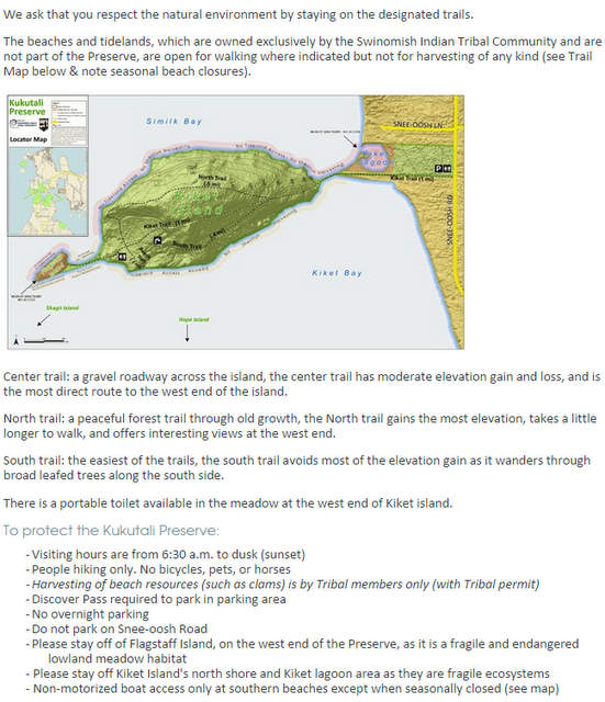
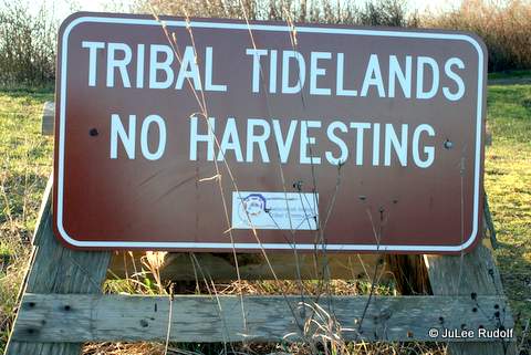
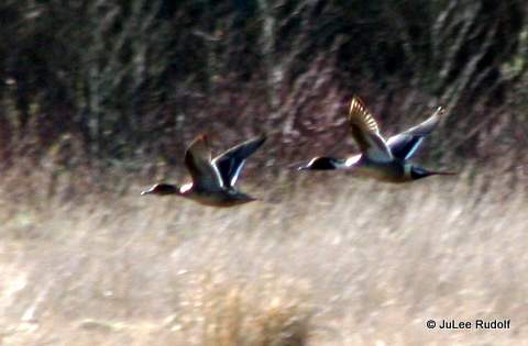
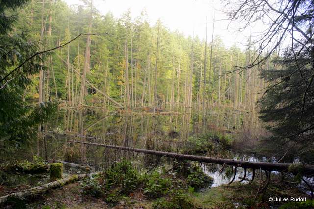
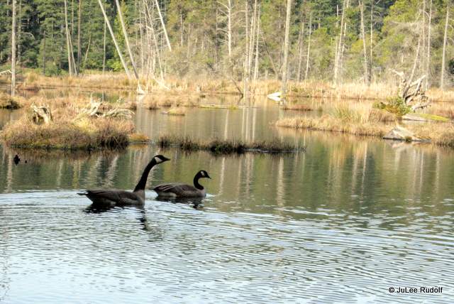
I headed down the road, noting the conspicuous, “No pets allowed” and “No Bikes” signs. The preserve was dead ahead. Kiket Lagoon was to the right. Birds swam in it, but were too far away for me to identify. In Similk Bay, half a dozen cormorants and a couple of gulls hung out on a small floating dock. As I neared the preserve, a flock of cormorants flew over.

The view to the south was beautiful and I took several photos of what I think is High Tide Island (with the lone tree) in the foreground and possibly Deadman Island in the distance.

IMG_8744

I checked out a sign that greets anyone who might enter the area by sea.

IMG_8741

IMG_8742
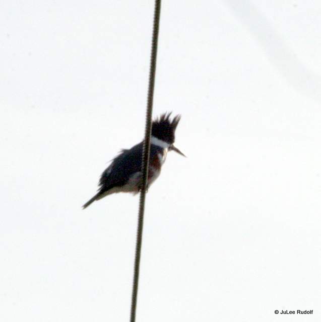
Then looked back at the access road as I reached the island. My nemesis in photography bird, the Belted kingfisher, greeted me with its call, as did, high up in a tree, a Bald eagle making a chatter call.

IMG_8753IMG_8760IMG_8756
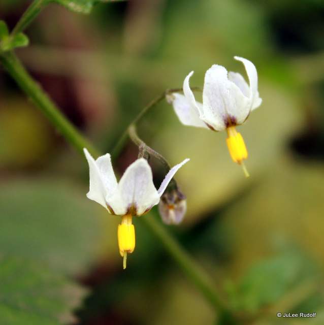
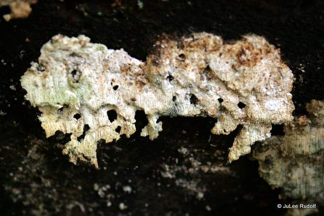
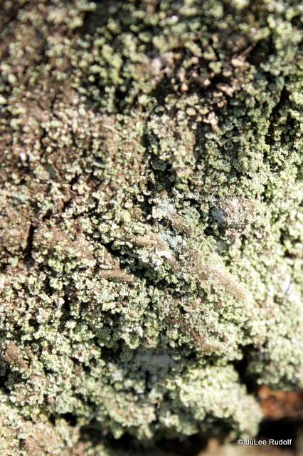
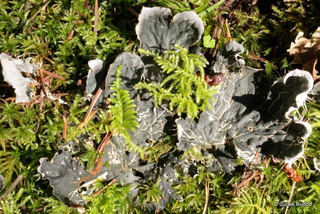
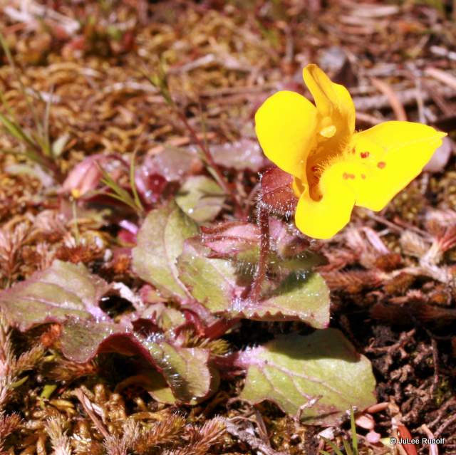
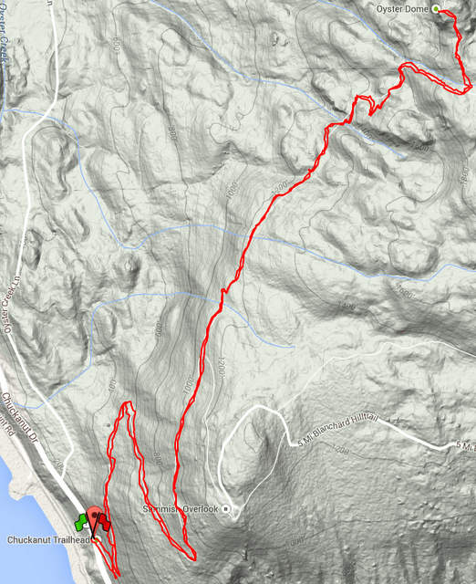
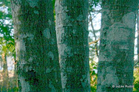
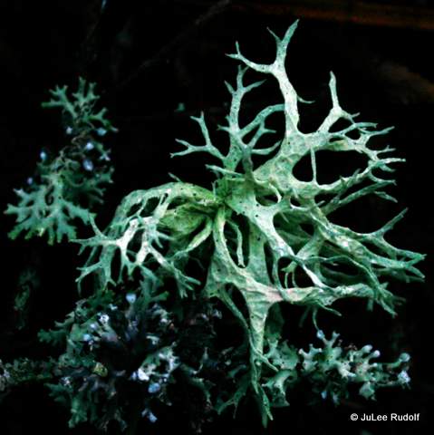
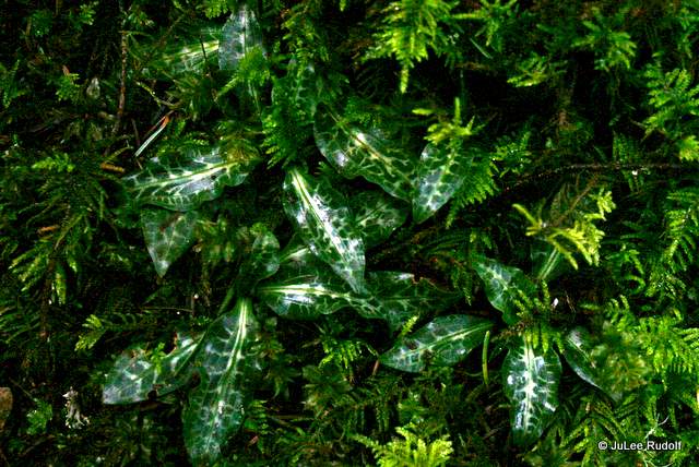
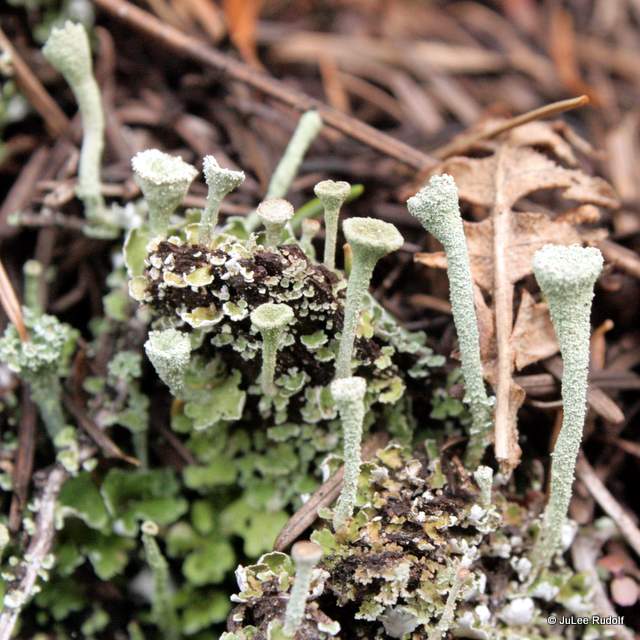
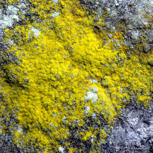
Because I’d already read the rules and other information, knew I could choose between three trails, the North, South or Kiket (actually a gravel road) and headed to the right in order to hike in a counterclockwise direction. The plant life was much like I’d seen elsewhere in Deception Pass State Park. There were several types of lichen: dog, some sort of foliose, and blood-spattered beard.

IMG_8761IMG_8765
The trails were also similar to those that can be found in DPSP and the ACFL, very green with plenty of salal and ferns.


IMG_8780IMG_8787IMG_8792
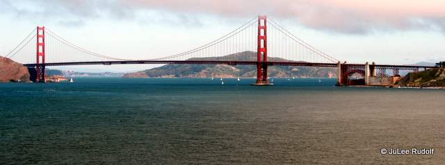
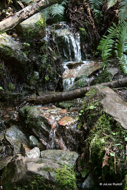
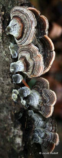
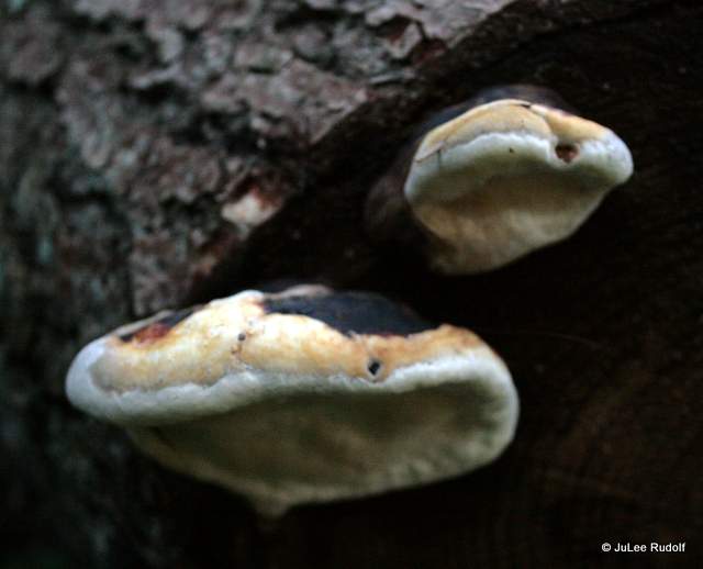
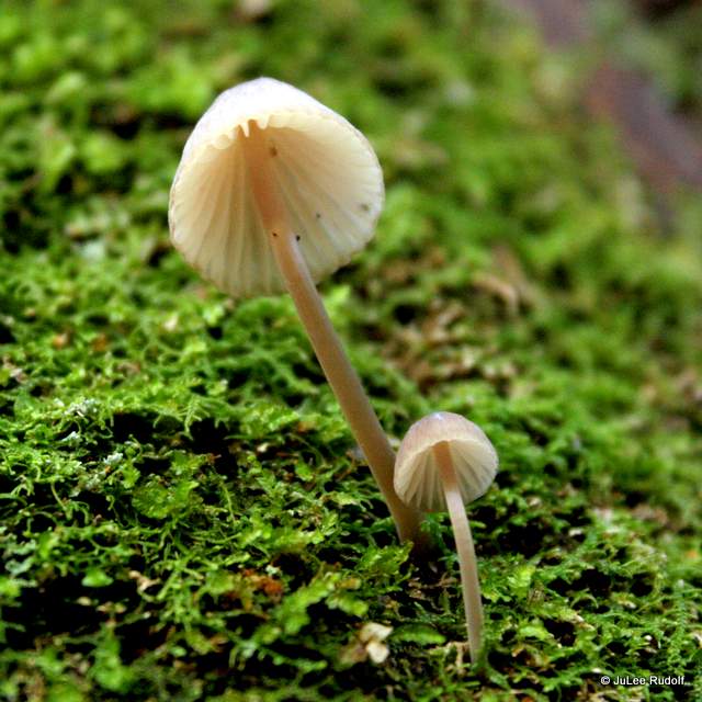
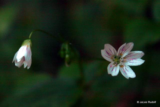
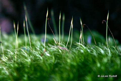
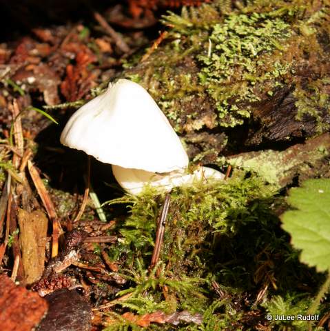
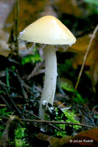
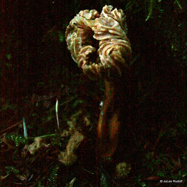
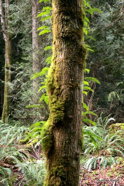
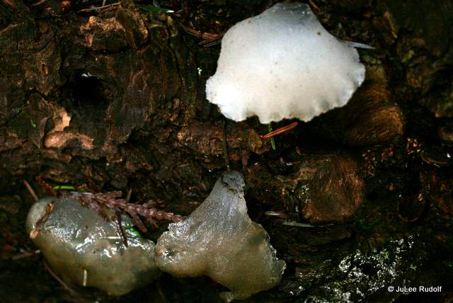
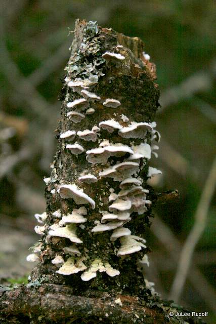
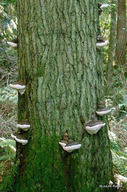
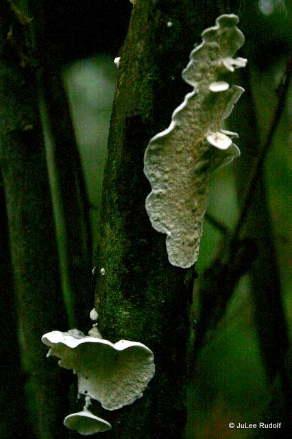
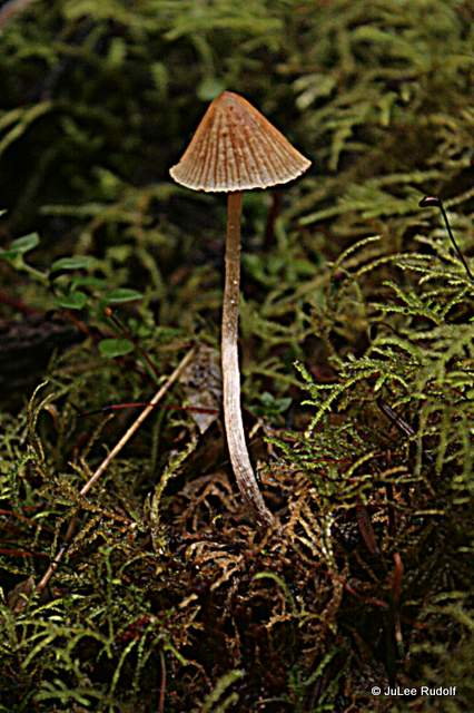
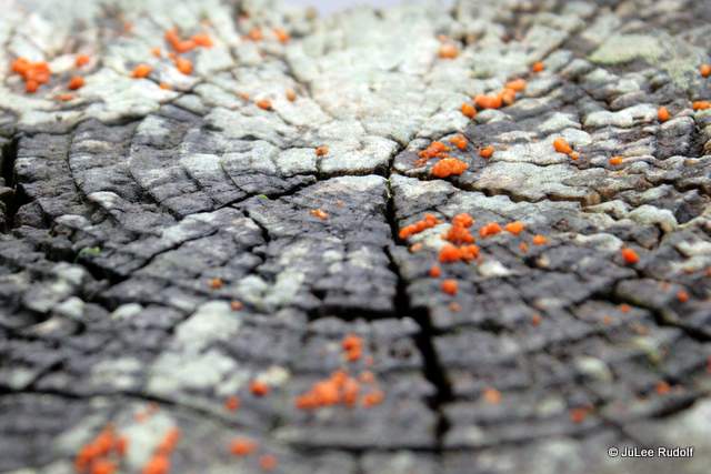
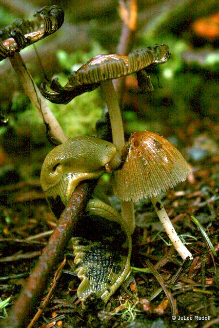
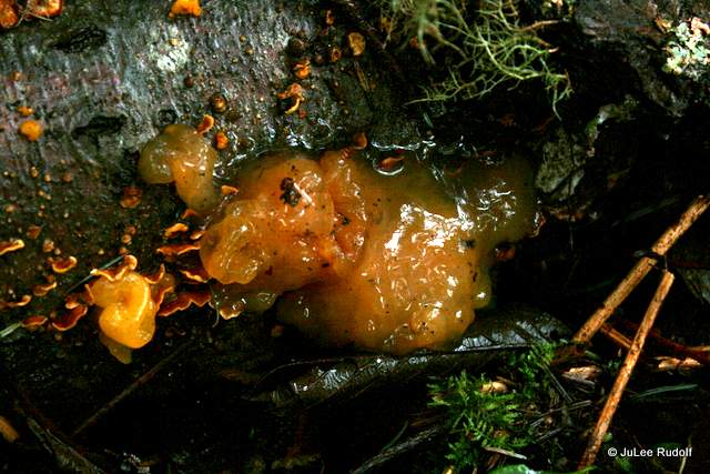
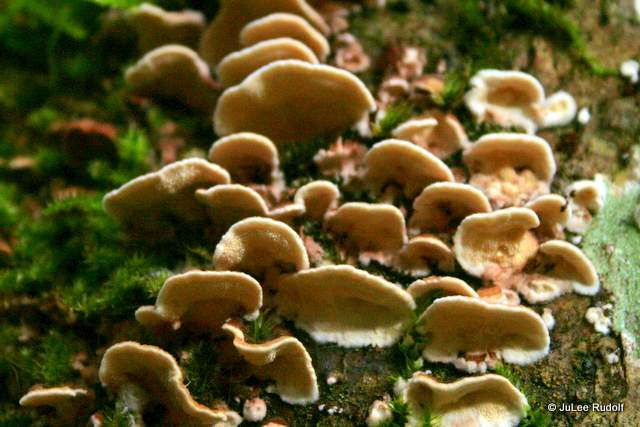
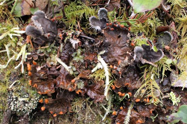
As usual, I kept my eyes peeled for fungi and moss, and found them. As I walked I tried to keep track of my position within the preserve, hoping to get my bearings. I was glad that I’d taken the counterclockwise route when I came upon this inconspicuous opening in the trees with a great view of the Deception Pass Bridge with Strawberry Island in the foreground.

IMG_8794

I continued on towards the west end of the preserve, noticing more moss and lichen.

IMG_8799

IMG_8807
crustose lichen
IMG_8812
antlered perfume lichen

IMG_8830IMG_8822IMG_8828
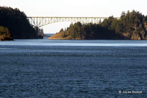
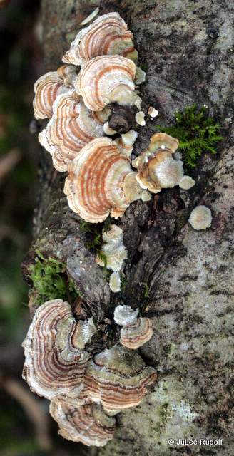
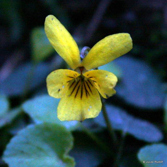
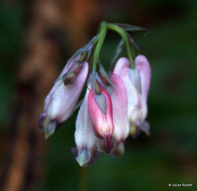
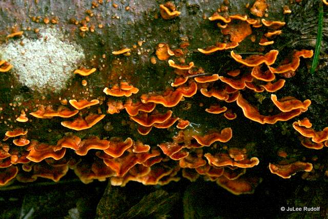
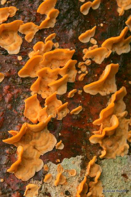
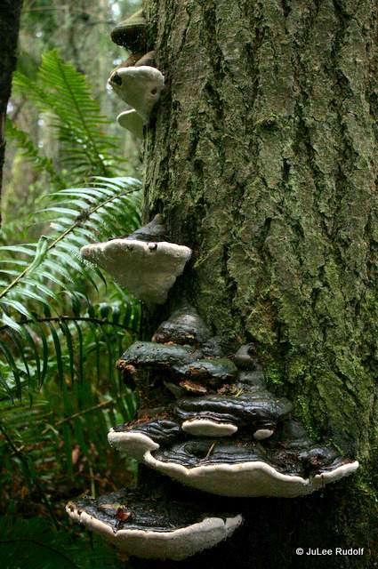
I got these shots of a red flowering currant, a polypore fungi and some sort of crustose lichen, respectively, as I neared a large open grassy field where all three trails again converge.

IMG_8832

Pink-tinged bright yellow mahonia was in bloom along the shore. The only birds I noticed were a pair of flickers.

IMG_8835
crustose lichen

IMG_8839

IMG_8842
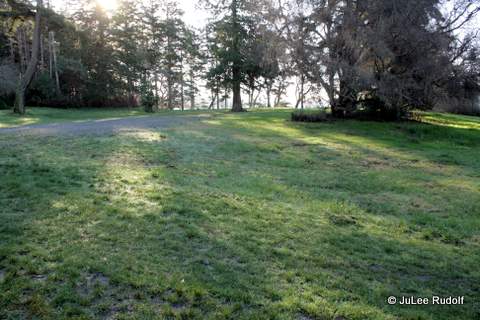
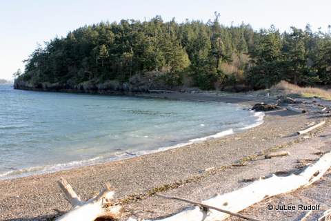
I knew that one of the most important rules was to stay on designated trails, so I proceeded towards the preserve’s limits with caution. This is along the southwest side of the path. Skagit Island is to the left, Flagstaff Island is to the right.


IMG_8845IMG_8846IMG_8850IMG_8855
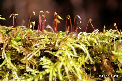
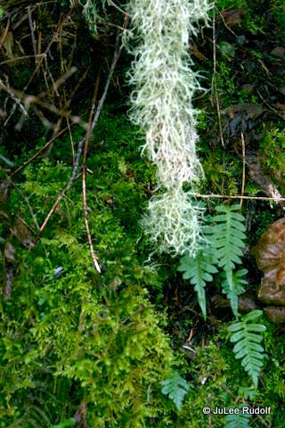
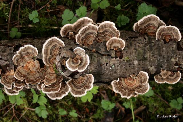
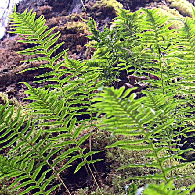
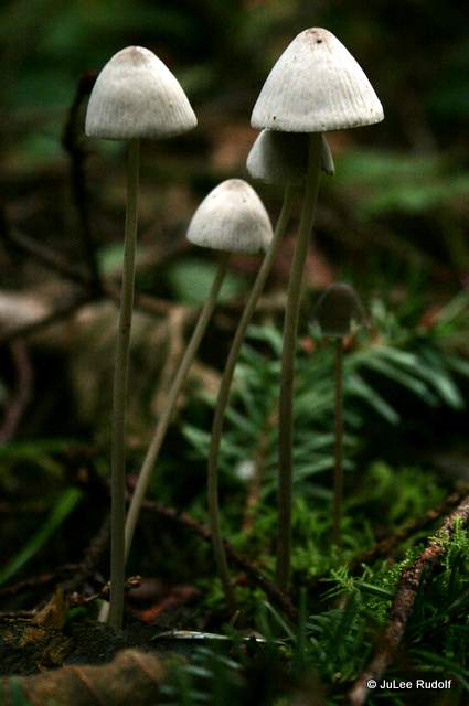
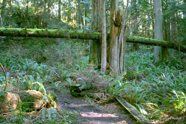
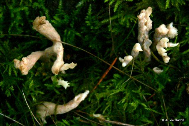
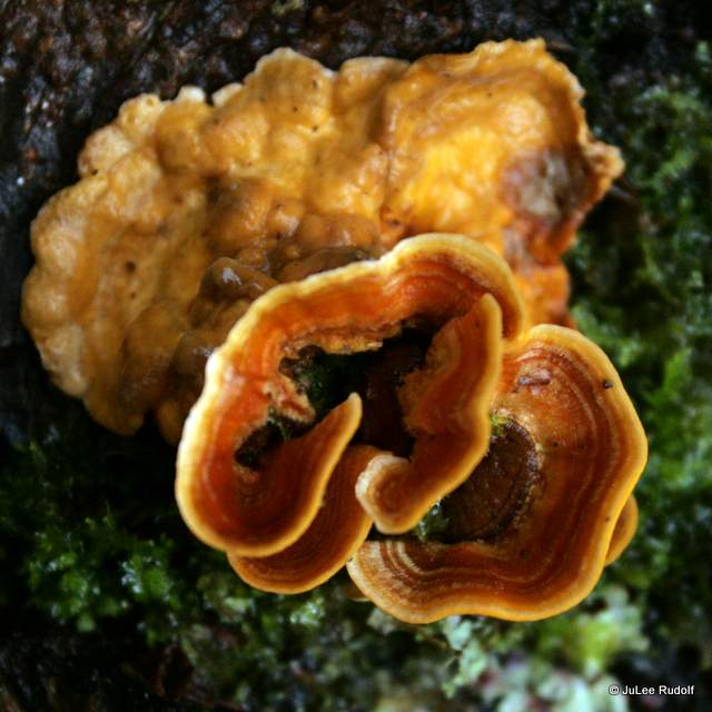
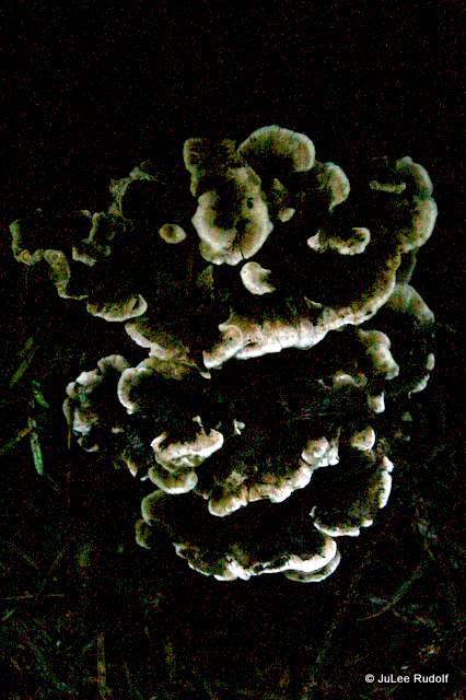
I was so scared of doing something wrong that I stopped well short of the barrier that blocks anyone who is not paying attention from attempting to enter Flagstaff Island, which is off limits. I turned around and made my way back to Kiket Island, crossed the field, took a look at the beach (Deception Pass Bridge is on the background, Flagstaff Island is ahead and to the right), and hit the South Trail. It was extremely wet and muddy, which is probably why I found more fungi, (witch’s hair) lichen, mosses and ferns.
IMG_8868IMG_8874

IMG_8876
Step? moss

IMG_8877

IMG_8880


IMG_8885IMG_8934IMG_8895IMG_8897
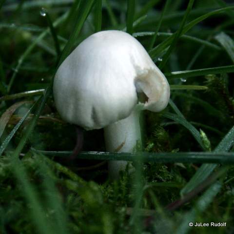
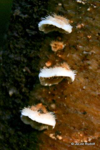
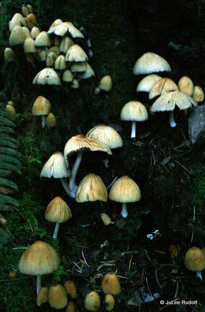
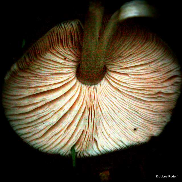
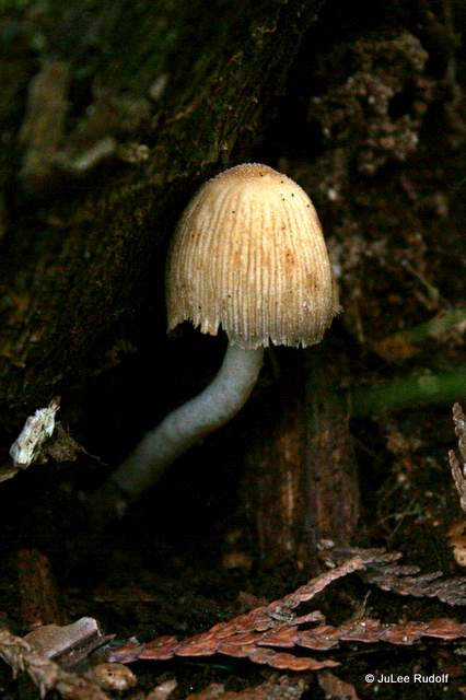
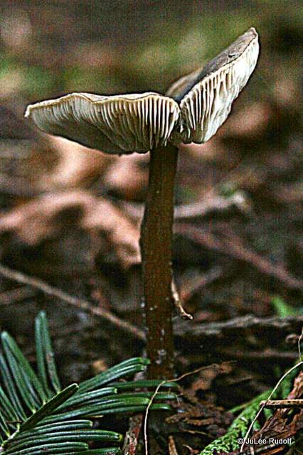
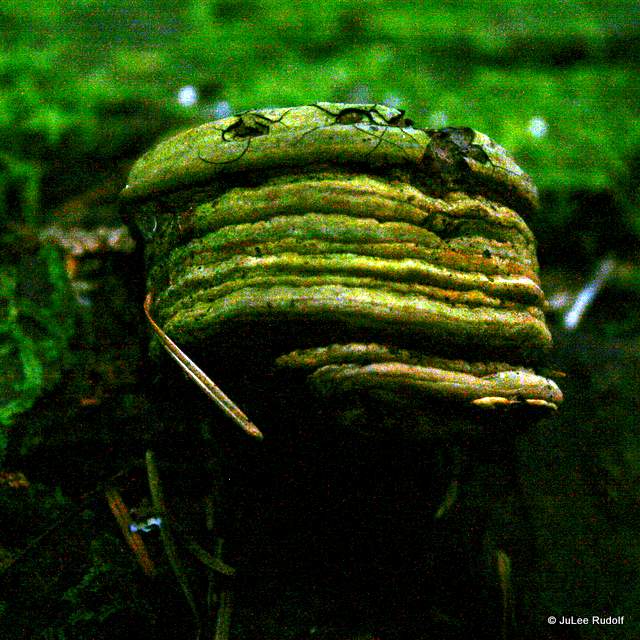
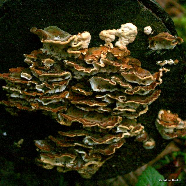
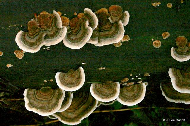
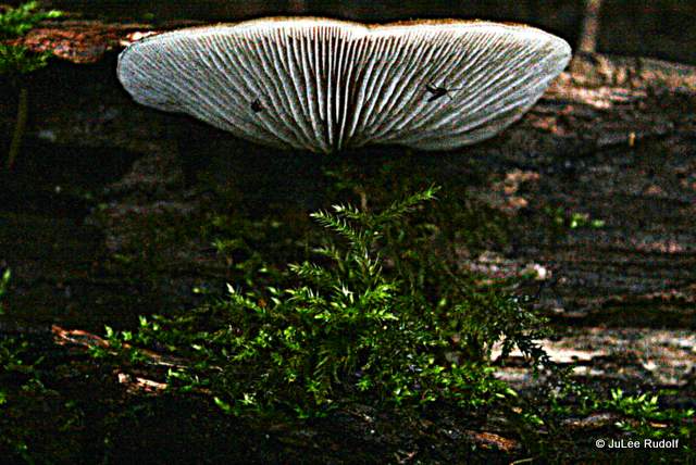
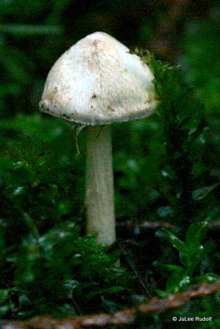
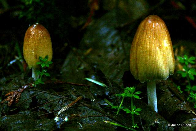
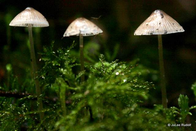
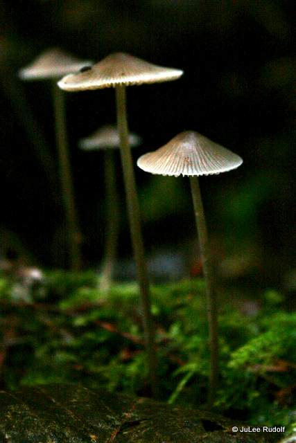
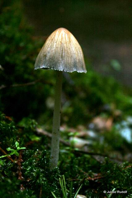
When I returned to the intersection of the three trails to the east, I decided to follow the road (Kiket Trail) westward to see what I might find. And was glad I did when I noticed these three species of mushrooms that I’d never seen before. The cap of the first species looks a bit like a slice of bacon, the second was unusual due to its dark cap and I thought that the third’s cap resembled a sombrero.

IMG_8908

A banana slug moved to the edge of a dog lichen, probably in search of fungi.

IMG_8916
banana slug on dog lichen

I noticed this stropharia ambigua, which I’d also observed at Heart Lake and Mount Erie.

IMG_8922
stropharia ambigua
IMG_8926
crustose lichen on a maple leaf

IMG_8940
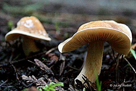
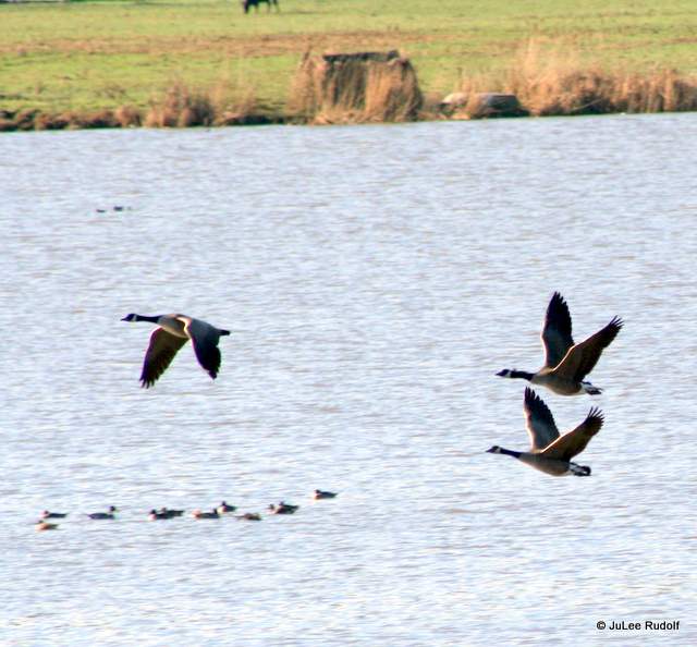
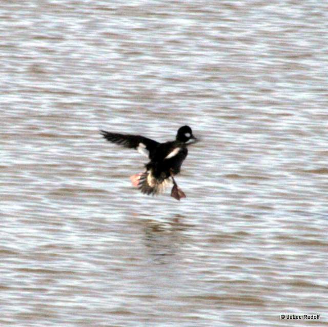
When I reached the open field on Kiket Island’s west end, I decided it was time to go. As I made my way back to my vehicle, I noticed a loon and several mergansers in Similk Bay. Ninety minutes had passed since I’d arrived, during which I’d covered just over 2.5 miles from parking lot to parking lot. In order to hit all three trails, I’d followed a counterclockwise course from North Trail to South Trail to Kiket Trail (and back). Although, except for a few of the mushrooms, most of the flora and fauna I observed were familiar from hikes I’d done at Deception Pass State Park and the Anacortes Forest Lands, I really enjoyed my first visit to the preserve, a peaceful place with great views.

Bye Bye Birdie: Departure of the Trumpeter Swans

Every winter I look forward to the arrival of Trumpeter swans in Island County, which, according to BirdWeb, “move south in late fall as water begins to freeze. Most migration takes place during the day, and flocks fly low overhead in a V-formation. Migration starts early in spring, and birds often return to the breeding grounds before the water is free of ice.” This map from NatureServe shows where they live and breed. Our area is shown in blue along the northern part of Washington state’s coast.

Chrome Legacy Window 3142015 80131 AM.bmp

We’ve had another unseasonably warm winter, which may be why the dozens of swans that have been hanging out in area of Dugualla Bay appear to have departed. This year was especially great because, according to a state wildlife officials’ count, we had a record number of swans. During the past couple of months, we’ve had over a hundred. That number has diminished lately down to these few stragglers I saw yesterday.

IMG_9490

Recently, I realized that the only photos I’d taken of “largest American waterfowl,” weighing about twenty pounds, five feet in length with a six foot wide wing span, were of birds foraging for food in local fields. A few mallard ducks joined them in this photo I took last year.

IMG_3365-002

I decided to try to remedy my no-swan-photos-while-in-flight problem this year, which I didn’t think would be difficult. The Trumpeter swans that show up tend to congregate in an approximately one square mile area of Dugualla Bay bordered by: Dugualla Bay Farms’ fields to the west of Highway 20, Jones Road to the north, Frostad Road to the south and Dike Road to the east. They spend much of their time within the unnamed waterway shown in this Google Maps screen capture (the Clover Valley label is incorrect).

Chrome Legacy Window 3132015 85530 AM

On a super sunny February morning, I grabbed my camera, switched to my (75-300mm) telephoto lens, and headed over to Dike Road where I hoped to get a great view of any swans traveling between the pond and the fields. I took up a spot not far from a dock that extends into the pond. Not only did I see Trumpeter swans, but also Canada geese, Northern pintails, Mallards, Hooded mergansers and other birds that I could not identify. The swans tended to travel in pairs or small groups, calling while in flight. They hang out just north of the pond, in the pond, in the waterway between it and the highway, and in the Dugualla Bay Farms’ fields.

IMG_7738-001

IMG_7831

The Northern pintails, shown here on the shore, in the pond and in flight made a neat call.

IMG_7774

IMG_7839

Watching birds in flight is a treat for persons like me. These are Canada geese.

IMG_7752

Seeing them land was a different matter.

IMG_7743

IMG_7756-001

IMG_7798

Even for the seemingly super elegant swans.

IMG_7820

IMG_8021

IMG_7767

IMG_7824

IMG_7826

Although it was noisy (in a cool way), everyone seemed to get along…for the most part. Trumpeter swans and Canada geese spent a lot of time together without incident. In the foreground here are Mallards (to the left) and Hooded mergansers (to the right).

IMG_7996

I took the opportunity to check out a gull with a black spot on the side of its head wandering alone along the shore just opposite the pond along Dike Road. It turned out to be a Bonaparte’s gull. Cool fact from The Cornell Lab of Ornithology, “The Bonaparte’s Gull is the only gull that regularly nests in trees.”

IMG_8108

Of course, my nemesis (in being impossible to get a decent photo of), the Belted kingfisher, showed up for a few seconds to watch for prey in the pond (and probably mock me).

IMG_8094

This small bird arrived alone. I think it might have been a female Bufflehead.

IMG_8047

I spent half an hour listening, watching and waiting for the opportunity to get some shots of swans in flight. And did, primarily as they left the water and returned to the land across Highway 20.

IMG_7812

IMG_7775

Although I’m sad to see them go, I know they’ll be back next winter.

IMG_7761

A Tale of Two Colonoscopies

Imagine learning you’ll have to drink super salty water that tastes like it’s been used to boil carrot peelings in order to prepare for a necessary medical procedure. If you are an Island Hospital Anacortes patient, you will drink 16 ounces of the disgusting stuff, but if you are a Naval Hospital Oak Harbor patient, you must drink 128 ounces, EIGHT TIMES times (that is not a typo) as much to prepare for the same procedure that you will undergo at the same facility as only-has-to-drink-one-pint guy.

About a year ago, my husband and I had both hit the half-century mark, which meant, of course, that it was time to schedule one of the most dreaded cancer screening procedures: colonoscopy. His (our) doctor had put in the referral nearly a year prior, before the current surgeon was on staff, he was treated like an Island Hospital (non-Navy) patient. He contacted IH to schedule it. They sent him the necessary paperwork to complete and information about preparing for the procedure. As directed, he bought two 1.5 oz bottles of phosphate from a local drug store for $5.50 each. The day before his appointment, he followed the required liquid diet. That night he drank the first half of the prep, one 1.5 oz bottle of phosphate mixed with 6.5 oz of water for a total of 8 oz of salty liquid. He then continued with the liquid diet. Early the following morning, he drank the second 8 oz phosphate plus water solution.

IMG_9192
Island Hospital patients drink two 8 oz glasses

We two hours before the procedure. After checking in, my husband stopped by the volunteer desk, where they called back to endoscopy to let a staff member know he was there. Once in the back, he put on a gown, booties and a head covering and waited in a movable hospital bed. A nurse placed an IV into his arm. The surgeon arrived, a fifty-something-ish man wearing scrubs who exuded calm competence. He said colon cancer’s prevalence is second only to lung cancer after the reproductive types but only about 30%-40% of persons choose to go through the screening process. He explained the risks of the procedure and, after asking my husband about his medical history, he departed for the operating room. Less than an hour later, it was over. My husband received a clean bill of colon health and would not need another screening for ten years.

A month later, it was my turn. Because our doctor had just put in my referral, they would treat me like any other NHOH patient. Everything was different. A scheduler called from NHOH to set up a pre-op. A couple of weeks later, I arrived at the hospital, sat in the waiting room, and eventually arrived at the assigned room. After a staff member had taken my vitals, the surgeon arrived. If I hadn’t known, I would not have guessed she was a surgeon, much less a member of the USN. Nervous, I commented on her youthfulness. She offered that she was thirty-two years old and board certified. I inquired about the number of colonoscopies she’d performed. She replied, “I wish I knew,” then rattled off stats that allowed me to do the math in my head in a matter of seconds. During the past six months (25 weeks), she’d performed four procedures a day three days a week (25*4*3=300). She added that she’d performed 60 to get certified. Then asked about my medical history and whether or not I’d experienced certain symptoms of colon cancer. She said if I chose not to go through with the procedure within the month, it’d take weeks to reschedule which would mean returning to meet with her again within 30 days of the procedure as required.

She added me to her schedule and handed me a pamphlet about the procedure on my way out. As I left, a staff member gave me a sheet with an appointment reminder for the following week, when I’d have to meet with a different staff member to learn about the prep and complete some paperwork. I returned to the hospital, sat in the waiting room, and met with a nurse who had me sign a form and explained the prep procedure. She instructed me to stop by the pharmacy, where I waited about 25 minutes to obtain an enormous plastic jug labeled GoLYTELY containing about half an inch of a white powdery substance which costs about $20 at the drug store and a prescription bottle with two yellow Dulcolax tablets an inexpensive OTC medication.

IMG_9192-002
GoLYTELY (128 oz) vs phosphate plus water (16 oz)

The day before the procedure, scheduled at the same facility, I ate a light breakfast as instructed, then followed the same liquid diet that he had. I added 128 ml of lukewarm water to the plastic jug, shook and refrigerated it. That night, instead of drinking 8 oz cup of super salty water as my husband had, I started in on the GoLYTELY, one 8 oz glass every ten minutes or a total of 64 ounces, which took me an hour and twenty minutes. The instructions state, “Nausea, bloating, or feelings of fullness are common.” Trust me. This is an understatement. As for what happened next, if you’ve been through it, I needn’t remind you of the horror; if you don’t have to go through it for a long time, you needn’t know;  and if you must do same soon, I needn’t scare you away from going through an important screening procedure.

In a word…”Ew.”

The next morning, I was had to do same; drink two quarts of GoLYTELY, one disgusting glassful every ten minutes. It was even worse the second time around because I already knew how awful the drink tasted and how horrible I’d feel while drinking it.

2015-03-08
NHOH patients drink-3,785 ml. Island Hospital patients drink -473 ml.

Due to some confusion, we arrived an hour earlier than I was supposed to, my husband’s and my roles reversed. A volunteer called endoscopy to let them know I’d arrived and they sent me back. Someone led me to an L-shaped curved room with about eight hospital beds separated by curtains; the operating room assembly line. A different person walked me to the rest room, handed me an enormous (one size fits all) hospital gown with a faded blue/gray/white geometric pattern, blue papery booties and a head covering made of the same material. After dressing, I returned to my spot. A nurse placed warm blankets over me. Soon, she decided to insert my IV, mentioning she was to start from the extremities in to locate a place to insert it. I was dehydrated, so her attempt to use a vein partway along my forearm failed. She cleaned off the blood drips and successfully placed it in a vein in the crook of my arm.

As I waited, others came and went. An elderly man exited the rest room after donning the same style gown, promptly turned around and, oblivious about the opening in the back, unintentionally mooned me.

About fifteen minutes before my scheduled start time, I saw the surgeon, dressed, pre-scrubs, in a light colored top with black stretch pants. She spoke with me, then with the guy who was up next. A surgical nurse then wheeled me to the operating room, which contained a monitor, tons of tubes, low light and a screen showing a chest x-ray kitty corner from the hospital bed in which I was lying. A second nurse arrive. I felt very nervous. The first nurse grabbed two pink-capped syringes, instructed me to lie on my left side, and injected the medicines (a sedative and another drug that supposedly has an amnesiac effect) into the IV. I started counting in my head one-one-thousand and made it to about twenty before I lost awareness.

Sometime later, I awoke to uncomfortable sensation of extreme tugging along my abdomen. I think I tried to move and heard someone tell me, “No, no, no.”

Had I been abducted by aliens?

I lost awareness again, came to once the procedure was over and was wheeled into a recovery room. Finally, I returned to my original spot in the pre-op room where I dressed, and collected my Golden Ticket.

Have I mentioned this lately?

Island Hospital patients
IMG_9487-001
Naval Hospital Oak Harbor patients

My reason for sharing this story is to raise awareness (and hopefully make positive change for patients): Naval Hospital Oak Harbor patients should not be forced to imbibe eight times the amount of a disgusting, nausea-inducing drink than everyone else in order to prepare for the exact same procedure performed at the exact same hospital.

Little Cranberry Lake in the Anacortes Community Forest Lands

The Anacortes Community Forest Lands, which, according to their web site, include 2,800 acres of land and 50 miles of multiple use trails, are one of my favorite places to trail run and hike. Our trail running group typically alternates between Little Cranberry Lake and Heart Lake, which means I’ve had a number of opportunities to get to know the lay of the land. After following our fearless navigational leader Nina for a couple of years, I finally ventured out alone last fall in hopes of mastering the trail numbers and locations. A dozen solo trips through the forest later, I’m now confident in my own navigational abilities. During the past several weeks, I’ve taken the time to do what I like to call speed hiking in order to travel at a slow enough pace to stop and take photos but not so slow that it takes me an eternity to complete a hike.

IMG_7661The first time I arrived (at Fircrest Drive) was on a weekday morning at 7:30, just as the sun was rising.It was really quiet, except for this sound coming from at least two different places in the trees above me. Lately, I’d noticed a new (to me) bird in the forest, robin-sized but with even prettier markings, which I suspected might be producing the call. Later, when I returned home and listened to it on line, I was thrilled to learn it was the Varied Thrush, an elusive bird that I’d seen half a dozen times but had yet to get a long look at. The thrushes continued calling for several minutes as I made my way along Trail 126 to Trail 10 in the direction of the Little Beaver Pond in hopes of spying a beaver. I’d soon reached my destination: Trail 12, the southwest side of the pond. I stood silently for about ten minutes looking for signs of movement in the water. On this day at least, it was not meant to be. I snapped a few photos of their handiwork, trees they’d fallen and wood chips lying around the base of trees that they’d spent time gnawing.

IMG_7683 IMG_7684

I also noticed a few cool fungi. I think the first is marasmiellus candidus, the last is a type of cup fungus.

IMG_7681

IMG_7691 IMG_7693

IMG_7697


The following week I parked at the A Ave access and followed Trail 10 to Trail 113, where I noticed several types of cool fungi. Last week, local mushroom enthusiast Ida Gianopulous replied to an email I’d sent her about fungus, at which point I learned that I’d been confusing polypore fungi with lichen. She provided some excellent information about distinguishing between the two (mainly, that lichen tend to be green) as well as the names of a couple of good guides by David Arora that I hope will help me identify both better in the future. For now, I can say that I’m pretty sure these are polypore fungi. The second is coprinellus micaceus, third and fourth show moss and ferns.

IMG_8436

IMG_8448

IMG_8449 IMG_8450

I found many mushrooms and fungi along Trail 113, most that I can’t identify (yet). I think that the second shot shows a type of crust fungi, the third jelly-like, the fourth mycena, the fifth I’d never seen before and looks to me like a stack of pancakes.

IMG_8453

IMG_8456 IMG_8462 IMG_8467

IMG_8475

IMG_8477 IMG_8479

IMG_8481

I returned within my allotted hour and so arrived at my next destination on time.

Two days later I spent nearly two hours (that is not a typo) speed-hiking a five mile trail run route that I absolutely love that would take the typical trail runner (including me and the gals I run with) less than an hour. Starting from Trail 10 at the A Ave access:  10, 108, 104, 100, 127, 128, 105, 11, 109, 110, 115, 12, 10, 113, 10, 134, 10. It was just as awesome (though twice as time-consuming) when traveled at stop and smell the roses pace. I noticed some polypore fungi.

IMG_8506   IMG_8508

IMG_8509

Then the leaves of Rattlesnake plantain.

IMG_8513

Along Trail 100, I found three different types of mushrooms, I think: pluerotoid, mycena and coral like.

IMG_8516   IMG_8520

IMG_8521   IMG_8529

As I entered a wooden structure near the northwester part of Little Cranberry, I scared off a small flock of mergansers as I stopped to take this shot of the parking area at the north end of the lake.

IMG_8530

IMG_8533

After crossing the lot, I continued along Trail 127. Soon, I spied two fungi, the first is jelly like.IMG_8541IMG_8546
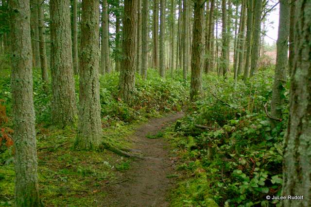
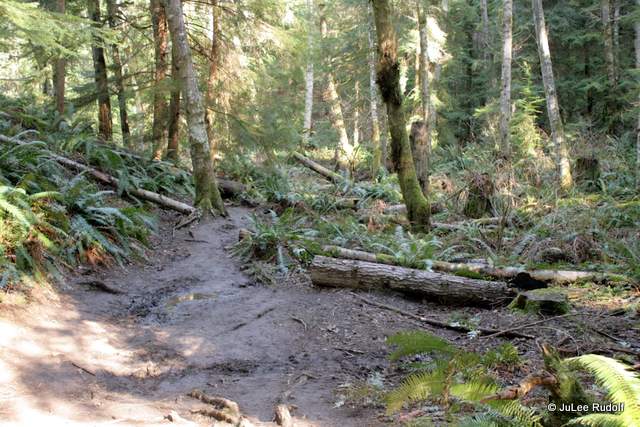
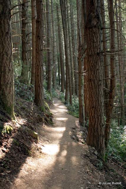
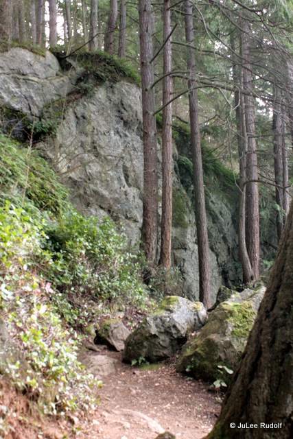
Here the sun peeks through the trees along Trail 128.

IMG_8549

As I neared Trail 105, I took a little detour to Trail 132, where I found a treasure trove of fungi, most of which I can’t identify, though the second and third were familiar to me, coprinellus micaceus. It seems that banana slugs enjoy eating mushrooms. The others are jelly-like followed by polypore fungi. IMG_8552

IMG_8556   IMG_8558IMG_8560

IMG_8561

IMG_8564

IMG_8567

IMG_8570
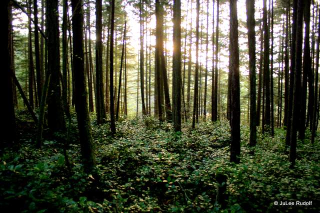
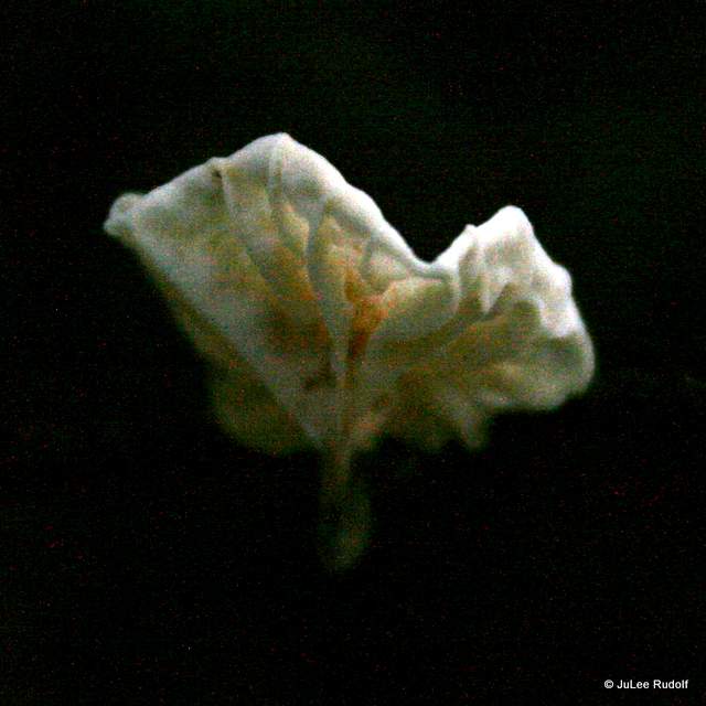
A few steps further took me to a swampy spot with lots of skunk cabbage, which, according to Plants of the Pacific Northwest Coast, Native Americans used (p 334) “…for lining berry baskets, berry-drying racks and steaming pits…it was mostly a famine food in the early spring; and it was then eaten only after roasting or steaming.” They really do smell like skunk, though it’s not as noticeable when they first emerge from the ground.


Back on Trail 105, I continued on my way. These are mycena, polypore, mycena (two types), polypore (two types, the second along Trail 109), Little Beaver Pond from Trail 12 and coprinellus micaceus. IMG_8578  IMG_8583

IMG_8586   IMG_8590

IMG_8593

IMG_8596

IMG_8599

IMG_8603

IMG_9086
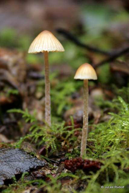
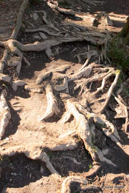
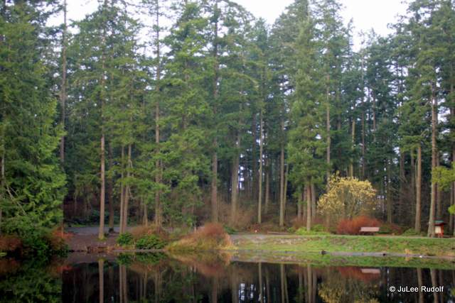
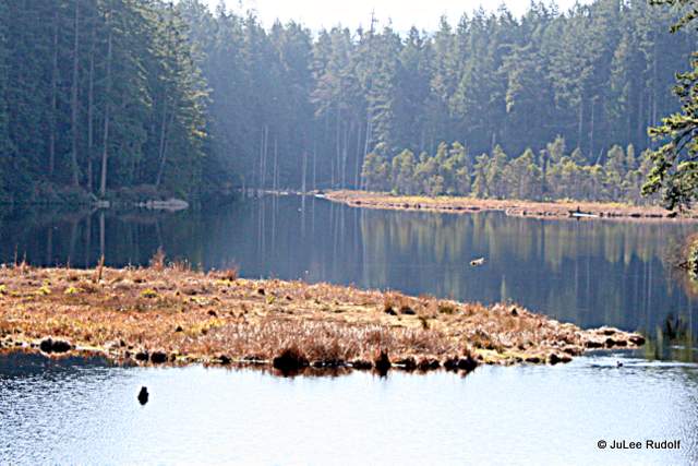
Yesterday, the weather was so amazing that it felt like summer, so I decided it was time to hike the trails around Little Cranberry that run along the shore. I found my way to the northernmost access: Oakes Road to Georgia Road to Little Cranberry Road. From there I followed the tight to the perimeter (for the most part) trails in a counterclockwise direction around the lake: 101, 132, 102, 100, a distance of 1.5 miles. The hike was awesome, though I wouldn’t recommend it for trail running because it is a little technical with lots of rocks and roots. Here’s a view of the lake from the north end looking south.

IMG_9092IMG_9094IMG_9105This is cladonia cristatella, a type of lichen; the view from the Trail 100/Trail 130 junction and a type of moss.
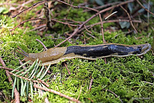
IMG_9107

This might be broom moss followed by sedum, red roof moss, coral like fungi.

IMG_9110IMG_9116IMG_9118IMG_9122
Here’s a typical rocky place along the trail followed by peltigera (lichen), IMG_9159IMG_9126   IMG_9141

While hiking along the southern part of Trail 102, I startled a couple of Canadian geese. Instead of flying away in a rush, the larger one made several quieter than usual calls as the pair slowly swam off.   IMG_9145

I noticed a neat type of lichen that I’d first seen at Sharpe Park and have since seen nearly everywhere, cladonia chlorophaea. They are one to two cm tall and just a few mm wide at the top. The second shows Gold dust lichen (just learned that today) and the final shot is of an enormous boulder.   IMG_9151 IMG_9161 IMG_9170

In summary, I love the trails in the Little Cranberry Lake area for trail running (except for the super rocky ones nearest the lake) and hiking. My only regret about spending time on these trails is that I didn’t do it sooner.

Design a site like this with WordPress.com
Get started