Hiking the Bluff Trail at Ebey’s Landing/Robert Y. Pratt Preserve

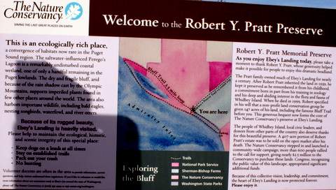
A few weeks ago my husband and I hiked the Bluff Trail that traverses three different areas: Ebey’s Landing, the Robert Y. Pratt Preserve (Mr. Pratt “gave 147 acres of his land, including the beautiful Bluff Trail, to the Nature Conservancy, for its wildness to be preserved, enjoyed and shared with the public), and the Admiralty Inlet Natural Area Preserve, which, “protects one of only 11 remaining populations of golden paintbrush, a federally listed threatened plant species.”

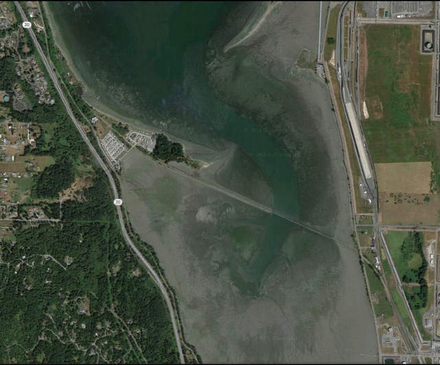
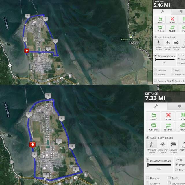
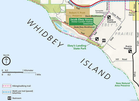
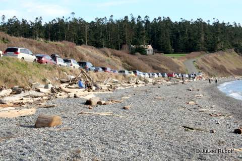
Because it was both Sunday and a sunny day, we encountered a lot of hikers who had the same idea. The parking lot is tiny, with room for about a dozen vehicles, so we, like many others, parked parallel to the shore along Hill Road, which is shown on this park map.

Chrome Legacy Window 2272015 115828 AM

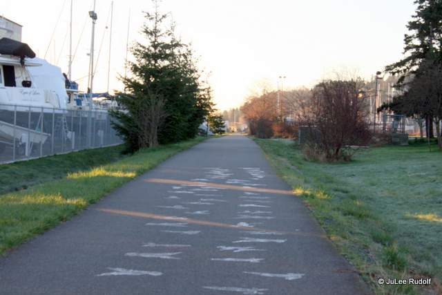
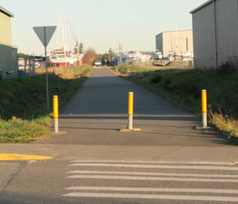
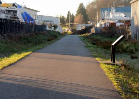
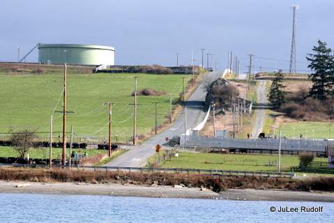
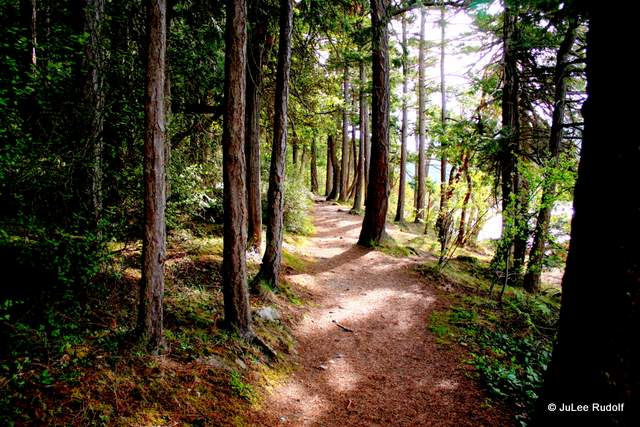
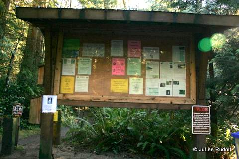
En route to the trail head,
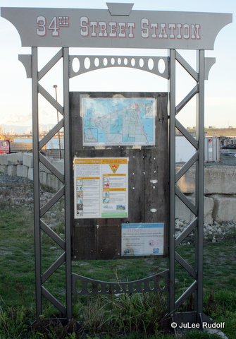
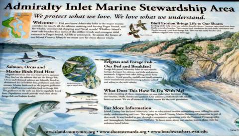
IMG_8115

we passed an area

IMG_8118

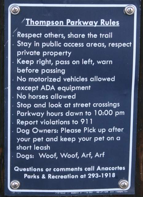
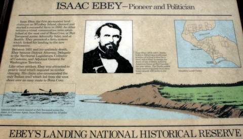
with informational signs,

IMG_8117

one notably about the man himself, Isaac Ebey, “the first resident land claimant on Whidbey Island” who “claimed and started a successful farm in 1850.”

IMG_8120

The park map indicates that the area from the parking lot to the trail head is part of Ebey’s Reserve.

IMG_8122

Moments later, we reached the limits of the Robert Y. Pratt Preserve. If, instead of walking up the hill, we’d gone towards the right, we’d have reached the Ebey’s Prairie Trail with access to the Jacob Ebey and the Davis blockhouses as well as the Sunnyside Cemetery. The weather was perfect, with clear skies, so we decided to continue on the Bluff Trail and save the other way for a different day.

IMG_8123

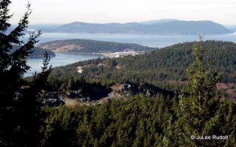
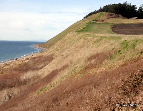
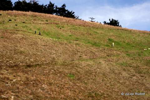
Looking down from here to the beach below, the hikers looked tiny. And the higher we went, the scarier it became because the hand-rail-less trail reaches 300 feet above the lake below. A fall down the hillside would likely be deadly. If you made it down alive, you’d end up in the drink.

IMG_8124

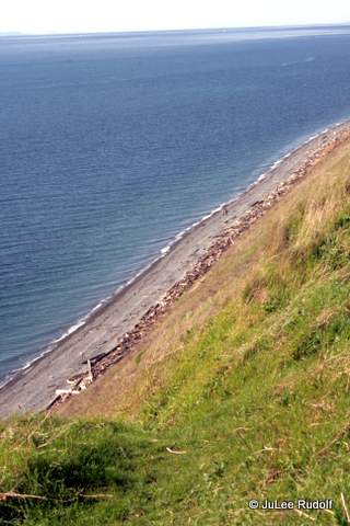
We stopped to look back from just above the trail head.

IMG_8125

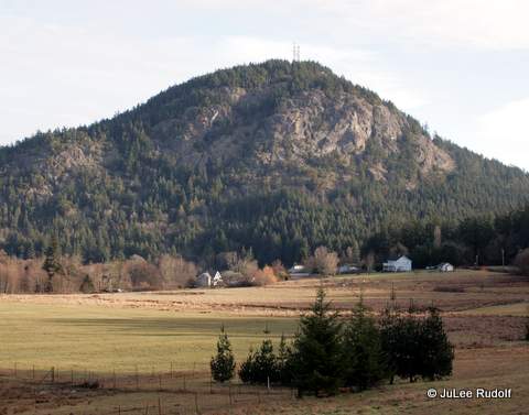
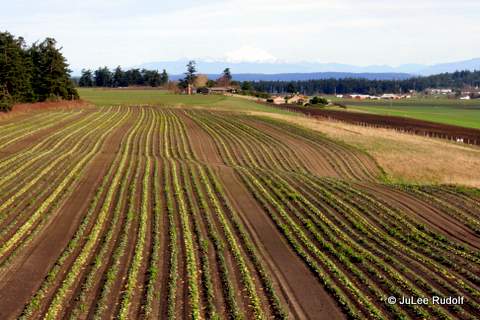
Still ascending, we passed farmland.

IMG_8126

IMG_8127

A few minutes later, a sixty-something guy with an iPod flew towards us, running along the trail. It didn’t seem so unsafe there to do so there, but further on, it definitely was.

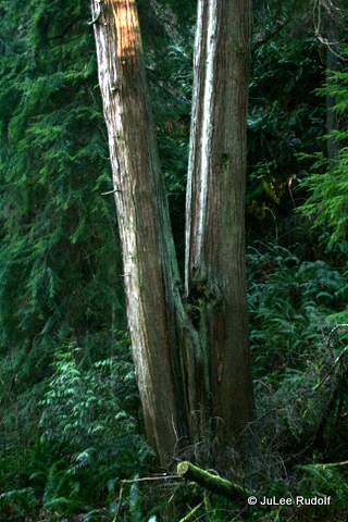
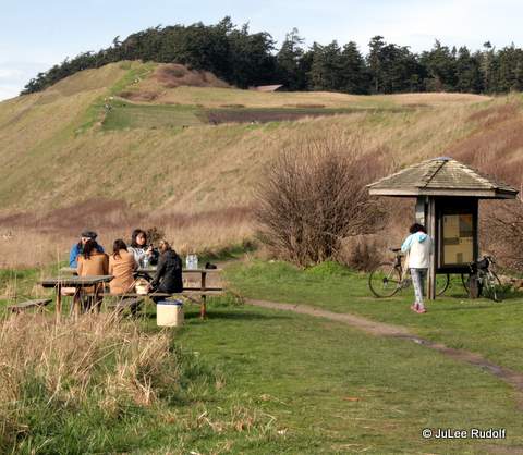
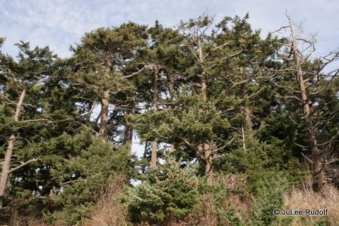
We saw several small groups of persons picnicking or just congregating, resting, and enjoying the amazing view. Soon we reached a line of sort of short gnarly-looking Douglas Fir trees, which should not have come as a surprise. The soil was dry and sandy and the trees aren’t protected from wind.

IMG_8130

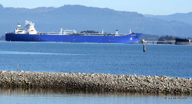
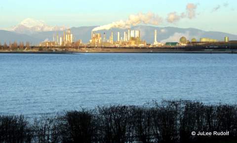
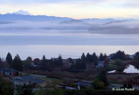
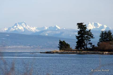
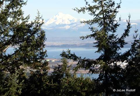
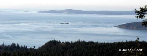
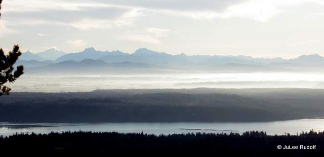
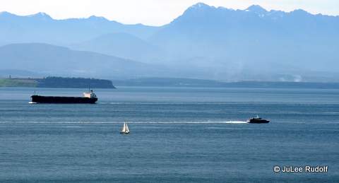
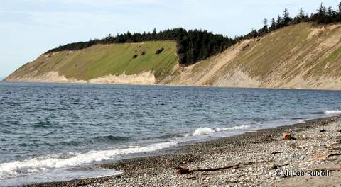
To the west was an absolutely superb unobstructed view of the Olympic Mountains. This shows what looks like an empty tanker, a sail boat and the Victoria Clipper on its way home.

IMG_8134

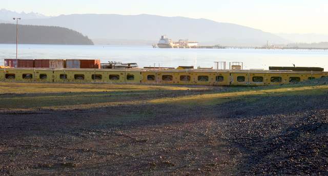
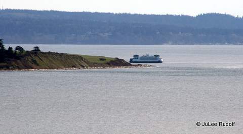
To the south, we saw the ferry that runs between Port Townsend and Coupeville near Admiralty Inlet, the Keystone side.

IMG_8136

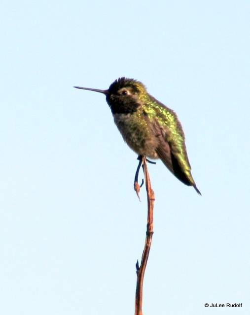
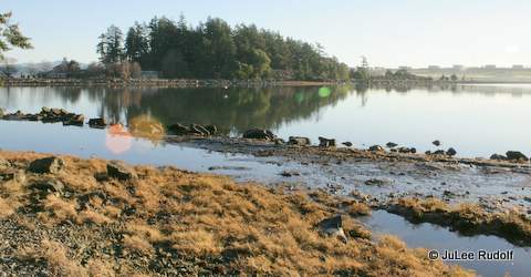
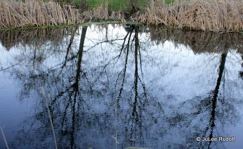
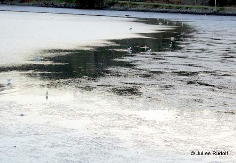
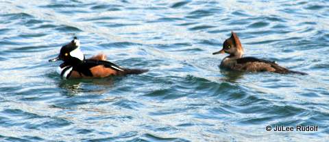
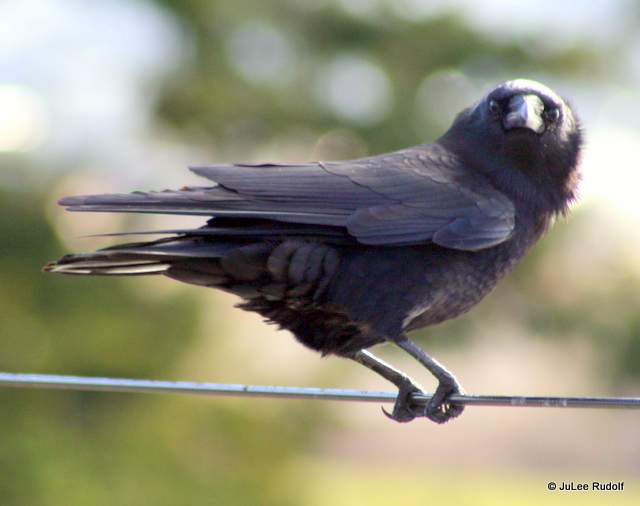
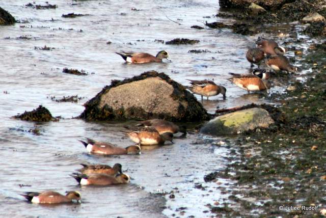
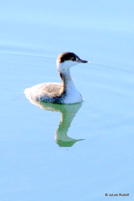
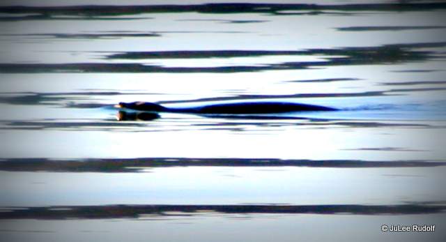
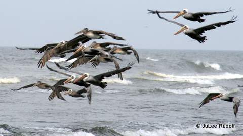
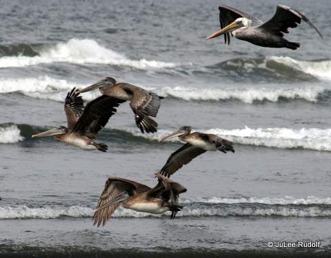
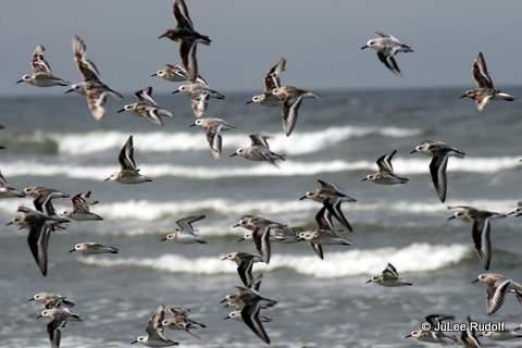
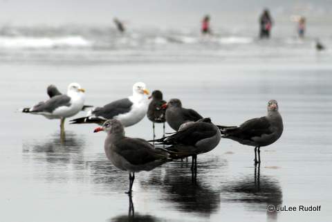
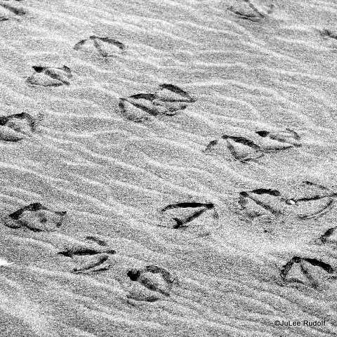
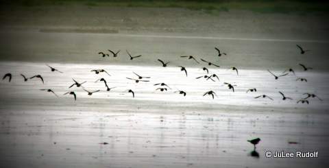
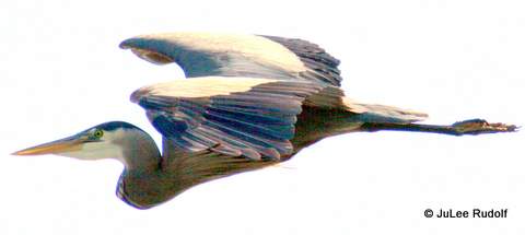
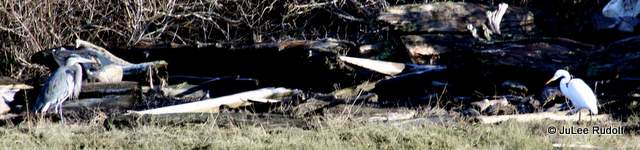
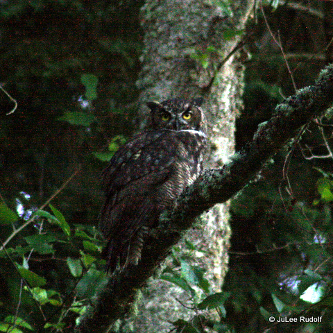
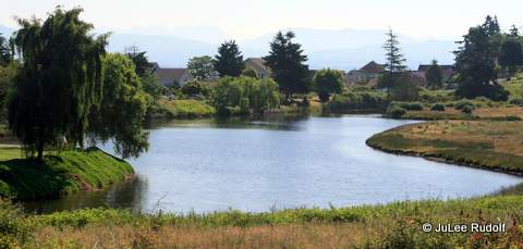
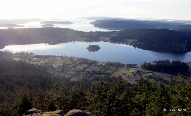
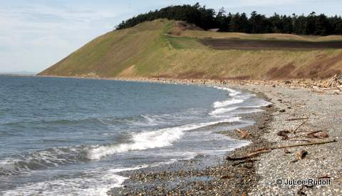
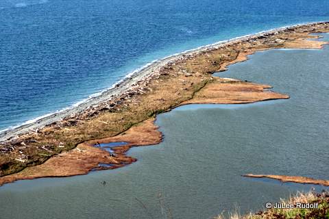
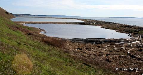
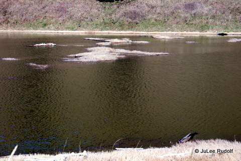
Finally, we got a good view of what looked like a lagoon, but is, in fact, Perego’s Lake. I was hoping to see birds, but, except for a hawk, was otherwise shut out as far as flying things go.

IMG_8139

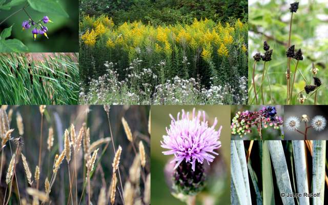
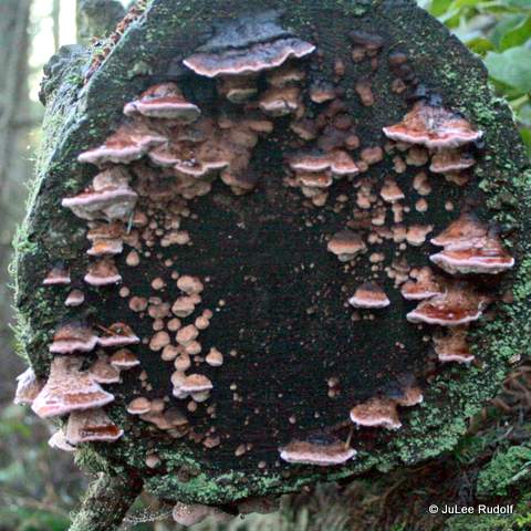
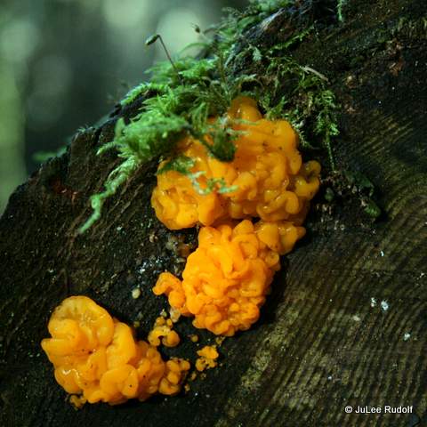
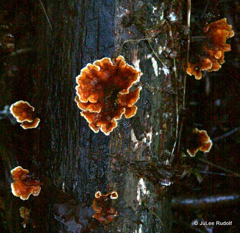
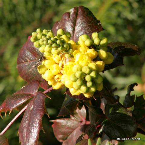
Because it was winter, there weren’t many plants in bloom, but I did noticed many of these, which I think are called leatherleaf mahonia also known as leatherleaf holly, apparently an invasive species.

IMG_8141

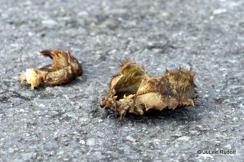
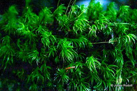
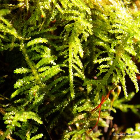
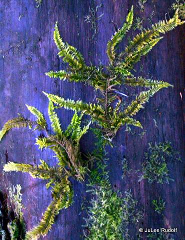
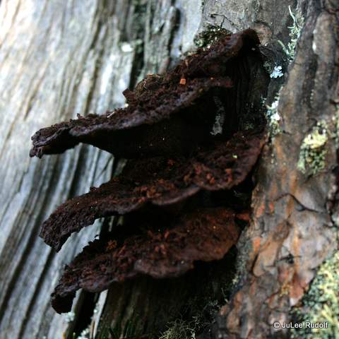
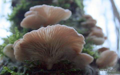
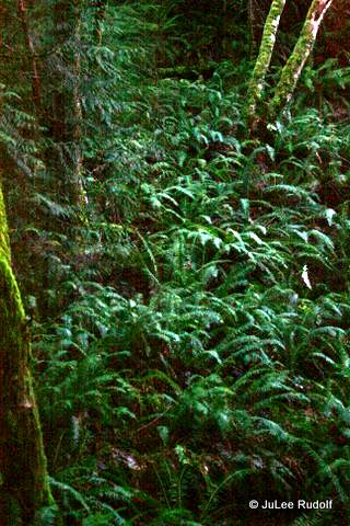
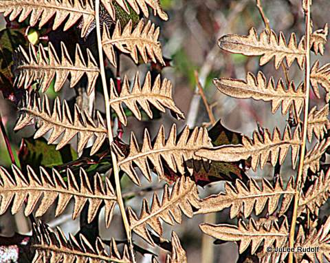
There were many dried up plants, like this fern,

IMG_8144

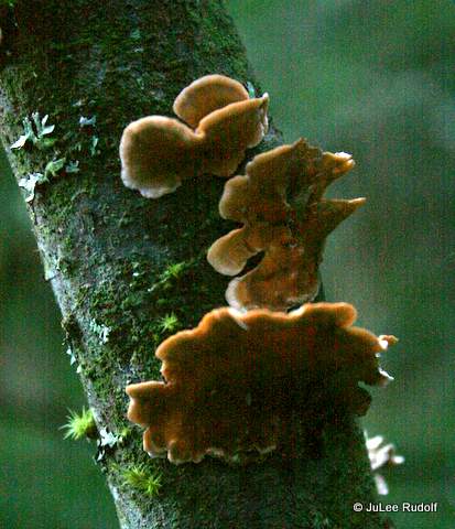
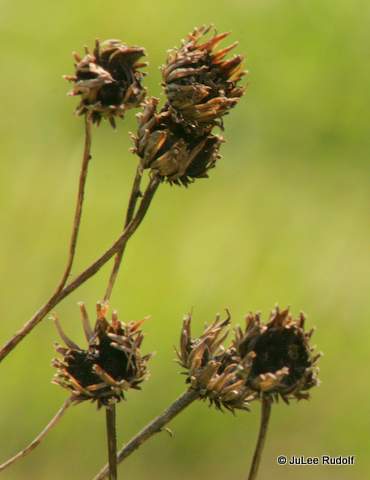
possibly some type of daisy,

IMG_8148

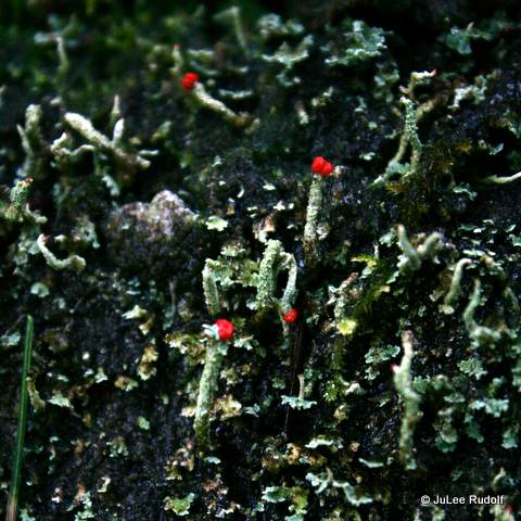
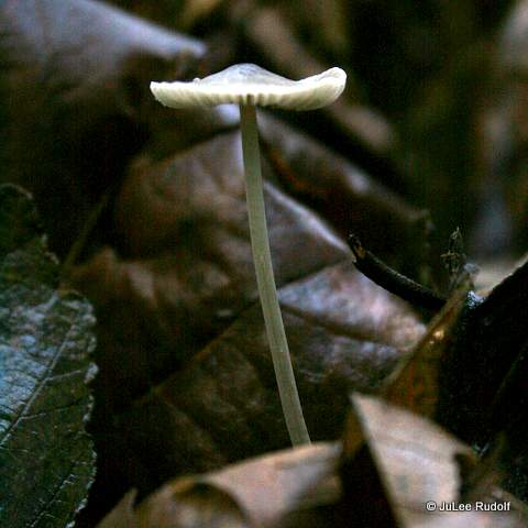
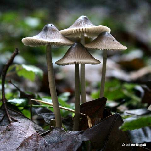
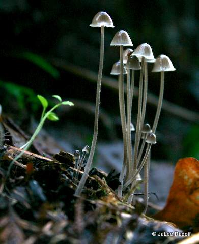
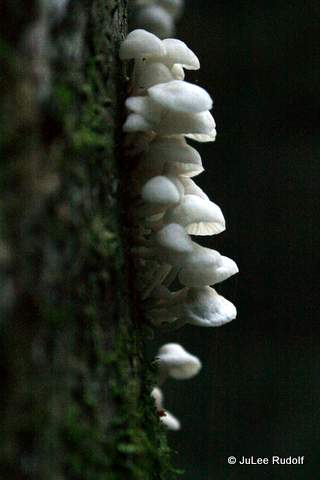
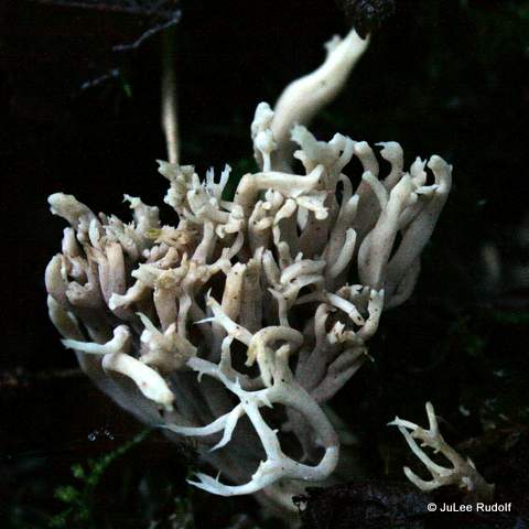
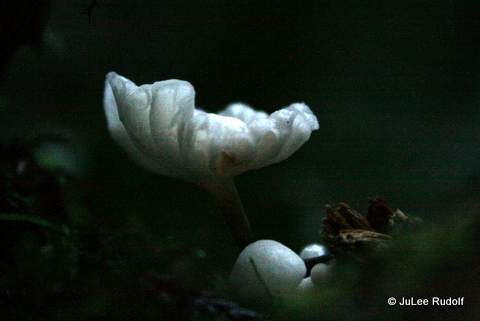
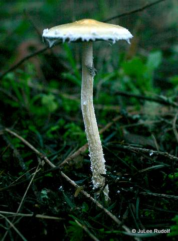
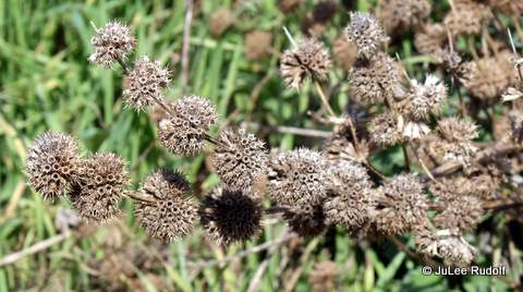
and this plant that I still have to figure out.

IMG_8154

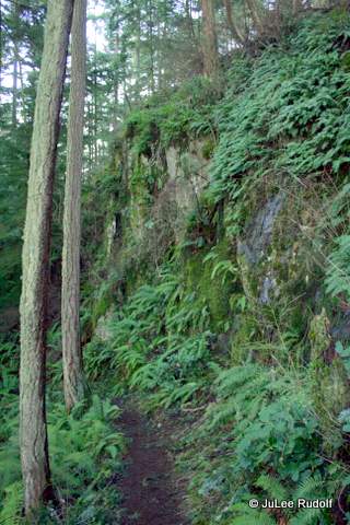
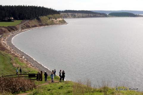
The trail follows the top of the bluff for the most part until the northernmost end, when it begins to switchback.

IMG_8155

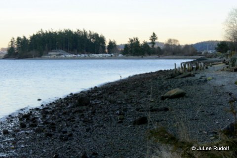
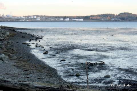
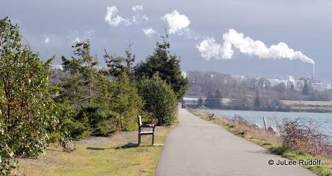
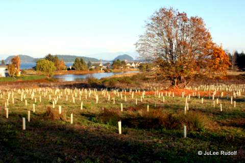
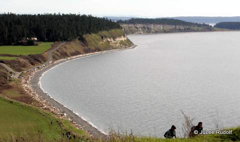
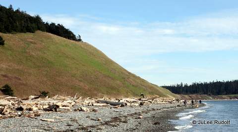
As we reached the beach, we tried to figure out the limits of Fort Ebey State Park, which likes just to the north, but isn’t accessible from the area of the Bluff Trail.

IMG_8158

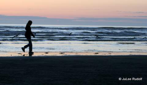
I was relieved to reach the beach, look up, and see others descending.

IMG_8160

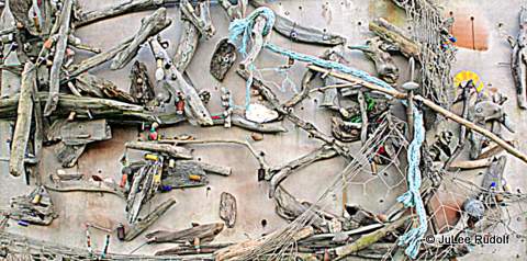
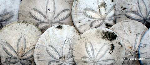
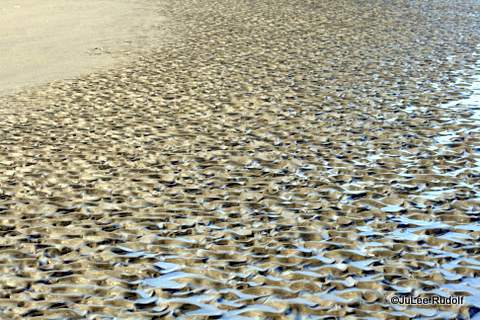
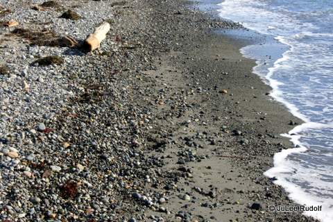
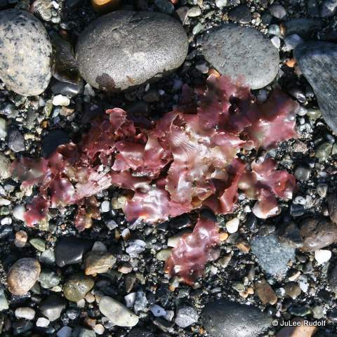
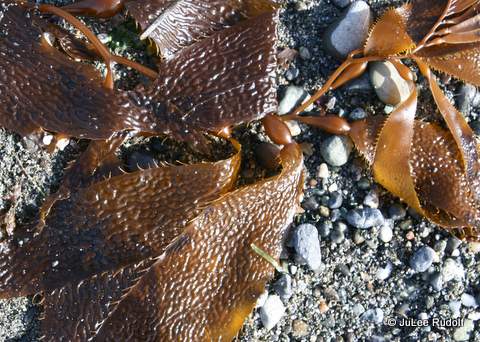
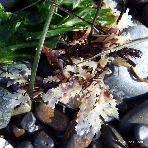
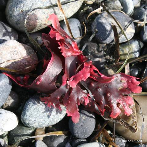
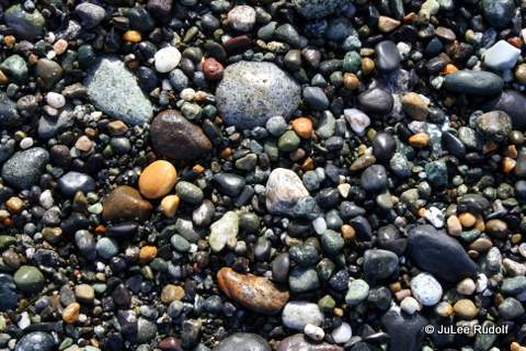
Driftwood, sand, seaweed and rounded rocks were everywhere along the shore line as we headed south.

IMG_8163

IMG_8167

IMG_8176

IMG_8161

IMG_8175

IMG_8171

A father walked along with his family, apparently not having gotten the memo that forbids the collection of driftwood (which helps reduce erosion), carrying a log long enough to knock someone’s block off. I kept my distance…

IMG_8165

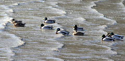
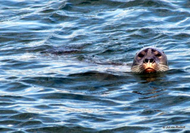
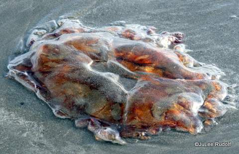
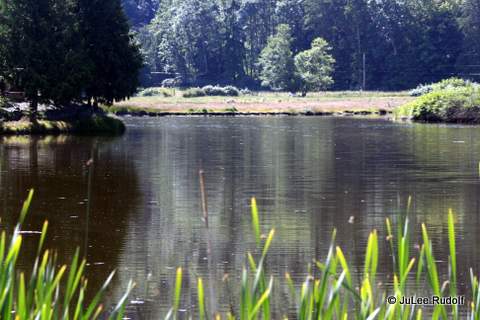
I walked past the driftwood over to the lake, hoping to spy a cool creature, but, at least on this day, they were nowhere to be found.

IMG_8173

After what seemed like an eternity of trying to keep up with my husband (who, at 6’7″ has a rather long stride) along the really rocky shore, we made it back to Hill Road where we were parked.

IMG_8179

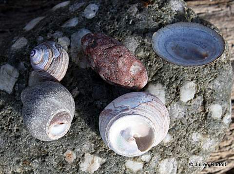
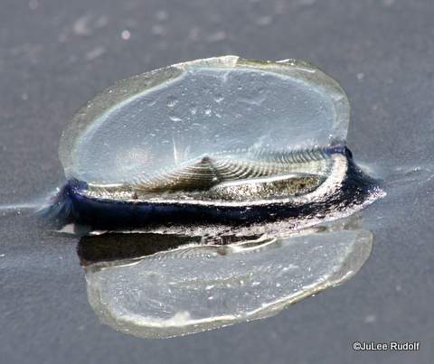
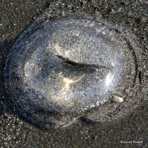
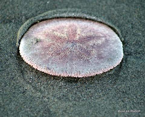
Ninety minutes from when we started, we’d completed the hike. My GPS watch showed the distance as 3-3/4th mile with an elevation gain of 300 feet. During a nearly two mile distance of beach combing, I’d found only four shells, three of them within the first few moments we’d arrived, at the furthermost distance from the water in the sand mere feet from where we’d parked. The forth was a that of a limpet. The only other cool things I collected (but left, along with the others) were two conglomerate rocks. I plan to return later in the spring to have an encounter with a Yellow paintbrush flower.

IMG_8182

Paint Your World in Oak Harbor

On a recent Saturday afternoon, I headed to Paint Your World in Oak Harbor with my teenage daughter and her friend. The girls spent about ten minutes searching through the store’s large selection of items to choose from. Not only do they have super practical stuff that you can use every day, like cups, bowls and plates, but also a bunch of silly monsters and other creatures that youngsters might want to display on a shelf somewhere.

IMG_7251

IMG_7257

IMG_7256

IMG_7255

After choosing their items, a cat for one, an owl with a topper to go inside of a sand dollar for the other, the teens chose their paints.

IMG_7243IMG_7244

Once they were set up with all of the supplies, one of the owners, Laura Apgar, gave instructions: three coats required, a glaze would be sprayed on that would make any unpainted places shiny, choose additional paints as you wish. Most importantly, have fun!

IMG_7245

I had no idea how long it would take, but at the rate they were going for the first about twenty minutes, I realized that it could take quite a while for them to finish. So, in spite of the fact that I am artistically challenged, I decided that I may as well paint something. After I did so, a small round box with lid, I chose three colors: red, white and black. Meanwhile, the place started to fill up. A woman with her grandson, and two twenty-something pairs of girls showed up. Soon, the birthday boy whose decorations had already been set up arrived with his parents and friends. The place was jumping! The girls noticed a menu with water, sodas and various types of espresso on their table, talked me into ordering drinks, took a quick break and returned to their projects.

When I asked Laura about a particularly cute pattern on a plate, she patiently explained the procedure, which involved simply dipping the back of three correspondingly smaller diameter brush handles in paint, blotting it on the ceramic, waiting for it to dry, then moving to the next size. I quickly completed three coats of red, then moved on to doing the dots, while the girls switched from paint to paint (to paint, glitter and all). My kid decided to add a couple of dots to her cat, which became several, which became a new style of feline fur.

IMG_7263
IMG_8668

When I’d finished, I wandered around the place a bit to see what we might want to do there in the future. I walked towards the back of the place and peeked into the Apgar’s office to take another look at the cute dogs we’d noticed when when we arrived. Poppy and Winston had taken over the room’s best sleeping spots. According to Laura, when not snoozing, the two have done a good job of helping kids get over their fear of dogs.

Nearer the street side, I noticed a display about glass fusing (and glass fused jewelry), which looks pretty cool and can be done during classes that they hold each month.
IMG_7260
Obviously, I’d already noticed that it’s a good place to hold a birthday party. Laura told me a birthday party at PYW will run you $125 plus tax for up to six painters including the ceramics, all painting supplies, cupcakes, juice, balloon bouquet and clean up.
IMG_7261
IMG_7262
Not only can folks paint ceramics and do glass fusing projects at the store, but students from Oak Harbor elementary schools can also participate in Paint Your World family fun nights (helping to organize these at a couple of schools years ago was my first experience with the Apgars). During these Family Fun Nights, Paint Your World offers either a reduced price on the ceramics or the regular price with a donation back to the school’s PTA, which typically runs and sponsors these events.

Here is some other information I found out. Owners Ron and Laura met on met on a blind date for the Napa Valley Wine Auction in 1994, hit it off and married in 1995. Ron’s background was hotel management and engineering, Laura’s was corporate sales and teaching. A year later, after visiting a studio elsewhere and thinking that was what their town needed, they opened their business with the same name as today, in Napa, California, which they ran for eight years. In 2004, thinking that Washington state is a friendlier place for a small business than California, the couple moved to Oak Harbor and opened Paint Your World downtown. Like all small business owners, they spend a lot of time at work. Fortunately, they have a part-time employee which allows them the chance to have time off, during which they love to travel and see friends (many of whom started out as customers) or just relax and enjoy the island.

Altogether, we spent nearly two hours there, which was plenty of times for the girls to catch up one what they’d been doing since they’d last seen one another. They instructed us to return after three o’clock on Wednesday to pick up our fired items. We learned that the reason it takes several days before you can see your completed pottery is because of all the work that goes into getting them customer-ready. After you paint them, items need time to dry. Then, after being clear glazed, they must dry again, overnight. Finally, it takes about eight hours to heat items to the required 1860 degrees (that is not a typo) and a day to cool down. Fortunately, their three kilns can each hold about forty items at a time, depending on the size.

IMG_8672

Paint Your World is a great place to try out your artistic (or not) skills. Find out more information about painting ceramics, glass fusing classes and other things you can do at their web site or Facebook page.

Meet Me…on the TTT

Anacorteans (or whatever those who live in Anacortes are called) are very familiar with the Tommy Thompson Trail, which, according to Anacortes Magazine, “consists of approximately 3.3 miles of paved trail for pedestrians and bicyclists between 11th Street and across the train trestle to March Point,” and, according to Trail Link, “follows an abandoned corridor of the old Burlington Northern Railway and is named for a man who ran a narrow-gauge railway along the Fidalgo Island shore.” Although currently only a few miles long, a Cross Island Connection – Guemes Channel Trail to Tommy Thompson Trail is in the works that will extend it to the Anacortes Ferry.

Officially, the TTT runs from 11th Street at its northernmost to March Point Road at its southwesterly end, but it’s easy enough to continue northward about eight blocks along Q Ave to 3rd Street (the planned route continues north to 8th, one block east to R Ave and then north to 3rd Street before heading west towards the Guemes Channel). Currently, traveling out and back from the start point at 11st Street allows runners, walkers and bikers about a 5-K each way, for a round trip total of a 10-K of paved trail on which to travel.

Although I wasn’t even aware of the trail when we first moved to Whidbey Island, during the past few years I’ve run many miles (and walked some too) along it. In addition, as Runner 8 during Ragnar Northwest Passage last summer, I got the chance to run on it at night. I’ve also run on (and beyond) it while participating in the Anacortes Art Dash. Both events take place in July. But I digress as usual. And now back to the trail…

During the past week, I’ve made a few trips to various places along the trail in hopes of seeing some super cool stuff to share with anyone who might need a little push to get out there and spend time on it.

North End
One weekday morning, I stopped by 3rd Street (technically north of the official start of the trail) at about 7:30 am. The first things I noticed, besides the sunshine, were the sights and sounds of shipbuilding taking place along the nearby waterfront.

IMG_8190
Facing north at 3rd Street and Q Ave
IMG_8191
Facing north at 3rd Street and Q Ave

Facing the south from the same spot you can see the sidewalk that extends beyond the north end of the trail. This is just above the little green arrow on the (featured image) Google map.

IMG_8188

Middle North Section
Continuing south for about a mile, you’ll reach a parking lot complete with bathroom facilities at 21st Street.

IMG_8199

IMG_8195
Facing east south of 21st Street
IMG_8198
Facing north from just south of 21st Street

From here you can access the Anacortes Skatepark, mere feet from the trail.

IMG_8193
Facing south from just south of 21st Street

Middle South Section
Along 30th Street, you’ll find another public restroom at a Yacht Broker building opposite some cool murals. In this image from Google Maps, the murals are on the building in the center which will be to your right as you head south along the trail. The restrooms in the blue building to the left.

Anacortes, WA - Google Maps - Google Chrome 2212015 80726 AM

IMG_8200
Facing north at 30th Street
IMG_8201
Facing south at 30th Street
IMG_8207
Information sign about the TTT Mural Project

Here are all of the murals in collage format.

TTT1-001

Thirty-fourth Street is just a few blocks south. This is where you’ll notice a lot more information signs, usually in groups of three. As you enter the trail here, you’ll notice the Thompson Parkway Rules. My favorite, “Dogs: Woof, Woof, Arf, Arf.”

IMG_7882

IMG_8194


IMG_8636

IMG_8640
Hummingbird


South End
Soon you’ll reach what I think is the prettiest part of the trail, the south end, where it extends across Fidalgo Bay.

Chrome Legacy Window 2222015 65921 AM
Google Maps image of the TTT as it crosses Fidalgo Bay

The following photos, which are in order from north to south along the trail, were taken at four different times: low tide at sunset, low tide at sunrise, high tide in the morning, and high tide during a very windy afternoon.

IMG_7902
East side
IMG_7904
Tesoro Refinery with Mount Baker in the background

I noticed a Glaucos winged gull (learned the species from an information sign) dropping a mollusk in hopes of breaking open the shell.

IMG_8413

IMG_7894-001

Just a little further south, you pass through the Fidalgo Bay Resort RV Park.

IMG_8360

This view is from just north of the entrance to the park along Fidalgo Bay Road.

IMG_8219

I hadn’t realized until parking along Fidalgo Bay Road and accessing the TTT along Weaverling Road (the entrance to the RV park) that the Samish Indian Nation owned this land. It isn’t a typical place to access the trail because there isn’t much space to park except maybe for a couple of cars along the dirt shoulder beyond the bike lane. Normally, you’d already be on the trail heading south as you passed through this RV park.

IMG_8429

IMG_8222

This Samish Indian Nation totem pole greets you as you enter the RV park.

IMG_8432

At the base of it is a sign with a key to the Welcoming Pole’s symbols.

IMG_8430

As you walk east along Weaverling Road (or south along the trail), you’ll notice this second totem just to the east of the trail north of the RV park.

IMG_8363
Samish Indian Nation Totem

Looking back (southwest) along Weaverling Road you’d see this view of some cute cabins that are part of the RV park.

IMG_7907

Soon, you’ll reach the trail, where you’ll see the final of three restrooms (a porta potty) next to an artwork display of fishing related items. As I neared the trail, I noticed a Belted kingfisher perched atop a tree at the inlet between Weavering Spit and the trail. Although one of my favorite bird species, I’ve found them to be nearly impossible to photograph because they are super shy and fast flyers. As I lifted my camera, it dashed off, making its call as it did so.

IMG_7911
Artwork at Weaverling Road/TTT junction
IMG_7913
Pond south of Weaverling Road along the TTT
IMG_7909
Facing south at the intersection of Weaverling Road/TTT
IMG_8364
Mallard ducks

“When the tide is out, the table is set,” applies to herons and gulls as well as to humans.

IMG_7920

IMG_7923
Glaucous gulls and Great blue herons fishing along the tide line
IMG_8368
Magnolia and Douglas Fir trees
IMG_7928
Weavering Spit with Tesoro Refinery in the background
IMG_7931
Shell Puget Sound Refinery in the background
IMG_8382
Repairing damage to the trail caused by high winds plus tides earlier in the winter

Walking along the part of the trail that crosses Fidalgo Bay, I noticed several crab shells that appeared to have been dropped by birds. These appear to be the remains of a Helmet crab but I also noticed some Dungeness crab shells.

IMG_8421

Wind blowing towards the backs of their heads gave these Hooded mergansers a new look.

IMG_8377
Hooded mergansers

The trestle, about four-tenths of a mile long, marks the southernmost part of the trail.

IMG_8384

I think this is a Red-breasted merganser.

IMG_8385


IMG_8617-001
Common loon


Along the entire section of trail that crosses Fidalgo Bay, you’ll likely notice many shells. This is what is left after birds (I’ve seen gulls and crows do it) drop mollusks (and, it appears, smaller crabs) in order to crack the shells to get to the stuff inside.

IMG_8395

As this 2012 Newsletter story confirms, the Skagit Bicycle Club provides volunteers to clean them off.

Chrome Legacy Window 2222015 122227 PM

As you near March Point Road, look to the left to see “the” (only) hill that you’ll have to climb if you choose to participate in the otherwise super flat, scenic, Anacortes Art Dash Half Marathon. It’s steeper than it looks.

IMG_8389

Although the wind was really blowing, several crows were hanging out on the cable that runs along the top of the fence on either side of the trestle part of the trail. This was my favorite shot of the day. As I neared the end, I heard a super loud siren coming from the direction of the Shell Puget Sound Refinery followed by an assurance that the warning sound was only a test.

IMG_8397
Bird on a wire along the TTT

Soon, I’d reached the south end of the trail. Bikers (and runners who want to go far) can access March Point Road just beyond the signs.

IMG_8402

March Point is a great, super scenic place. Completing the smallest loop (following N Texas Road) from the end of the TTT, you could add 5.5 miles to your route. The large loop would add 7.3 miles.

Screen Captures7

I had no plans to complete any extra miles on this particular day. When I reached the end, I turned around and headed back.

IMG_8404

I noticed a bunch of ducks harvesting something (probably mollusks) along the north side of the trail in Fidalgo Bay.

IMG_8406
American wigeons near March Point Road

Paying super close attention (since the water was really choppy), I’d been hoping to spy a harbor seal. And did! This one submerged as soon as I stopped and acted interested. When it didn’t surface after a few minutes, I gave up on seeing it again and continued on. I could even see its whiskers.

IMG_8410
Harbor Seal in Fidalgo Bay along the TTT

I also noticed a Bufflehead, which are pretty common in the area.

IMG_8416
Bufflehead in Fidalgo Bay along the TTT

On a separate calm, sunny morning, while walking with my husband, we noticed a loon (shown earlier), several grebes (they seems small compared to most shore birds) and what I’m pretty sure was an otter.

IMG_8622
Horned grebe
IMG_8629
River otter


I was super happy to have had some really cool creature-encounters along the Tommy Thompson Trail.

Chrome Legacy Window 2202015 121024 PM

Spice Up Your Running Life

After completing the Whidbey Half Marathon for the fourth time in 2011, I realized that I needed to spice up my running life. To prepare for that race I’d trained the way I’d always done; alone for every workout while following a combination of Hal Higdon’s Half Marathon Training Guide Intermediate and Advanced versions. Race day was as usual, rainy. In addition, the forecast called for a temperature of 43 degrees (feels like 39) with wind gusts of 20 mph. I ran my slowest pace ever for the WHM, feeling awful the entire time. Afterwards, I exchanged messages with my good friend Sheryl, who’s been running as long as I have. She suggested that I find a training partner or running group, so I did. It took me nearly a year, but by the next time the Whidbey Half rolled around, I was better prepared mentally and physically and on my way to gaining: running partners (who became friends) and new running experiences and adventures.

My poor performance in 2011 reminded me of something I’d known for a long time: if I wanted to run faster, I’d have to train faster and include intervals as part of my plan. I also decided to take Sheryl’s advice and so made a post-2012-race week running date with a prospective training partner named Nina. In 2012, I completed the half with a WHM PR and ran with Nina weekly through the end of June. In the fall, our duo morphed into a group and Nina suggested we hit the trails, which we’ve been doing, mostly on the Anacortes Forest Lands and Deception Pass State Park, nearly every week for the past 2.5 years. That first fall, with multiple women runners participating, it seemed like a good time to see if we could find a dozen women willing to form a Ragnar Northwest Passage team for the summer of 2013 race. We did. And had a blast!

Making small changes to my running routine helped me gain lasting friendships, improved my performance, nudged me into participating in different events, pushed me towards spending time on the trails and, in general, resulted in me having more fun running than ever before. It has also enabled me to put together this list of things I’ve learned during three decades as a recreational runner.

Ten Things to Spice up Your Running Life

Dare a Different Distance

Chrome Legacy Window 2162015 81154 AM.bmp

Everyone seems to think that the ultimate sub-ultra distance goal distance must be the marathon, but it doesn’t have to be that way. While a progression of 5K, 10K, 15K, Half-Marathon and Marathon makes sense, most folks have a favorite distance (mine is 13.1 miles) and tend to stick with it. Last June, I read a Runner’s World article about the benefits of training for 5-Ks entitled C’MON EVERYBODY!, in which runner/author Laura Fleshman, a two-time U.S. outdoor 5000-M champion, claims that “the 5-K is FREAKING AWESOME” and shares a story about striking up a conversation with a guy on a plane who looks like a runner (he is, a marathoner). With no clue about Fleshman’s running prowess, (she placed second at the UW Invitational Indoor Mile in January in 4:42.77) his reply to her revelation that she mostly runs 5-Ks is, “I started out running 5-Ks, too…Keep at it, you’ll get there.” That cracked me up. The issue also include Top 10 Reasons to Spend a Year Focusing on the 5-K, 5-K Takeaway and a six week training plan. It’s available through EBSCO Host Connection. This year, I’d like to see how fast I might be able to run a 5-K if I actually train for it. I haven’t done one since the Carlsbad 5000 in the mid-nineties. Of course, I’d also like to find out if the distance IS, as Fleshman says, FREAKING AWESOME.

Do a Destination Race

Chrome Legacy Window 2162015 81506 AM

Running local races is convenient, especially the part about getting to sleep in your own bed, but driving (or flying) to experience a race elsewhere can be really fun, especially if you don’t go alone. My friend Shannon and I traveled twice during a five year period to participate in the Seattle Half Marathon, which starts downtown, a mere five minute walk from the La Quinta Inn. It’s a huge race with a hilly, pretty course that takes runners through the Washington Park Arboretum. Last year, my friend Erin and I headed north across the border to Canada to run the Vancouver Half Marathon, which boasts stunning scenery along a course that passes through Stanley Park. We stayed in a hotel, rode the rails, ate in restaurants and did a little bit of sight seeing. My favorite part, besides having a really good race, was riding the SkyTrain early in the morning with dozens of fellow runners heading to the same place. I can’t wait to do another destination race.

Find a Partner or Group

IMG_3839
The Regulars: my awesome running partners

I have never minded running alone. In fact, I’ve put in many more miles solo than with others. But in the last few years I’ve spent much more time running with others and have totally loved it. Not only do you get the chance to make lasting friendships, and find out what others who have different strengths, weaknesses, running knowledge and goals are up to, but running with others helps motivate you (and them) to actually get out there and to be a better runner.

Get Good Gear

Screen Captures5-001

I used to think that gear didn’t matter and would wear any old thing. In fact, I confess, I felt a certain level of disdain for folks who would look really pretty in their expensive gear but spent the last few miles of a race walking. I’ve since changed my view and my tune. There’s a lot of good quality, great gear out there these days, not only cute, practical clothes with moisture-wicking fabrics, but useful items like compression socks and tights, warm gloves and special shoes that provide great grip on the trails. The most important item I’ve acquired recently was a GPS watch. Although sometimes it provides more accountability than someone like me needs, it’s a great way to keep track of your pace, elevation gain and total distance, especially when trail running.

Give Trails a Try

IMG_3515-001

I can’t believe that I’ve spent the last nine plus years living near miles of trails and have only begun running on them during the past few. Unfamiliar at first, I would trip and fall over protruding roots and rocks regularly and felt a little lost and a lot stressed by not knowing what I’d find around the next corner. But with a good map, some experience and patience, I’ve learned a lot of the trails locations, names and numbers and now spend most of my time on the trails. Doing so has given me the chance to see some neat plants, animals and birds and enjoy the peace and quiet that communing with nature provides.

Learn Good Form

Chrome Legacy Window 2152015 82733 AM.bmp

A couple of years ago, our running group decided to take a field trip to Fairhaven Runners in Bellingham to check out their shoe selection. While there, we learned that they offer a running-form clinic every month and, at that time, were willing to take it to us in Anacortes if we could come up with eight paying participants. We did and on the specified day we met the clinicians guys along the Tommy Thompson Trail where they taught us the concepts of Good Form Running, which involves Posture, Mid-Foot (strike), Cadence, and Lean. The next week, I headed out on a long run and tried to incorporate all I’d learned. It was a disaster. The following day my feet and legs felt sore because I’d tried to do everything right and felt like I was doing it all wrong. Since then, it’s been better. I’ve consistently incorporated all but Lean into my running form. If you are interested in Good Form, check out Fairhaven Runners’ Store Clinics link for more information about this class and others that they offer.

Prepare a Playlist

Running 2162015 83703 AM.bmp

Did you know that listening to music helps decrease pain levels? It’s true. And anyone who runs knows that listening to an up-tempo playlist while running can motivate you to, at best, run faster, or, at least, continue on when you just aren’t feeling it. I often listen to music when I run on the roads, though not on the trails because I think it defeats the entire purpose. Plus, it seems kind of dangerous. The one thing I learned the hard way was not to rely entirely on running with music. Doing so may make you feel like you can’t run without it. One year I arrived at race parking, grabbed my iPod and checked the battery. It was dead! I ran the race feeling like a gal with a broken leg who’d lost her crutches. Since then, I always make sure to complete several long runs music-free, just in case.

Read All About It

I love reading about running and have read both dogs (no offense Man’s Best Friend) as well as some great, highly motivating books and blogs like The Oatmeal and Runner’s World. I’ve even seen a few movies on Netflix like Prefontaine and Desert Runners. I think that reading about running is just one more way to learn about other runners’ experiences and maybe get inspired to try something outside your running comfort zone.

Run Less Run Faster

Chrome Legacy Window 2152015 84938 AM

Last year my friend Nina shared a training program she’d learned about with me. It was Run Less Run Faster, a 16 week program that required only three days of training per week (plus two days of cross-training) that, if followed, would supposedly lead you to faster race times. I decided to try it. It was very pretty difficult (I can’t imagine following the marathon plan which required very long runs starting only a few weeks in), but, in the end, it worked. Although I won’t be doing it again any time soon, I think it’s a great program, well-worth the effort if you want to increase your speed.

Run Ragnar Northwest Passage

Chrome Legacy Window 112015 70313 PM

Several years ago I noticed a post on a local running group’s Facebook page about Ragnar. Only about a month from race day(s), a team was looking for someone to run three legs totalling 16 miles. I felt too intimidated to take it on, and later regretted it. Then, after a group of us gals began running together, we decided to form an all-rookie team in 2013, which I captained. It turned out to be one of the funnest running events I’d ever done. The following year, we formed another team consisting of six veterans and six newbies. This summer, we’ll do it again. If you’ve never run Ragnar, I highly recommend that you do. It’s as challenging as it is fun. And anyone who lives anywhere between Blaine and Langley is so close to the Ragnar Northwest Passage course that they have no excuse not to sign up. If you don’t live here, there are plenty of Ragnar Relays all over the United States.

Relic

Several years ago, my friend Shannon, who’d been taking a weekly writing course taught by Ruth Wilkens through Skagit Valley College, convinced me to sign up. At registration time, current class members (who would register repeatedly, session after session) recruited friends and acquaintances to sign up in hopes of gaining the required number of students. The group was primarily made up of seniors, with an occasional subsenior.

Participating in the class was an eye-opening experience. The quality of my fellow classmates’ writing was downright impressive, putting my own efforts to shame. During each class, the teacher offered several potential topics, which students would free-write about in class. A few volunteers would read aloud the story they were to turn in that day. Whatever we couldn’t get done in class we’d complete at home.

Although I only participated for two sessions, I found that being forced to come up with something each week reinforced authors’ often cited advice: putting pen to paper (fingers to keyboard) was a crucial part of becoming a better writer. In October of 2011, I came up with the following story in response to one of that week’s prompts: Write about a relic. Ruth Havens has since passed away, but her positive attitude, encouragement, and inspiration live on in all of us who participated in her writing classes.

Relic

          Johnny’s first memory was of going into anaphylactic shock while at his Grandma Horton’s place when he was five years old. The pain of the insect’s sting was nothing compared to the prickly sensation of heat that followed. It felt as if as if someone had attacked him with a welding torch. This, coupled with the scary sensation of suffocation was seared into his brain, impossible to forget. Fortunately, his grandmother, who had always been handy with pharmaceuticals, fed him Benadryl to ease the symptoms before racing him to the local hospital, a distance of nearly 30 miles that she managed to cover in less than half an hour. The soldier of his misfortune, a bald faced hornet, had come from a seemingly benign container; an old aquamarine-colored bee catcher, from which he had curiously removed the leaf-shaped stopper. Johnny didn’t know what became of the trap afterward. It had been setting in a remote corner of his grandpa’s hay barn encrusted with an oily, dusty  grime when he happened upon it that hot July day. By the time he next visited, several years later, his grandfather had passed away, and the contents of the barn had nearly disappeared. He figured that the bee catcher had been sold or donated, probably to benefit the local Methodist church, which he’d been dragged to on several occasions to attend Sunday school.

*** 

          Misfortune has never followed me, which is why, on that winter day when I brought home a relic; a gorgeous sea green glass container, similar in color to those ancient insulators my parents would occasionally acquire while yardsaling, I didn’t give what happened later a second thought. Its surface was covered with a thin layer of dust, while the trough along the bottom was filled with some sort of gooey substance in which several species of insects had become stuck and died, like minuscule dinosaurs trapped in a tar pit. It had obviously been included in the couple’s items for sale as an afterthought, placed haphazardly on the garage’s cracked concrete slab next to a box of romance novels. I thought it a steal for four bucks, and confirmed it as such when I later found one on eBay for $39.95. Its leaf-shaped lid could be removed and a sugary substance placed inside in order to attract bees. Unable to fly out, they would eventually end up in the sweet viscous liquid and die of starvation if they didn’t drown. Unfortunately, the vintage wasp killer that I acquired with such optimism brought me nothing but bad luck; heading home the day I bought it, my tire went flat. When nobody stopped to help, I spent a perilous hour changing it along the shoulder of a busy highway, ruining my shoes in the wintery slush.

The first time I set the trap out, in the spring of the following year, the bees quickly clamored towards their goal; a sugar-water mixture I’d  concocted from an internet recipe. Before I could place it near the highest concentration of wasps nests, I felt a pinch, and noticed a pink bump forming on my wrist. Having always adhered to the adage that bad luck comes in threes, I did my best to get rid of the relic. The next time I hosted book club, I waited for a particularly annoying gal who happened to be a beekeeper to comment on the unlucky trap, which I’d filled with a potpourri of fragrant wildflowers, stems set carefully in its water-filled moat.

“What a neat bee catcher,” she commented, “Where did you get it?”

Of course, I felt obligated to offer it to her. And when she accepted, as I knew she would, I refused the fiver she halfheartedly handed to me. She always was cheap.

“Let me get that for you,” I said, as I walked her out to her car and wedged it carefully between the front seats. She thanked me profusely for the gift. “What are friends for?” I replied. And I meant it.

Pacific Beach

A few years ago, during the last few days in August of 2012, we decided to spend some summer vacation time at Pacific Beach. My husband had heard that the cabins at Pacific Beach Resort & Conference Center were a nice place to stay, so we decided to give them a try. Although called cabins, lodgings are, in fact, houses. And because we booked early, we were able to get a place near the beach.

The beach was beautiful, flat and sandy and extending for what seemed like miles.

IMG_8730

There wasn’t much to do in town, where there was little more than a couple of mini-marts and a nice little coffee house that also served food called Surf House Espresso. But we didn’t care. For entertainment we could go to the main building at the Conference Center which had an activity center for younger kids, a game room for teenagers, a bowling alley, a hot tub and a restaurant. Sometimes we ate there, other times, we prepared meals in our cottage. We brought our dog along because the complex was pet-friendly.

Of course, the best place to be was the beach. From our cottage we could venture down the street and access it from a sandy trail. I found this view from Google Maps that must have been taken during a kite festival. It shows the entrance to Pacific Beach State Park, which is located at the southernmost end, near the place we reached the beach.

Chrome Legacy Window 292015 104927 AM

From there we would typically walk north about a mile to Analyde Gap Road, head up the hill and enter the Resort and Conference Center through a gate along the northernmost side of the complex.

The biggest bird surprise was the presence of pelicans, which seemed too big to fly. They were everywhere and weren’t bothered much by beach goers.

IMG_8782

IMG_8761

IMG_8764-001

IMG_8786

I also noticed a bird species that looked like a turnstone. It doesn’t necessarily impress with its basic look (white and black with a twittery call) but they fly in flocks, moving in unison and putting on an impressive show.

IMG_8780

Of course, there were also gulls.

IMG_8744

And the sunsets were spectacular.

IMG_8804

We left thinking that we’d like to return some day, and did.

This past summer, my immediate family plus three caravanned back to Pacific Beach. My sister had her heart set on Horseback riding at Ocean Shores, but I was dying to be reunited with the pelicans. We arrived three weeks earlier than we’d been there the last time, again in August. Pelicans were nowhere to be found.

This time we were in a bigger place with four bedrooms that was, because we waited until the last minute, off the beach though not a long walk to it.

After dropping off our stuff, my sister and I walked down to the shore. We both noticed something we’d never seen before: plastic-toy-like things strewn everywhere along the water line. On closer inspection, we realized that they were some sort of sea creature. Eventually we learned that they were velella velella, a type of jellyfish also called By-the-Wind Sailor, that contain a sail to help propel them along the water. Although they weren’t much to look at, these sea creatures fascinated us, mostly because they were so abundant.

IMG_4487-002

IMG_4493-001

IMG_4498

IMG_4538

We also saw a couple of dead sea creatures that had washed up on the shore, including a Lion’s Mane jellyfish and another type with which I we were not familiar.

IMG_4486-001

IMG_4480

The last time we’d been there we hadn’t seen sand dollars, but this time they were pretty prevalent.

When we saw a guy with his family, a cool tool and a bucket, we asked if he’d mind showing us what they were doing. Turns out they were collecting shrimp for bait to catch perch. He’d stick the tube-like tool into the sand, dump what looked like a soil boring sample and riffle through it for shrimp.

One afternoon, my sister and I headed out northward during low tide. We noticed and started picking up sand dollars. When we had too many to carry, we started stuffing them into our pockets and the cuffs of our clam digger jeans. We kept saying we wouldn’t collect any more, but couldn’t resist when we saw them. All told, we ended up with nearly twenty.

IMG_4632

Although most of the sand along the shore was very smooth, in some places the waves had created a pattern. IMG_4534

Further up, we saw lots of sea gulls and their tracks.

IMG_4505-001

The turnstones were back, but they were kind of shy and would fly off, so I didn’t get a good shot.

IMG_4496

On our last day, we arose really early to comb the beach and saw, for the first time, persons wading through tide pools in search of crabs. We also stopped to watch a live sand dollar propelling itself along.

IMG_4552

After our seemed-too-short, several day trip, it was time to head home. But we’ll be back…in hopes of reuniting with the pelicans.

Have a Fab Flora or Fauna Encounter at Dugualla Bay

I’ve lived in the area of Dugualla Bay, located at the northernmost notch along the east side of Whidbey Island (at the upper (20) marker on this map), for nearly ten years now, which has given me plenty of time to see dozens of different species of plants and birds as well as some sea creatures and other wildlife.

Chrome Legacy Window 252015 10135 PM

During that time I’ve taken over a thousand photos and spent hundreds of hours walking and running in the neighborhood, observing all kinds of flora and fauna.

The Whidbey Audubon Society site entitled Whidbey Audubon Society’s Guide to 15 Special Spots list, “Swans, dabbling ducks including canvasbacks, other waterfowl, wading birds,” doesn’t do justice to the many bird species that spend their time here.

I have several favorite birds (among them, the almost impossible to photograph Belted kingfisher, Pileated woodpecker, Western screech owl) but my favorite photograph taken in Dugualla Bay is that of a heron in flight. I love the way the feathers of its wings are clearly visible. And it looks perfect, every feather in place, peaceful and serene.

Heron_2012_JuLeeRudolf-001

I’ve had a few awesome avian encounters. One was actually a multi-day thing that began when I noticed what appeared to be a Great egret near Dike Road in December of 2012. I found out that…it was! I drove by every day for a couple of weeks to see if it was still there. Sometimes it was alone, others, with a heron. I took this shot on January 1, 2013.

IMG_9892

In August of 2014, when the summer was almost over, I realized I’d been lugging my camera along every time I went out on a walk in hopes of seeing a Western screech owl, which we could hear calling at dusk nearly every night of every year from some time in June through the end of August. I was minutes from home when I looked over and saw one. It remained on its branch, staring carelessly, for a couple of minutes, long enough for me to get this shot. Sadly, that summer was the last time I saw or heard that species of bird. I miss them.

IMG_8681

I could go on and on, but I don’t want you to stop you from reading so I won’t. Here are a couple of collages of some birds I’ve photographed in Dugualla Bay. One is of a Virginia Rail, which I’ve only seen the one time I took its photo. It’s the second from the top on the left, clockwise from there: Cedar waxwing, tern diving, Bald eagle, sandpiper, hawk, quail, Spotted towhee, peacock (that’s another story), purple finch.

By Date-002

Here are the last few. I promise. From top left: likely juvenile heron, osprey, shore bird, Belted kingfisher, grosbeak, hummingbird, Pileated woodpecker. The osprey is from a nest tracked from afar from volunteers for the Center for Conservation Biology. It’s Osprey Watch Nest #1098.

Alina's 100 flickr favorites-001

If you are more into insects, we have many different species of those as well. From top left: tussock moth caterpillar, spider, blue damselflies mating, pacific burrowing wasp, white spider, spiderlings, wood boring beetle, moth, bee fly, leaf hopper, stink bug. A few of these I haven’t seen often, but the spiderlings show up every year hanging off webs along the perimeter of the house all clumped together. If you touch the clump, they scatter.

Flickr Favorites

In the spring when our yards’ tulips, daffodils and later rhododendrons, hydrangeas and other plants and shrubs bloom, the wild things that grow in Dugualla Bay show up too.

Collages-001

A year ago September, my daughter and I volunteered to help clear weeds out of plastic sleeves that had been placed around plants just outside of a lagoon that lies along Dugualla Bay.

IMG_9708

Two other views.

IMG_5937-001

IMG_5940

Due to perfect weather conditions (lots of rain the night before and sun the day of), I got some shots of several different types of mushrooms, including bird’s nest fungi or “splash cups,” (they look like eggs in a nest) hare’s foot ink cap (the black and white one viewed from the top) and several types of mycena mushrooms. I haven’t seen most of these much since in this area.

2013-09-28

Because it’s so wet, we get a lot of snails and slugs, mostly the garden snail and brown slug,

IMG_9016

but also sometimes banana slugs. In fact, I saw one yesterday. I took both of these photos of a garden snail on different days along the path that runs between the DCI Clubhouse and Dike Road.

GardenSnail_2011_JuLeeRudolf

IMG_1273-002

When the sky is clear, the view from along Dike Road towards the water is pretty spectacular. I took this along the Dike Road looking back towards the DCI clubhouse.

IMG_5144

For some reason, even though it rains often from fall through spring, we rarely get frogs and toads. These two photos are the only amphibians I’ve been able to photograph. The frog encounter was awesome. I was running along Dike Road when I noticed a big, bright green blob on the blackberries that become ripe in late summer. I returned with my camera and it was still there!

IMG_1915

The toad hopped over one damp October day and spent a little time trying to find its way out of our garage before we said our goodbyes.

IMG_9597

Sometimes we see (more often hear rustling the long grass) garter snakes.

IMG_7578

Of course, we also have deer wandering around Whidbey Island. This doe and her two fawns showed up one morning as I backed out of my driveway, which is when I noticed our cat eyeing them warily. The best part of this deer encounter was that the stare down scare down victory went to…the cat! Worst: mama ate most of the leaves off of my rose bush. You can’t see the more cautious sibling, who was off to the side. I’ve become more interested in them after watching an informative PBS documentary entitled The Private Life of Deer, which you can view online at the PBS site for free. I recommend it.

2013 Summer and Fall1

Before I share the story of an otter encounter, I need to tell you about three other mammals that are common in the area. First of all, the rabbit, which show up in big numbers in the spring along with their kittens. This is what you usually see them doing if you try to get close.

IMG_1348

Before you read on, I need to warn you that the following two photos are of dead things. Trust me when I tell you that it’s nearly impossible to get a good shot of these two critters. First of all, a mole. This one was lying out in the open far from the nearest mole hills. Based on the info from the web site I’ve included, I think it is a Pacific mole. You never see them but you see do see the havoc they wreak on yards so you know where they are.

IMG_0791-001

We tend to refer to these rodents voles, but based on what I just read about moles, I suspect it might actually be a vagrant shrew which are closely related to moles. Normally when we see dead things around the house, our super skilled huntress cat has already…ahem…feasted on its organs but this shrew didn’t have a drop of blood on it.

IMG_7098-001

The last absolutely awesome encounter I’d like to tell you about took place in April of 2012. We’d returned from an out of state spring break trip to a super scenic national park and I was walking along the bay, remembering how annoying it was to hear the water rafting guide we’d had had firm-grasp-of-the-obvious telling us, over and over, how scenic things were at the park. The ironic thing was although the scenery was spectacular, besides a bunch of crows, I observed very few species of birds and other creatures. But the day after I returned to Dugualla Bay, three river otters showed up to play near the shore of Dugualla Bay. I’d heard we had them but had never seen them there before. They swam and played for about ten minutes, stopping to stare at me for a few seconds before heading off to their next adventure.

IMG_7655

Last but not least…the view, which I can enjoy by simply looking out my window every morning. Although it’s often cloudy, you can still notice the weather, watch the tides and see the sun rise and set.

IMG_6520-001

Dugualla Bay is the best place I have ever lived. I hope that you’ll take the time to stop by the area in the spring, observe some birds and maybe have a cool creature encounter too some day.

Island FTC Robotics Team Alliance Advances to Super Regionals

On Saturday, January 31, thirty-one FIRST Tech Challenge Robotics teams from Washington and one from Canada converged on the Kent ShoWare Center at 8 o’clock in the morning to prepare for battle.

Robotics Teams (2).xlsx 232015 91311 AM

Each set up in the pit, a staging area complete with practice fields where teams could test, modify and repair robots if needed.

IMG_7606 IMG_7610

By 11:00, judges had completed checking robots to ensure they met standards and the pre-contest captain’s meeting. All thirty-two teams were scheduled to play six matches, each while paired with a different, randomly chosen partner, for a grand total of forty-eight matches in initial play. The captain of each of the top four teams after match play would then choose two alliance partners, with 1st and 4th ranked alliance and the 2nd and 3rd ranked alliance competing against one another for a spot in the finals. The three members of the winning alliance plus five award-winning teams would qualify for a spot in the super regionals.

The Anacortes Cyborg Ferrets Team #7198 participated in the first match of the day.

IMG_7602 IMG_7604

Three girls, two drivers and one captain, wearing lilac t-shirts and tutus from Franklin HS Team #4040 Clockworks formed the second half of the Blue Team.

TNT_8157

Blue defeated Red, composed of Vashon Island HS Team #5961 Rock Solid Robotics and Sedro Woolley HS Team #9517 RoboCubs by a score of 280 to 186, earning many of the points during the initial 30 second autonomous period by placing balls in the center goal and releasing the kick stand, which drops balls onto the field that can be placed in goals for points. During autonomous, there’s little for the team to do but watch.TNT_8873

A router glitch delayed matches for over an hour, so they broke for lunch and by 1:00 pm, match play continued. In Match 16, the Cyber Ferrets and Renton’s Hazen SHS Team #8693 Scarabs took on #8437 White Pass JR&SHS Tech Wolves II and #6541 Titan Robotics II from Bellevue’s International School, a team that, at Regionals (Pasteur Interleague Championship), the Cyber Ferrets had offered alliance when they finished first during initial match play. Along with the RoboCubs, the three teams used their combined skills to earn berths at state.

IMG_7614

As opponents, Titan Robotics II had no qualms about using a defensive strategy that judges had clarified was acceptable during the pre-competition meeting: robots were allowed to bump their opponents in order to prevent them from scoring.

The Penguin-hatted International School team’s use of the move led them to victory with the Blue Team defeating the Red by the smallest possible margin, one point.

In Match 22, Team 7198 was paired with the red-hard-hatted (complete with a black gear) Union HS’s Geared Reaction Team #6559. Three of four teams scored during the autonomous period. Both alliances continued to place balls in goals during the 2:00 minute period, including during the final thirty seconds or end game. The Red Team barely beat the Blue, Seattle Academy’s Leviatech Team #6157 and Cascade HS’s Hibernotics Team #7342, by a score of 448 to 390.

IMG_7617

In Match 26, Anacortes paired with Olympia HS’s Robot C Robot Do Team #8548 against Enumclaw SHS’s Cybourgeois Team #4213 and Edmonds HRC’s Atomic Robotics Team #3805. During the autonomous period, the Cyber Ferrets were unable to score but their partner, Robot C Robot Do scored balls in the center goal and released the kickstand, earning the Red Team significant points. During the two minute tele-op period, Robot C Robot Do became disabled, but had already done what they needed to do. The Blue Team scored balls in a goal but was penalized for knocking over a goal. The Anacortes team scored during the end game and the Red Team defeated the Blue with a score of 246 to 100.

IMG_7619

For their fifth match (35) the Cyborg Ferrets were matched up on the Blue side of the field with Seattle Academy’s Tesseract Team #2856 against Lynnwood HS’s Robotics Royals Team #9393 and Olympia HS’s Bearly Digital Team #8457. Tesseract scored a ball in a goal during the autonomous period, then grabbed a rolling goal and dragged it to the Parking Zone. During tele-op, Tesseract employed their signature move: grabbing the 90 cm goal and filling it with balls. Although the Red Team was able to push all three of their rolling goals up the ramp and themselves, they remained there during the end game, earning no additional points. The Blue Team earned additional points by placing balls in goals, especially during the end game. The match ended with one robot on each ramp and one in each parking zone. The Blue Team defeated the Red 479 to 180. Based on the continuously updated match play rankings, the Cyber Ferrets knew they had to win their final match to reach the top four and guarantee a spot in Championship play.

IMG_7621

During Match 47, the Cyber Ferrets and Olympia HS’s Team #6424 Oly Cow made up the Blue Team to take on Team #7742 North Thurston HS’s Electric Sheep from Lacey and Team #7364 Mindbot Maniacs of the Neighborhood Group from Auburn. Not much happened during autonomous play, but during tele-op, the Red Team released their kickstand and moved a goal to the parking area. The Blue Team collected balls and placed them in goals, but, unfortunately, knocked over a goal, which results in a penalty. During the end game, Oly Cow scored in the center goal and then bumped the Red Team, preventing them from scoring all the balls in the goal they had intended. Meanwhile, the Cyber Ferrets gave the fans a big surprise by using their robot arm to push the base of the fallen rolling goal, returning it to an upright position (go to 2:48 in the video to see it)!

IMG_7623

Blue Team won with a score of 336 to 252.

After initial match play, the Anacortes Cyber Ferretts Team #7198 were ranked 4th place, meaning they’d earned the opportunity to compete in post-match play but would have the least advantage during alliance partner selection.

They chose Victoria BC’s Fix It Team #3491 (Vancouver Island), ranked 9th after initial play, and Vashon Island’s Rock Solid Robotics Team #5961, ranked 22nd after initial play. Teamed up once with Fix and once with Rock Solid Robotics, the Cyber Ferrets’ alliance won both the first and second matches against the Number One Alliance, their former alliance partner Titan Robotics II, End of Line and Robot C Robot Do to advance to the finals.

TNT_8793

IMG_7631

In the first championship matches, the 2nd ranked alliance team, Tesseract, Mindbot Maniacs and Atomic Robotics defeated the 3rd ranked alliance, Geared Reaction, Oly Cow and Zenith in two of three matches to move on to the finals.

In the finals, the Cyber Ferrets’ Alliance defeated Tesseract’s Alliance in two matches!

IMG_7634

At the end, volunteers formed a line, announced winners and handed out awards.

TNT_8892

All three of the Event Winning Alliance Teams, plus five other teams (seven of the twelve teams that participated in the post-qualification play) advanced to the Super Regionals, to be held in Oakland, California at the end of March.

TNT_9108

IMG_7647-001

http://www.flickr.com/photos/firstwamediacrew/16236261709/in/set-72157650585941852

NOTE: Photos (six total) of: the lilac wearing Franklin High School Team, three Cyber Ferrets watching game play, Fix It, Cyber Ferret mascot dancing in the stands, trophies and medals, and line of volunteers handing out awards are from the FIRST Flickr site. http://www.flickr.com/photos/firstwamediacrew/

Summiting Mount Erie

The view from the top of Mount Erie on a clear sunny day is one of the best in the area. From the parking lot just south of Heart Lake, follow the road up about 1.7 miles to the summit, a trip that takes about ten minutes. According to my GPS watch, you’ll climb from about 800 at the base to 1,200 at the summit. There are a few places to pull out on the way, but drive all the way up for the most spectacular view.

A map labeling points of interest is located in front of a bench at the summit view point. In the following photo, Lake Campbell is in the foreground with Ala Spit just off the shore and almost directly behind the lake’s island. To the left in the photo below is Hope Island (the larger one) and just in front is Skagit Island.

View from Mount Erie
View from Mount Erie towards Lake Campbell
Google Maps Mount Erie (red teardrop) and surrounding area

Here’s a better view of the islands with Ala Spit at high tide just visible on the right.

Hope Island (background) and Skagit Island viewed from Mount Erie
Hope Island (background) and Skagit Island (foreground) from Mount Erie
IMG_6592
View from Mount Erie with Lake Campbell in foreground
IMG_6594
Lake Campbell viewed from Mount Erie

You can also walk out to a second viewing area towards the northeast with Mount Baker in the background and the Tesoro refinery at March Point in the foreground.

Mount Baker viewed from Mount Erie

You should be able to easily complete the entire low impact adventure in under an hour, even if you stop at multiple spots.

On our way home, we took a look from the base of the mountain, which is also really pretty.

Mt Erie viewed from below

After summiting Mt Erie by car, I got the bug to try it by trail. During a sunny afternoon last week, I grabbed my map and GPS watch, entered the lot, parked adjacent a line of cars and made my way towards the trail head.

IMG_7496

IMG_7494

My plan was to follow Trail 215 to the back side of Sugarloaf Mountain and then continue to the summit.

Information kiosk near the 215 Trail head

At first, the trail was pretty flat. There were plenty of things to photograph that grow well in the wet. Unfortunately, the trees provide a lot of shade, which made it harder to get good shots.

IMG_7380
Fungus on base of fallen tree along Trail 215

Soon the trail became very steep. For quite a while, it seemed more like a hike than a walk.

IMG_7428
Red belt conk on fallen log along Trail 215
IMG_7433
Lipstick Powderhorn Lichen
IMG_7412
Fungi along Trail 215

IMG_7379 IMG_7382 IMG_7388

IMG_7439

IMG_7426

IMG_7422

Once I’d gone way past Trail 225, I realized I’d have to back track a lot in order to get to the top by trail, so I modified my original plan and continued on towards the viewpoint at Sugarloaf Mountain.

IMG_7441

IMG_7451

Two last types of lichen greeted me as I wandered around the looping trail at the view point.

IMG_7454

IMG_7456
Orange Jelly-Like fungi (Witches Butter) near Sugarloaf Mountain summit

Since I’d already gone wrong, I decided to continue along Trail 215 to the road. It was much dryer than the section opposite Sugarloaf Mountain over which I’d already traveled.

IMG_7458

At what, to me, was the end of Trail 215, I reached the Sugar Loaf Trail head.

IMG_7459

After following the road up towards the next access point, I realized that I didn’t have enough time to hike to the top, so I decided to return on a different day and see if I could complete the task as originally planned. On the way down, I noticed a blotchy type of lichen, dog ear lichen (in bloom?), the sun shining on an alder and the tiniest, prettiest cluster of fairy bonnet mushrooms.

IMG_7465-001
Dog Lichen

IMG_7462 IMG_7484 IMG_7488

I also stopped to listen to the sound of water trickling down a dark rock face.

Early this morning, the sky was clear and I was feeling a little under the weather, too much for a trail run but not enough to stop me from my second attempt at the summit. While I waited a couple of minutes for my GPS watch to sync with the satellite, I heard a Pileated woodpecker’s distinctive call and water flowing along a brook near the parking lot.

This time, I started out the same way on Trail 215, but paid better attention to the map, turning onto Trails 225, 226, 230, 207 and 216. I heard the twitter of what sounded like many sparrow-y species of birds and further up the trail, I watched, stock still, as a Varied thrush perched mere feet from me. They are super shy so I didn’t move a muscle until it took off. Then so did I.

I noticed many of the same flora that I’d seen before, plus several new plants. Observing all the stuff adjacent the trails entire trip was a fern, fungi, moss and lichen lover’s dream.

IMG_7523
Marasmiellus candidus
IMG_7531
Tiger’s eye fungus
IMG_7511
White coral fungus

IMG_7502 IMG_7507 IMG_7509 IMG_7524 IMG_7533

Towards Whistle Lake, it was flattish with bike tracks marking the mud. It seemed like a good place for a trail run.

IMG_7536 IMG_7539 IMG_7540

Nearer the top, it became very steep and the trail took off in more than one direction. I decided to buck convention and head towards the light, and finally saw the sign indicating that I was near the summit. At the top, I couldn’t resist stopping for a shot of the towers visible from afar.

IMG_7544

During the entire hour or so that it took me to reach the summit, I hadn’t seen a single soul! I tried to be mindful and sat at the viewpoint for about ten minutes, soaking up the serenity and a great view. On a nearby bench, someone had left yellow flowers, likely in remembrance of Jacob Calvin Jeter, a youngster who died in an accident on January 22, 2011. I read the plaque and acknowledged the memory of someone I’d never met, but who walked the same school hallways as my kids, whose loved-ones remember their loss every year on the same day that we celebrate my daughter’s birth…sigh. I struggle to live mindfully, but I felt compelled to remain as long as I could. And did. The last thing I remember hearing was the call of Trumpeter swans off in the distance as I walked back towards the road.

IMG_7551 IMG_7558

On the way down, I noticed several persons walking up the road, squirrels calling back and forth, another Varied thrush and this cool-looking pale-yellow-topped mushroom.

IMG_7570

I returned home via a route that gave a good look of the mountain from the bottom.

IMG_7574

My next trip up will be a group Trail Run/Hike with friends. I can’t wait.

The Cat’s Meow

I have a confession. I…am…a…cat lover. There. I said it. No offense to dogs, which I also love (even a certain sweet, hyperactive Cairn terrier that would rather chase a ball for an hour than spend five minutes on my lap), but if I had to make the pet version of Sophie’s Choice, I’d be crying as I handed off man’s best friend.

My 14-year-old daughter is also a cat person, which is why, continuing a tradition we started last year, she asked several friends to join us in celebration of her birthday to pick up, pet and listen to the purrs of the twenty or so felines housed at the The Cat’s Meow.

IMG_3272
Libby in January 2014

And I mean that “housed” part literally. Our animal shelter experience was primarily at WAIF in Oak Harbor, where we’ve been several times to visit kitties. Proceeds from the sale of items at the adjacent WAIF Thrift Store, our chosen donation location, support the shelter, which is traditional with a twist: it contains a large windowed room filled with toys where cats can play and roam free. The Cat’s Meow, located at 803 4th Street in Anacortes, takes the idea of non-traditional to a whole new level. It provides shelter for about 20 cats inside and the same number outside (in an enclosure) of a house about 1,600 square feet in size. Proceeds from the sale of items at Thrifty Kitty support the shelter.

IMG_7240

Shelly, one of the shelter’s three employees greeted our group and told us a little bit about it. Cats are placed in specific rooms based on, I guess you might say, personality and ability to get along with others. Downstairs rooms allow cat door access to an enclosed area outside. Each of the six rooms has a slightly different color decor and typically contains: a comfortable couch with pillows, a kitty condo and a cupboard with litter boxes inside.

IMG_7211

We were asked to help keep cats in their assigned rooms and started greeting the kitties that live downstairs.

IMG_7212
Greyson

Most cats were happy to get attention, like Harlow, who was covered with the softest fur.

IMG_7203
Harlow

A few were shy.

IMG_7197

Girls started petting. Cats started purring.

IMG_7239-001

After we’d had some time with the inhabitants of the downstairs, we headed upstairs, where there were three more rooms, plus an area for cats receiving medical care.

IMG_7221
Sweet Pea
IMG_7233
Misty
IMG_7236
Pumpkin has been adopted since our visit.
IMG_3279
Alexis in 2014. She’s been adopted.

It was impossible not to want to take an animal home. In fact, one teenager asked if she could call her uncle to try to talk him into adopting a super cute, friendly three-legged kitty. Another returned repeatedly to the first room where she sat to snuggle one groomed like a lion while Sugar hung around purring, hoping for a turn at petting.

IMG_7231

Even the most reluctant participant, who’d had a negative experience with a cat as a child, gave cat petting a try. Two teens asked the employee about volunteering and promised to return. The hardest thing was getting the girls out the door because they kept wandering back to give their favorite feline one last pet.

Information about adoption, donations, volunteering and hours is available at The Cat’s Meow and WAIF.

Design a site like this with WordPress.com
Get started