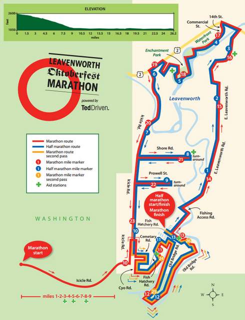
In August, my sister and I signed up for the November 8, 2015, Silver Falls Trail Half Marathon, my fourth and her first trail race. Registration for the super popular 1,000 participants race, in existence since 2010, typically fills up within an hour. We looked forward to the chance to run along the Trail of Ten Falls in northwestern Oregon.
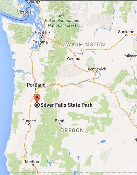
Days before the event, I realized I should have read the fine print, “This race takes place in early November in Oregon, so be prepared for anything! Rain, wind or maybe a touch of snow or ice is a possibility.” Race weekend we followed weather forecasts for the nearest city, Silverton, in hopes of sun, in spite of what the fine print said. We arrived in Salem, about a 45 minute drive from Silver Falls State Park, the day before, on a Saturday that saw 0.68 inches of rainfall, and debated what to wear the race day for the predicted weather conditions: clouds and rain with temperatures from the mid-forties to low-fifties.
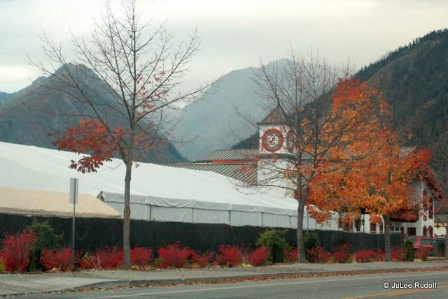
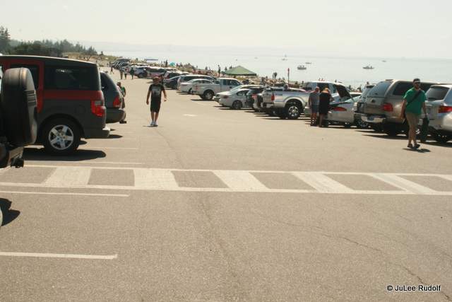
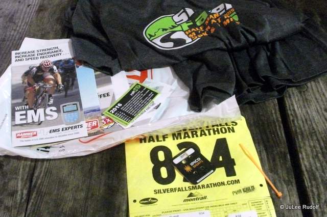 On Sunday, we left Salem at 7:00 am and followed a meandering road with views of rolling hills and tree farms 27 miles to the park, arriving 90 minutes early for our 9:15 race start time. Organizers handed us a free parking pass as we entered the gate and directed us to an enormous parking lot. We found our way to a packet pickup inside a huge white tent, collected our race bibs, safety pins, t-shirts, goody bags (containing only coupons), race chips and orange plastic zip ties. Race shirts were for sale in all various sizes for twenty bucks, only five dollars more than at registration. We returned to the lot and chatted with a couple of gals parked next to us with a Washington state license plate. Turns out the car was a rental. They’d flown in from California, same state as the winner of the race: Andrew Wagner from La Jolla, who completed it in 1:15:42 with a blistering 5:48 pace! Most participants were Oregonians, but about an eighth of came from sixteen other states, primarily Washington and California.


 Racers were divided into two waves with a 2:15 completion time cutoff. We’d signed up for the slower wave, which turned out to be a mistake. On race day we heard from others that the second wave was larger, so we’d be running in a bigger pack. As 9:00 am approached, we stood near course and cheered as the first wave took off. A fellow runner pointed to a small patch of sky less cloudy than the rest. We held out hope for a break in the clouds as we awaited our fifteen minutes later start. Then we were off.
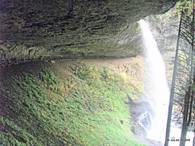
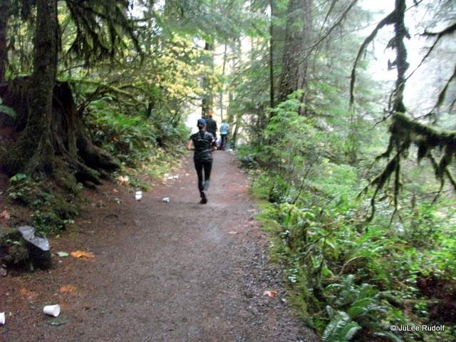
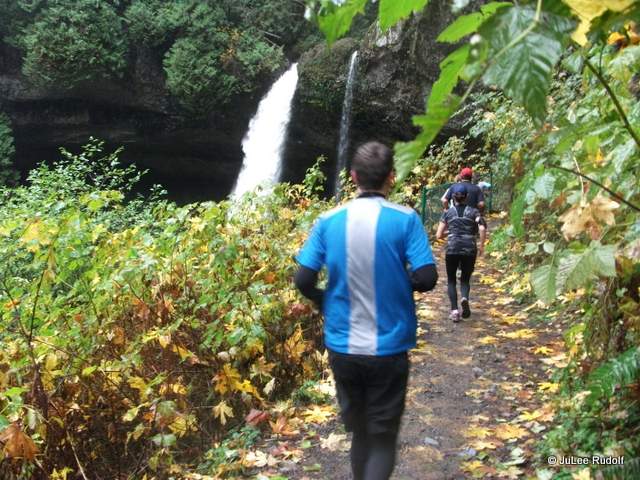
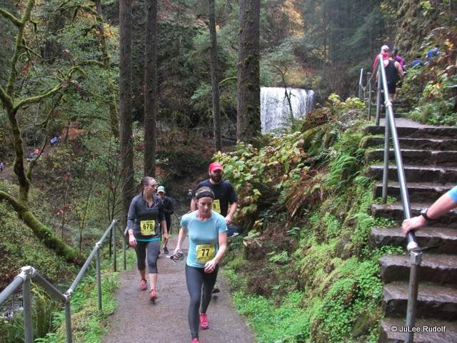
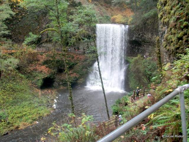
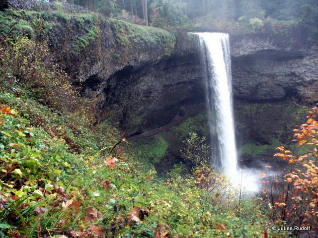
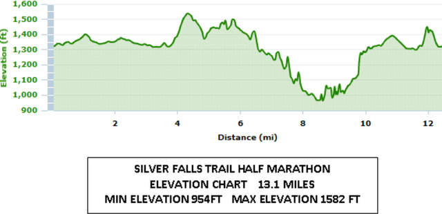 We began on park roads. According to race info, “The first 1.1 mile is on a scenic paved road to allow runners to spread out before hitting the trails…Amazing views, huge fir trees, several bridge crossings and lung busting hills make up this picturesque 13.1 mile course that passes under and near several waterfalls!…trail mixed with portions of paved paths and gravel.” Our plan was to run together with JoDee setting the pace. At first she was hesitant to pass other runners, which meant we were stuck in a long line running at a pretty slow pace. At mile three, we returned to the area near the start where we dropped our gloves and jackets. At about mile five, we heard moving water and encountered our first falls. Much of the course ran along a river, which was rocky in places and scattered with maple leaves. Shrubs, ferns and lichen-covered trees lined the sides. As we neared one of the falls, the sound of the water cascading over the rock ledge was deafening and got me all verklempt as we ran under an enormous rock ledge and behind a colossal waterfall. For the most part, the course did not seem hilly, though the total climb was around 1,500 feet.
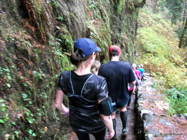

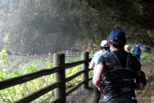
 I’d brought a small camera along, so I’d stop to take a few photos, then speed up to catch my sister. In a few spots, we were slowed by steep, rocky, narrow stairs. By about mid-race, JoDee had figured out how to safely pass. But all good things must come to an end, and did as we reached mile 11 where my sister hit the wall. While we were running along a flat section, she suddenly said, “If I see a hill, I’m walking.” I was like, “Um…it’s flat here…?” She had reached a distance that took her beyond her comfort zone (her longest training run had been 10 miles) and had had enough. I reminded her that we could expect a hill in about a mile. She got quiet as we continued, but had lost her spunk and her speed. We soon passed near the finish area and could hear the announcers calling out times and racers’ names. We’d reached mile 12, the start of the muddy hill and walked. As did nearly everyone else around us. Half a mile later, we arrived at the top and returned to running. We found ourselves slipping and sliding down the other side.
 Minutes later, we returned to the flat area, crossed a little bridge, and saw the finish line. I called to my sister, who was a short distance behind me, “Get up here.” Her reply, “I’m going to throw up or fall down.” I smiled. I know when to shut up. We crossed the line, handed off the bottom part of our race bib to one volunteer while another clipped the chip from our shoes, and stood in line in front of an elementary-school age girl sitting on a chair who was following a slow, specific way of removing the medals slung over her arm to hand to finishers. While waiting (Jeopardy song in my head), I realized I hadn’t stopped my watch, did so, accepted my medal, and high-fived my sister. We’d completed the race in the top half of the pack (barely), two of the 505 females and 313 males who completed the course. The overall average finish time was 2:17:06.
 Living near Deception Pass State Park and the Anacortes Forest Lands, I have high standards for scenery. And Silver Falls Half Marathon did not disappoint. The race was well-organized and the course: gorgeous. I’m not sure I’d be willing to spend 12 hours (round trip without traffic) in the car in order to run it again, but I highly recommend the race for an awesome once in a lifetime destination run experience and the park for its abundance of beautiful waterfalls.

 Fortunately, they found a new home about a mile away that provides easier access for non-military folks and

 I visited the museum both when it was on-base and, a few weeks ago, in its new location. A friendly, well-informed volunteer greeted visitors, collect admission, handed out museum maps, directed folks to the guest book and gave out TripAdvisor stickers while reminding them to provide feedback. She mentioned that guests should return to the desk after touring the museum to obtain a token allowing access to the plane display across the street. As luck would have it, I arrived at the same time as two gentlemen. One proudly proclaimed that he had been born in 1935 in Oak Harbor and observed the base being built. The other’s son had been a flight surgeon during four tours in Afghanistan. We chatted a bit as we viewed the displays.


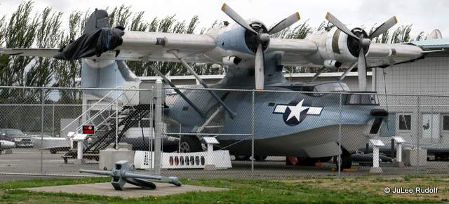
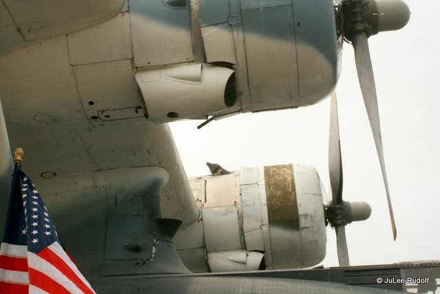
 After the film, I checked out the simulator room where interested visitors could attempt to fly a plane. They must be pretty popular because a sign on the wall asked visitors to limit their time to 15 minutes when busy. Afterwards, I obtained my token and carefully crossed the busy street where a well-informed volunteer named John greeted me. His father had flown the PBY. I spent about ten minutes reading the display signs and getting a close look at this remarkable airplane. Make no mistake: the
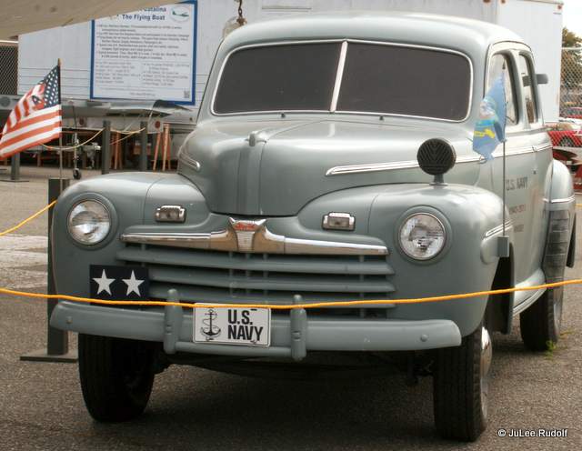


 What felt like an eternity but was actually fewer than twenty minutes later, we reached the fish hatchery grounds. A spectator said (someone always says)…”You’re almost there.” The gal I’d been running near much of the race and I commiserated about that unhelpful, untrue encouragement. She asked and I told her that we were only mile 10.6, at which point we returned to the trails and crossed a bridge that sent us out onto a long loop. Faster folks were already on their way back. And although I normally love unpaved paths, this trail was topped with a soft dusty powder, which was covered with patches of long pine needles, slippery with road shoes. I dreaded running away from the finish line because I knew I’d have to run back. What seemed like hours later, we recrossed the bridge, approached and crossed the finish. At the end of the chute, a cute little blonde girl handed me a medal and a second girl held out a bottle of water. I’d reached the best part of the race.
 In spite of my many mistakes: signing up late, under-training, not properly previewing the course and using untried headphones, I completed the race at a respectable for a 51-year-old pace. The weather was perfect, the race was well-organized, the volunteers were great, and the course was super scenic, but I’m not sure I’d be willing to participate in the event again. Best of the race outside of my mistakes: super scenic. Worst: the shirt.
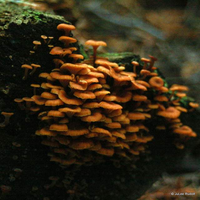


 These are some bonus photos I’ve taken since during the winter of 2015, also along the Anacortes Forest Land trails near Heart Lake.
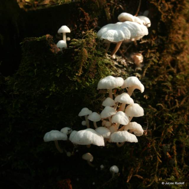
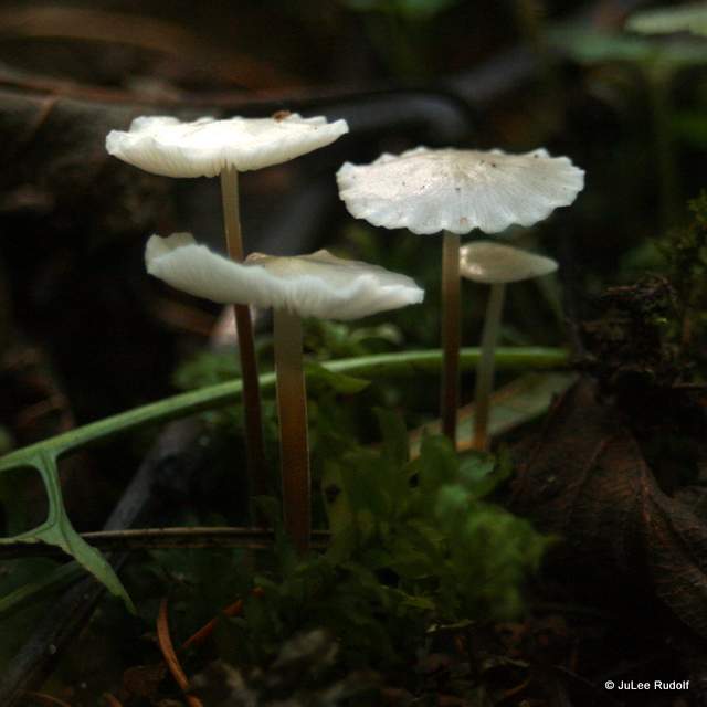
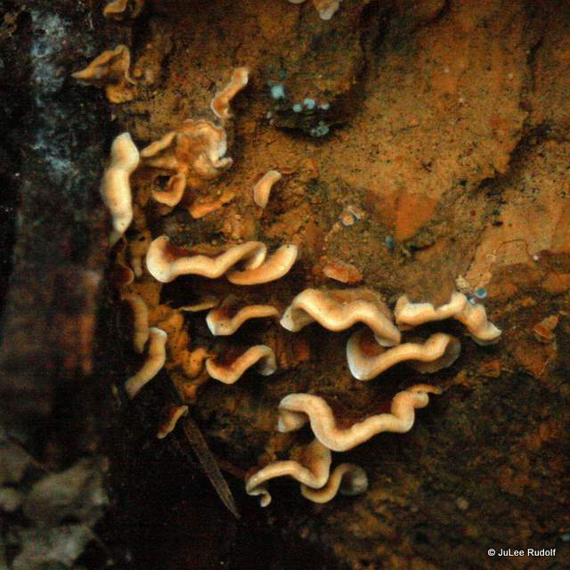
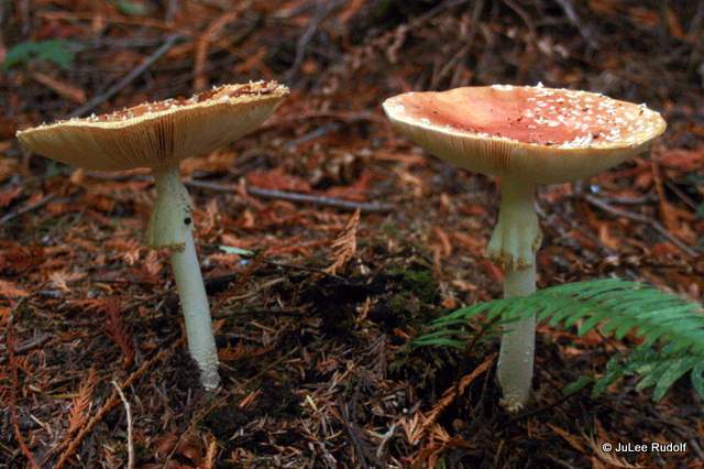
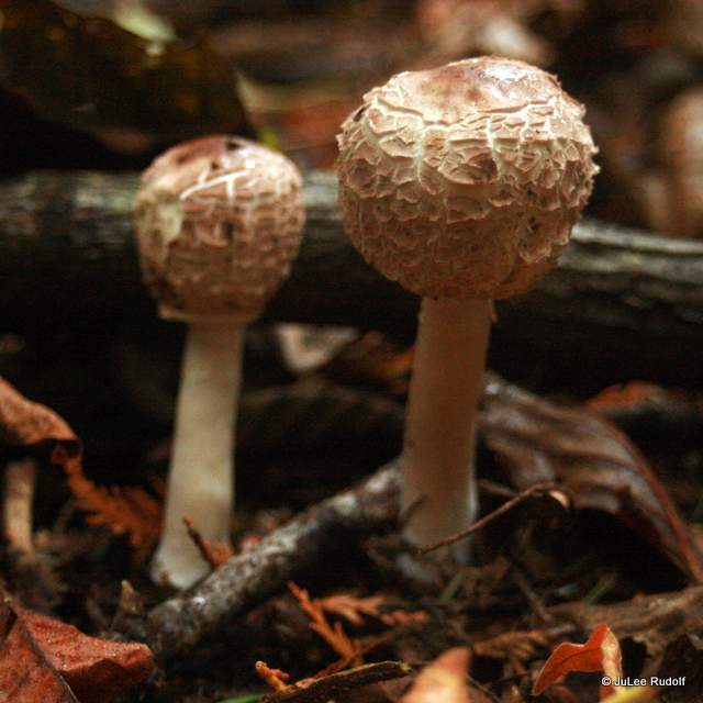
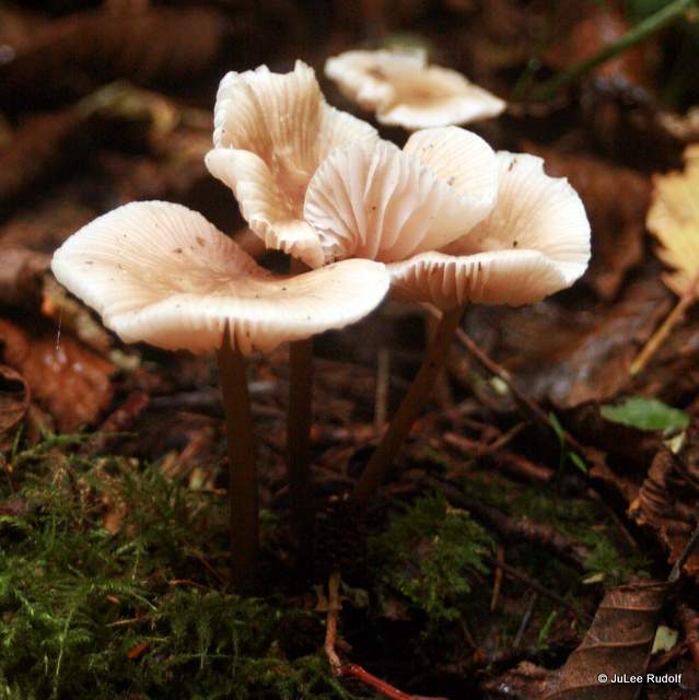
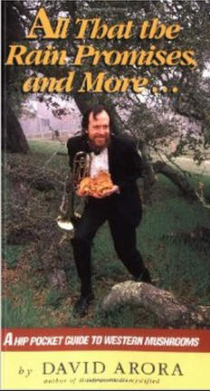
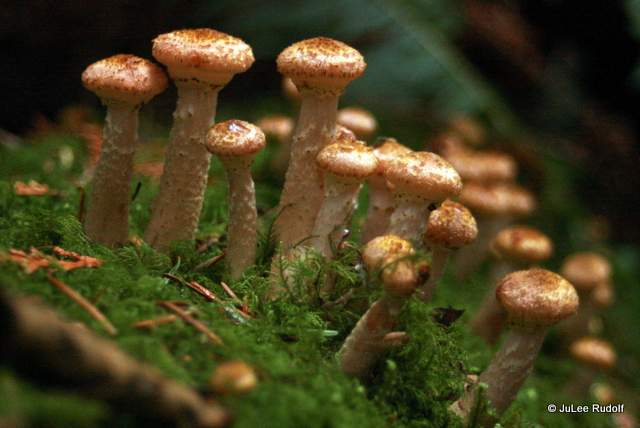
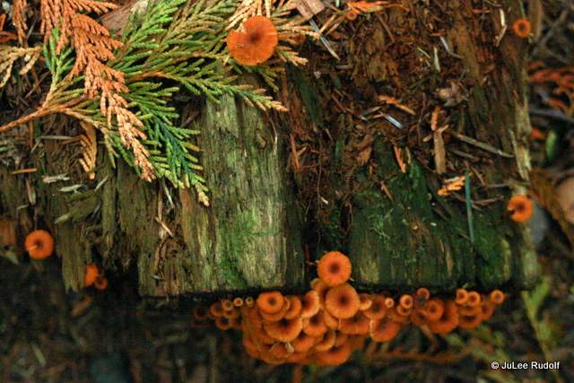
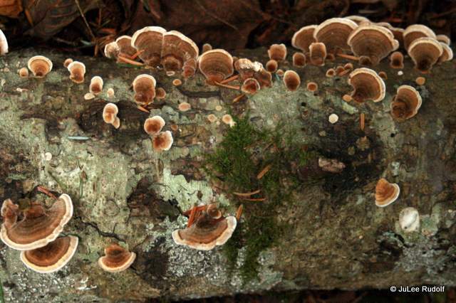
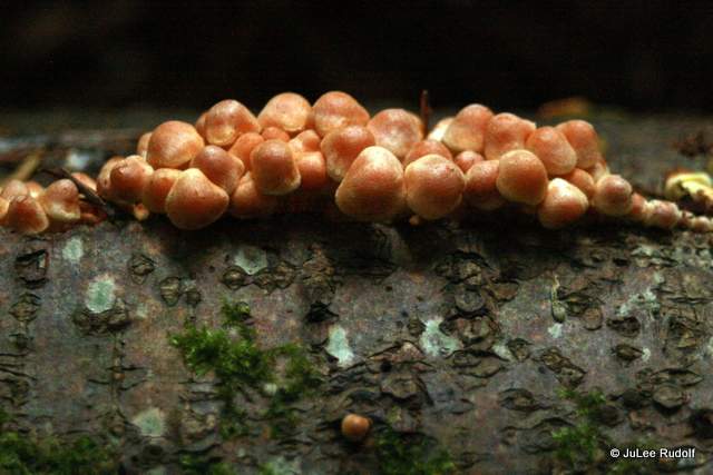
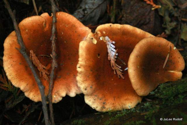
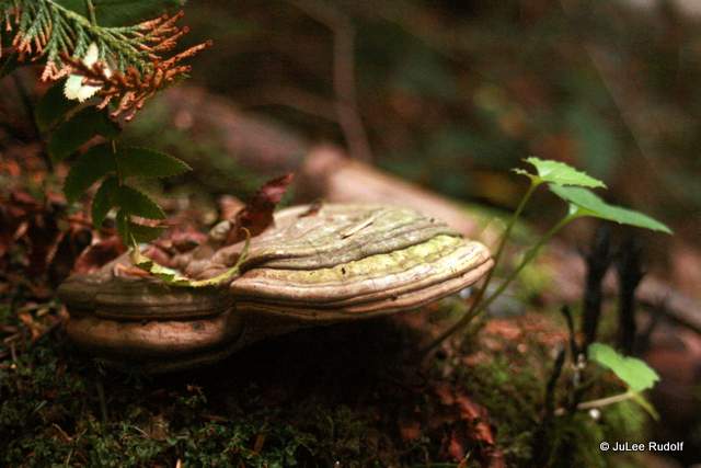
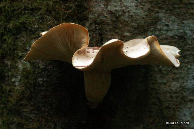
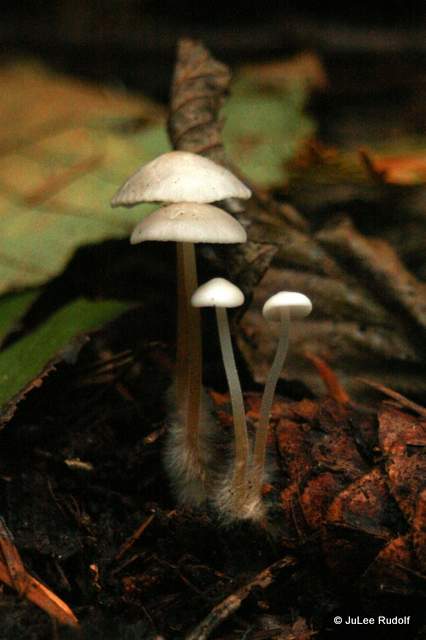
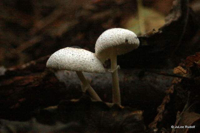
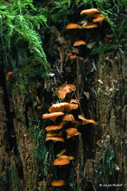
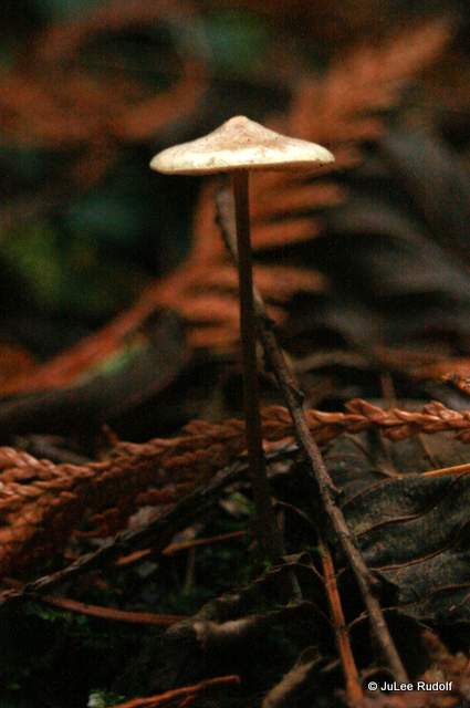
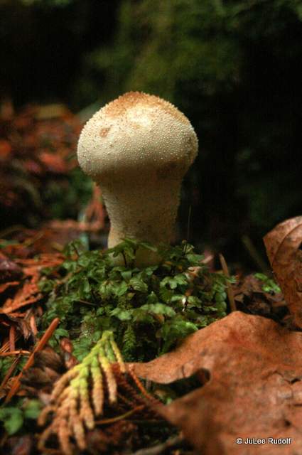
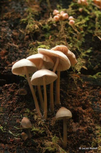
 During my obsession, I learned about the Langdon Cook’s entertaining book The Mushroom Hunters, and raced through it. It covers such subjects as: mushroom hunting/hunters and collecting/collectors (chanterelles, porcini, black trumpets, boletes, truffles!), a mushroom competition, mushroom sellers/buyers, descriptions of mushroom-containing dishes, David Arora (p 229), “…his book Mushrooms Demystified is largely responsible for introducing recent generations to the charms of mushroom hunting,” and a bunch of stuff about fungi (p 5), “All mushrooms are fungi, but not all fungi are mushrooms.” The format reminds me most of a book I love – the Good Rain by Timothy Egan, in that each chapter could sort of stand-alone.

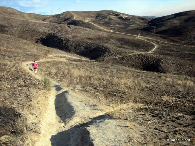
 Last weekend, my friend Wanda and I hiked from the trail head east towards the bridge along the North Beach Trail, followed the Discovery Trail southwest to its southernmost point, then northeast to northwest up the Summit Trail, down again to the Perimeter trail, and back towards the Summit Trails from a different direction, Lower Forest Trail to the Perimeter Trail and back (it’s harder than it sounds) for a grand total of nearly six miles and over 1,200 feet of climb. In this way we covered every trail through the Goose Rock area (except a couple of short connectors). These trails are also great for running. In fact, two trail races pass through this area of the park: the
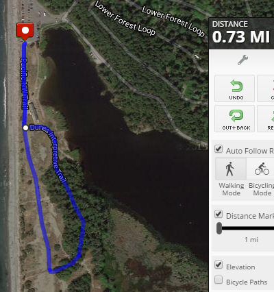

 One last hike I noticed only recently while stopped on my way out of the park was the Upland Trail. The sign claims it’s a quarter mile hike that should take about 30 minutes to complete, so I decided to check it out. An informational sign marks the route and explains the trail. Pamphlets explain each of the highlighted items along the route. I confess I was disappointed by the trail, which I completed in fewer than ten minutes even with photo-taking stops. I think it’s a great idea and it might be nice in the spring when things are blooming, but in summer it seemed that several of the items were absent or less than obvious and I couldn’t figure several of them out even though I know a decent amount about the parks plant, shrub and tree species.
 At low tide the rocks at the northwest corner of the parking lot, reminiscent of the Urchin Rocks across the way at Rosario (another awesome part of the park), are a great place to see some cool sea creatures, though Rosario’s are more extensive, less sea-weedy, and safer to walk across.


 You’ll find aggregating anemones, barnacles, painted anemones (during very low tides-look at the base of the rocks to find them) tube worms galore (way more than at Rosario), chiton, limpets, hermit crabs and shore crabs. Last weekend when I visited I encountered some kids tide pooling too. We carefully made our way around and across the rocks. Besides the usual, we found feeding barnacles and a Red Rock crab.


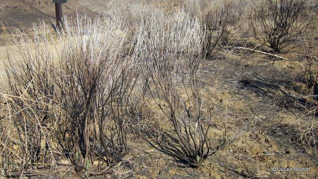
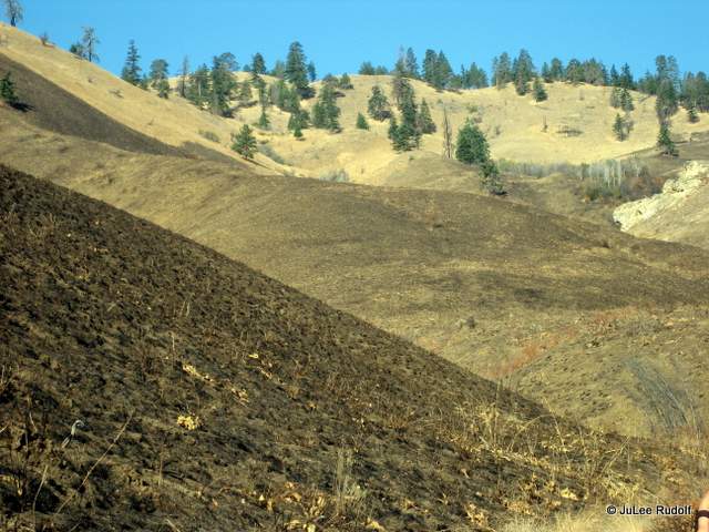
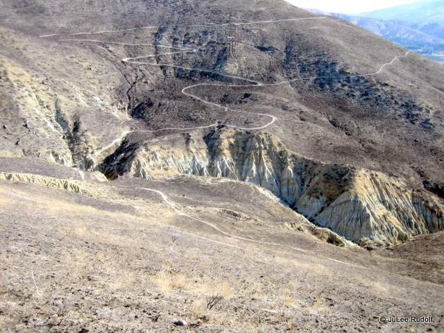
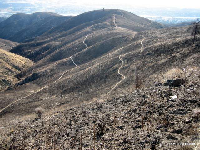
 During the safety briefing, I realized that my fire shelter had been breached. I had never been so scared. It was the summer of 1986, the year before I graduated from college, and I was one of a group of many Gifford Pinchot National Forest employees highly encouraged to volunteer to help fight forest fires in Eastern Oregon, specifically, in the Umatilla National Forest. Fortunately, someone tracked down a better shelter and switched it out with mine. Before (and after) my short (about two weeks) stint as an amateur volunteer firefighter, I worked in the geotech department in Packwood, Washington, where I helped measure gravel depths on Forest Service Roads and performed gradation tests on soil samples four days a week and hiked nearby trails during three day weekends.
 Once geared up with fire-retardant yellow Nomex shirts, helmets, hiking boots, fire shelters and a shovel or pickax, we headed out to our destination in the bed of dusenhalf (two and a half ton) trucks. As USFS workers, we received something like 150% of our base pay (I was earning $5.50 per hour) plus additional Hazardous Duty pay for working the night shift. My group was tasked with digging fire line, which meant creating a long narrow trench in the dirt at a specified location outside the boundary of the fire to reduce the chances of it spreading. What I remember most was being unable even to cat nap when allowed because of the fear of snags which were dead trees that could fall unexpectedly and kill you. We would occasionally hear them fall off in the distance, which was frightening. That summer, we learned that other firefighters had been forced to deploy their shelters, a super scary situation considering the flimsiness of the shelter and the skepticism that this thin metal shield could protect a person from high fire temperatures.
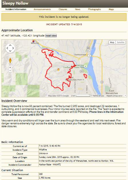


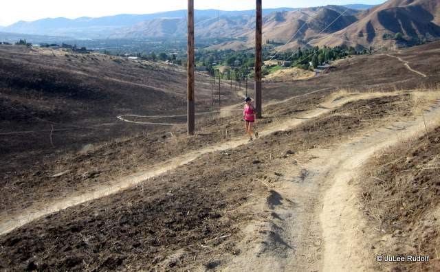

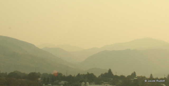
 We decided the damaging smoke-inhalation effects outweighed the benefits of running and stayed inside…sigh. A light dusting of ash covered streets and vehicles and didn’t let up, so I cut my trip short and returned Sunday morning, driving under smoke filled skies along Highway 2 from Wenatchee through to Everett, then north on Interstate 5 to Highway 20 West. We couldn’t tell that the skies somewhere above the smoke were actually clear until Anacortes, though visibility was diminished there too. Back in Dugualla Bay, Mount Baker was noticeably obscured, though we could see scattered clouds in the distance.
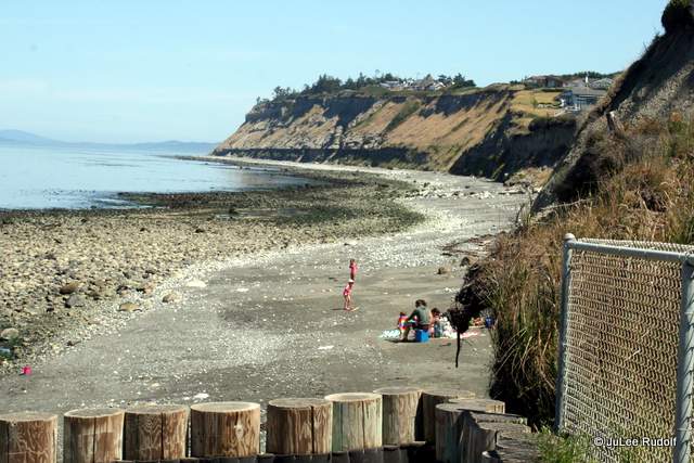


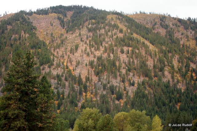
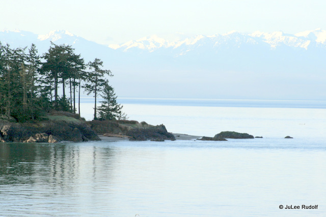
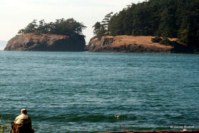
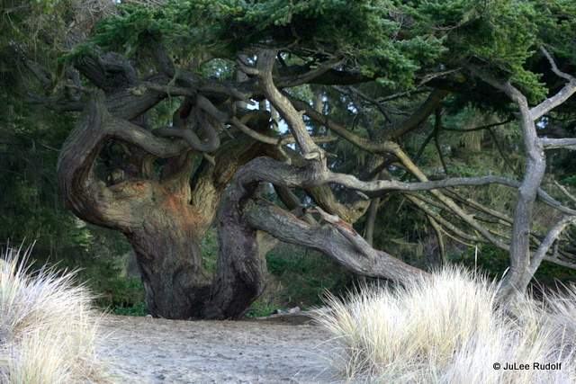
 Anyone who has spent time at Fort Ebey or Ebey’s Reserve will be familiar with the conspicuous yellow-green bluff that runs along the west side of the island. For the most part, it’s topped with a darker green that includes plants and trees (and in some places, houses).
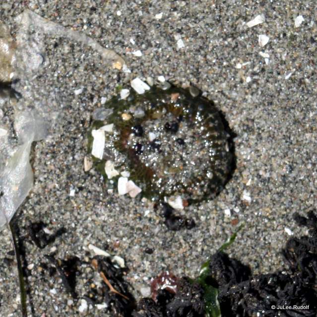
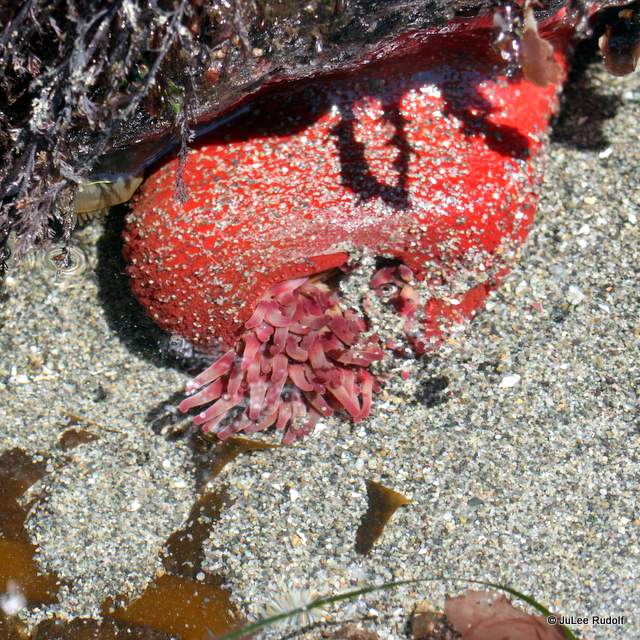
 but the biggest surprise was the prevalence of a specific type of sea star species:
 I’ve seen these sea stars at Cornet Bay, but never in such large numbers. According to the


 As I exited the beach area, I ran into a local gal who was collecting rocks to landscape her yard. We talked about the tides. She mentioned that “about 3:00 pm (I thought, huh? Like, every day…but kept my probably-understands-the-tides-a-bit-better-than-her mouth shut.) the tide comes in” and showed me how high the water rises, so high that it would cover the entire beach (though I suspect she means in the winter).
 Before I left, I took a couple of photos of some little kids, undeterred by the absence of sand at that location, playing in the water.
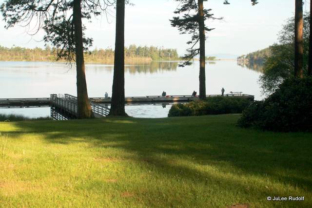
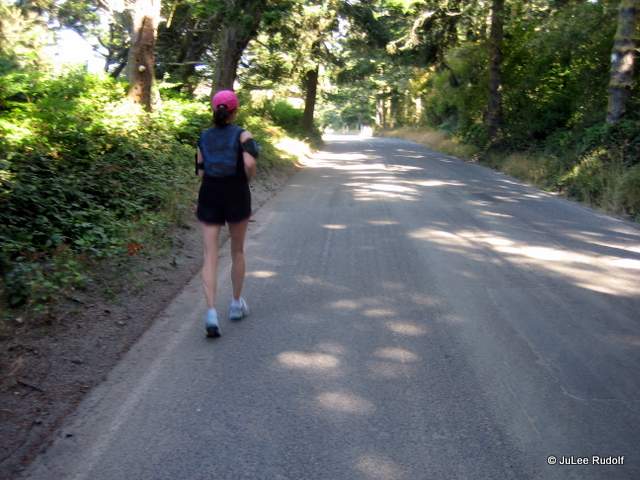
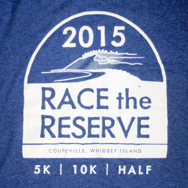
 “Never leave your wingman,” is what I always think (and sometimes say) when my race running partner starts to fret about us sticking together during a race. In this case, it was my 11 months older, 52-year-old sister JoDee, who took up running in April and now, fewer than four months later, was running her first half marathon: Race the Reserve in Coupeville.
 We said “hey” to a friend, chatted up fellow runners in the porta potty line, loitered, discussed our strategy, and, when we heard the fifteen minutes to the start warning over the PA, headed over to the track.
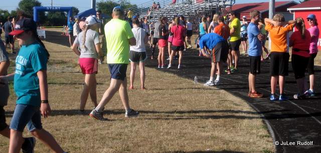
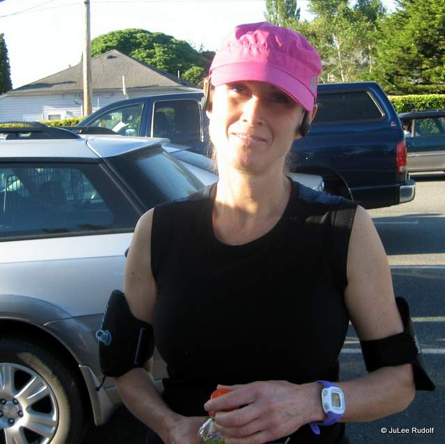
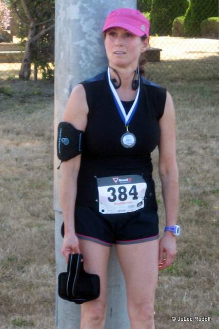
 I decided to take my camera along to document the event, and got a shot, pre-race, of JoDee and her un-photogenic best friend.
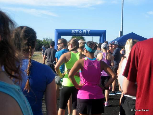
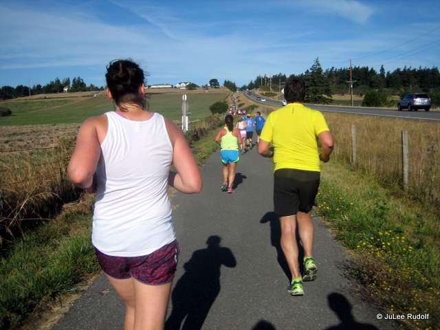
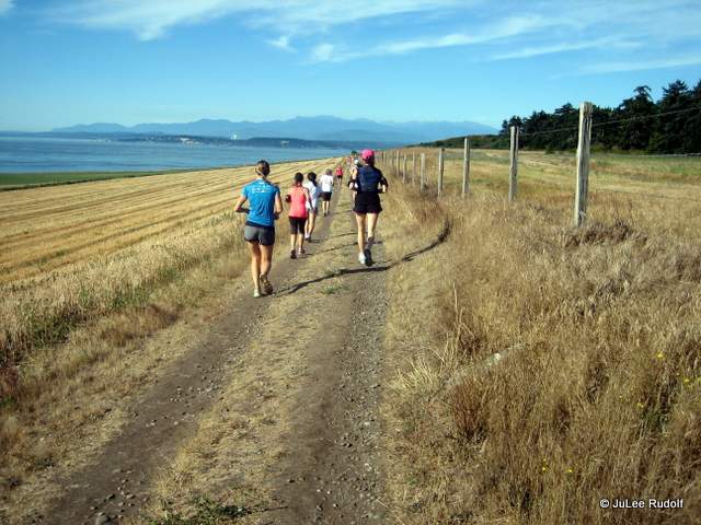
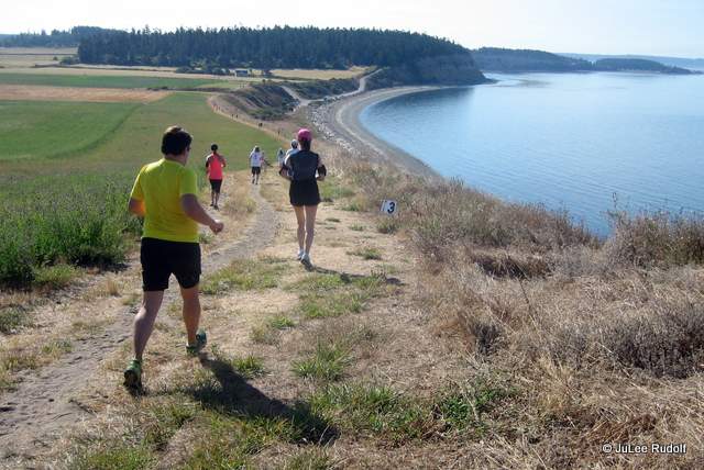
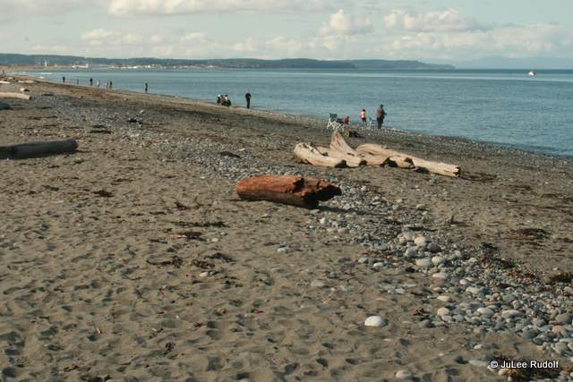
 The race profile was pretty flat, in fact, the course contained a mere 500 feet of climb, the biggest hill was shown at mile 9, a small grade that continued past open fields. We were passing (along the uphills) and being passed by (along the dowhills) by a cute, strong runner gal wearing an orange tank, so when we passed her on the uphill late in the race, I said, “Good job. We’ll see you when you pass us later on the downhill.”
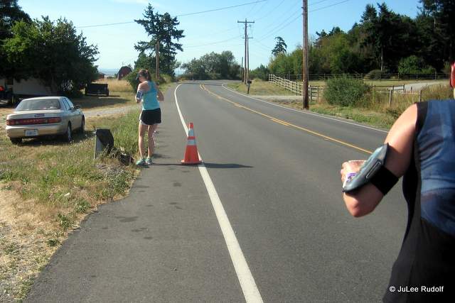
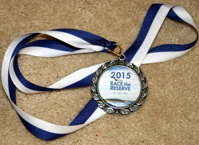
 Soon, we were re-running along the exact same part of Engle Road that we’d run during the first few miles. At about mile 12, we reached a water stop with three teenage girls, one a girl I know from our neighborhood: Julianne, who I expected to see at some point since I knew she was part of the Coupeville High School Class of 2016. I called out her name and she cheered us on as we continued past. My sister decided she no longer wanted to stop at the water stations as doing so made it hard to get started again. Finally, we reached the sign indicating 12 miles and passed a man walking, who then began running. The run/walker gal in green didn’t walk at all during her last mile and finished ahead of us. We never saw woman-in-orange again after our last pass, though it may have been because the last part of the course was flat to uphill. Finally, we could hear the crowd cheering finishing runners in the distance. Not too many steps later, we passed through the fence, continued to the track and crossed under the blue inflatable awning and the finish line, where a volunteer handed us each a medal and, even better at that point, a bottle of water.
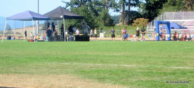


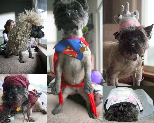 When our son was eleven, we agreed to get him a dog. I had in mind a quiet, loving, sweet-tempered, mid-sized creature that would race to the door to greet him, wag its tail often, walk obediently by his side, sleep at the foot of his bed and spend a little time on my lap. To prepare for the acquisition, my husband sought information about energy levels, longevity, health and kid-friendliness of various breeds. We spent a few months stalking animal shelter websites in hopes of giving a mutt, the type of dog we’d both typically had growing up, a good home. I went so far as to put down money on an eight-year-old Pomeranian mix from WAIF named Pooh Bear with a tendency to pee when startled. My husband nixed that plan. The problem was, by the time a photo of a smaller dog in which we were interested reached the web site, it had typically already been adopted. Finally, we resorted to (I am embarrassed to share) a breeder. Scott’s research led him to a breed about which I was unfamiliar: the Cairn Terrier (the same as Toto from The Wizard of Oz) bred for hunting rodents and other small animals. My son and husband eventually traveled to a nearby island to meet a female, one-year-old dog-show reject (not kidding).
 My son returned home happy. He’d spent nearly an hour playing ball with the dog. And even though I’d cautioned against rushing into anything, they’d put money down on her. She was to be ours a safe amount of time after being neutered. My son wanted a dog so badly that I knew he’d have been satisfied with any old fur-covered beating heart. I reminded my husband that I did not want a hyperactive dog. He smiled…
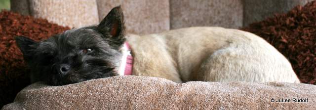 Her crate collects dust in the garage as she chooses to sleep on the nearest available piece of furniture, preferably atop a soft pillow or blanket. Her now 16-year-old person still loves her but plays with her less and less. Fortunately, she still gets plenty of exercise on walks around the block, a nearby lagoon, trails at Deception Pass State Park and the Anacortes Forest Lands, local roads, and sometimes, dog parks, courtesy of the rest of the family.
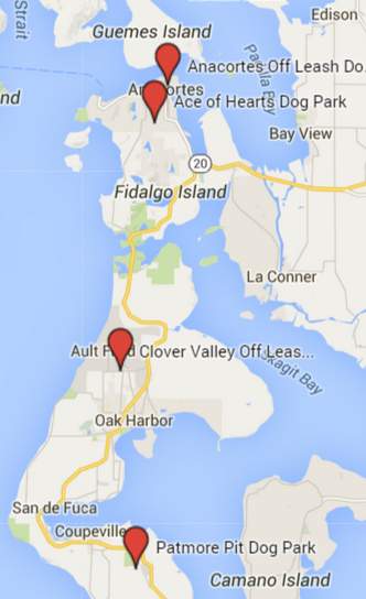
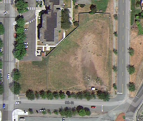 Although we’ve had Scamper for five years now, we’ve only recently made the effort to take her to the four dog parks closest to our house. The northernmost one is in Anacortes, northwest of Safeway, at the corner of 9th Street and R Ave and is called the Anacortes Off Leash Dog Park. One day last winter, Scamper and I arrived with the sun to an empty field. The park, which covers about an acre by my rough calculations, was stocked with plenty of dog refuse bags, water, discarded balls and even a retired bus shelter in case of rain. Scamper and I played ball, which led to lots of barking when I didn’t throw the ball quickly enough. As it was a little early to risk waking up the neighbors, I decided it was time to go. We returned a second time this summer. Scamper didn’t know what to do about the four other dogs’ jumping, barking and…ahem…nether-regions-sniffing. But then, she didn’t much care. She chased a tennis ball we threw far across the field with help from an orange plastic launcher with a well-chewed handle that we found in a bucket at the park. When she decided to lie down and then wouldn’t budge from a cool shady spot in the dirt, we decided it was time to go. Best of the dog park: convenient location (just north of Safeway near the waterfront). Worst: no water spigot, so volunteers kindly fill and leave milk cartons with water.
 When I mentioned our quest to visit dog parks, an Anacortian suggested Ace of Hearts, so Scamper, my daughter and I stopped by one day. It lies inconspicuously along H Ave. Two other couples, each with a small dog, socialized in the small dog section. Scamper noticed that Kenzie, a Westie, liked to play ball as much as she did. Kenzie was willing to follow her ball anywhere, even into the water bin. The other small dog was obviously even more spoiled than the Westie. Its female person asked it, as one might a toddler, if he was thirsty, set out a clean, fancy inflatable bowl, and poured bottled water into it while Scamper obliviously slurped from the Kenzied water. Wild guess: the dog’s persons’ didn’t yet have kids. Twenty minutes later, the small dogs had had enough, so we took Scamper over to hang out with the big dogs. A puppy tried to play with her while she was chasing her tennis ball but she wanted no part of that. This big dog side had a big dog sized water dish-a kiddie pool, a water hose, benches and a covered shelter. Both had dog refuse bags and garbage cans. We didn’t stay long on this hot day but decided that we preferred Ace of Hearts over the Anacortes Dog Park. Best of the dog park: separate fenced areas for small dogs and large dogs. Worst: the small dog section was very, very small.
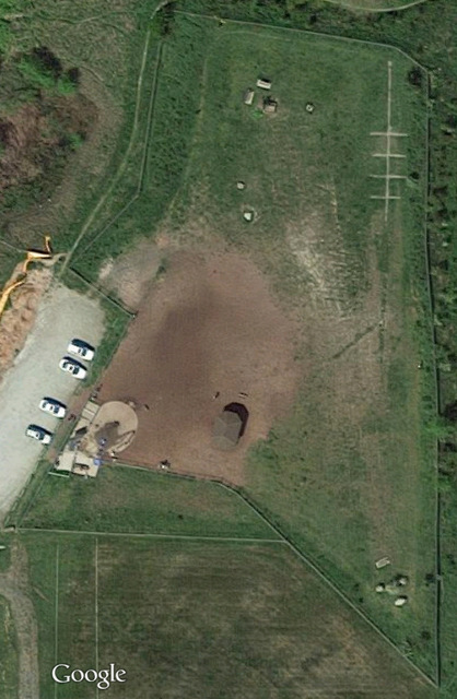
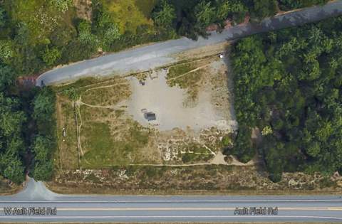 We next visited the park closest to our house, off of Ault Field, Clover Valley Off Leash Area. CVOLA is about 3 acres in size and less damp during the same time of year than the Anacortes Dog Park with a larger variety of terrain (a mix of dirt, grass, plants and trees) than either park in Anacortes. We arrived on a weekday morning to an empty park, about half of which is open and grassy. A spigot allows easy access to water. Scamper sniffed around the main area and then headed off to tree-covered trails to the east. She wandered along the perimeter fence at her leisure, then returned to the field. Best of the dog park: water on tap. Worst: off the beaten path.
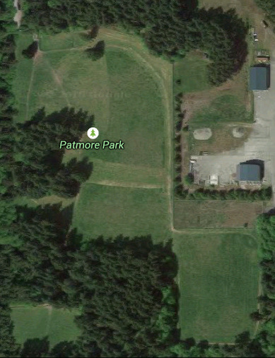 Two words to remember for dog lovers in the vicinity of Coupeville: Patmore Pit. Man’s best friend can’t help but love its 15 acres of fenced space, including wide grassy fields, shaded, tree-lined trails and a large patch of long grass. A bench and several large jugs of water were located just inside the fence near the entrance.

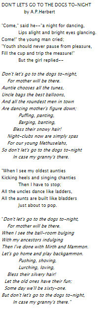 In case you were wondering, Don’t Let’s Go to the Dogs Tonight is the title of an A.P. Herbert poem (She-Shanties (1926)) and an excellent memoir by